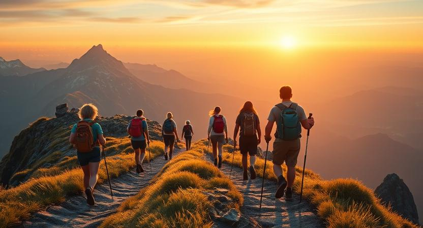
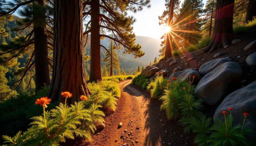
Introduction to Joshua Tree Hiking
Why Best Hikes in Joshua Tree Are Iconic
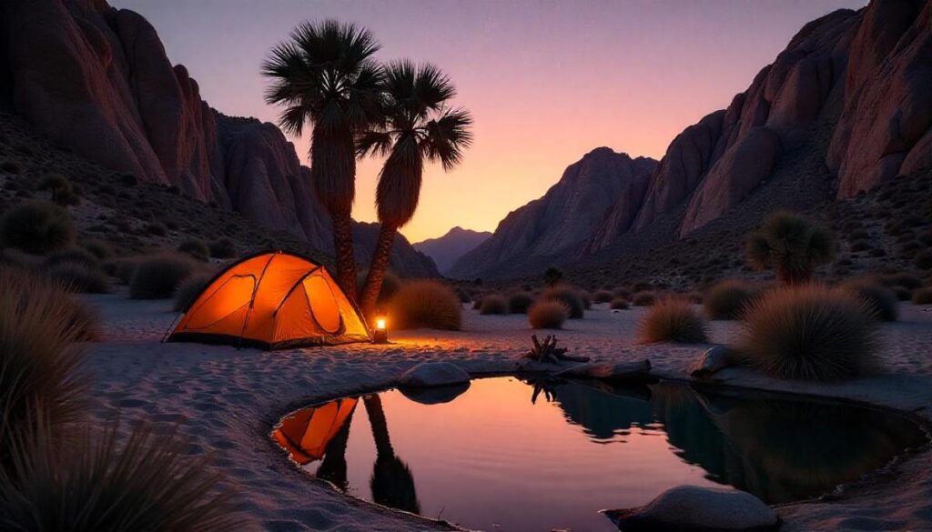
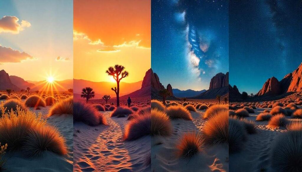
Joshua Tree National Park sits where the Mojave and Colorado deserts meet, creating spectacular rock formations and forests of its namesake yucca trees that feel almost otherworldly. Hikers come here not just for exercise but for immersive experiences—from exploring Hidden Valley’s monzogranite walls to watching the Milky Way arch over Barker Dam. With easy trails for families and challenging backcountry routes, the park truly earns its reputation for hosting some of the top hikes in Joshua Tree.
Joshua Tree National Park Overview & Elevation
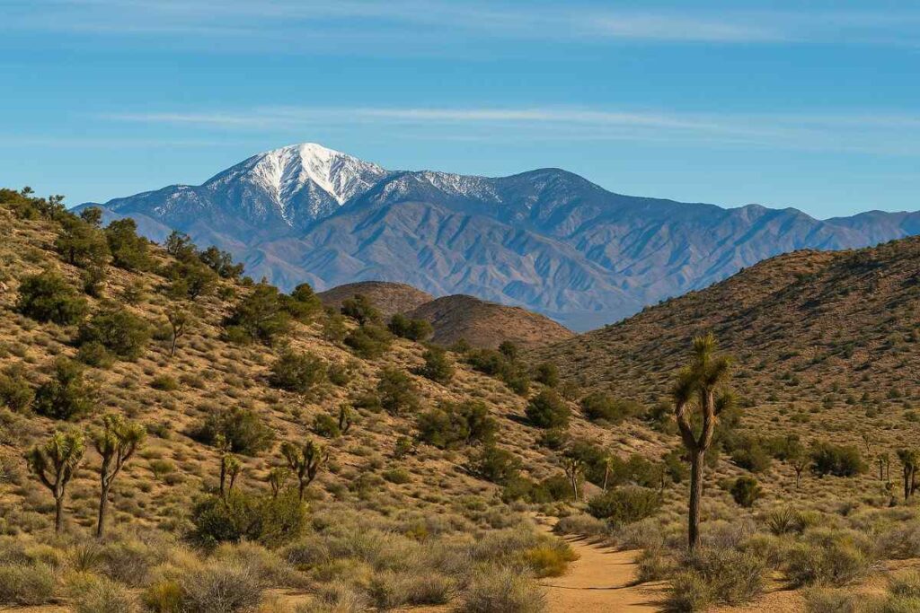
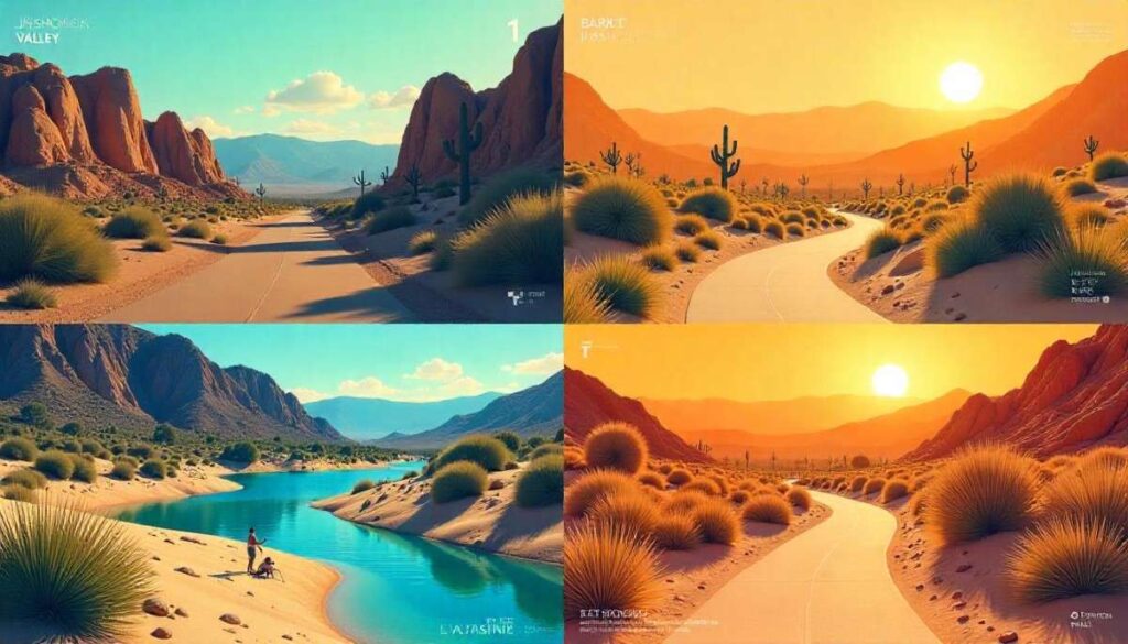
Covering over 795,000 acres, Joshua Tree is a vast playground of desert ecosystems, sculpted by wind and rare rains. Elevations range from a low of 536 ft in the southeast corner to a high of 5,814 ft atop Quail Mountain, meaning you can hike temperate foothills one day and alpine-like ridges the next. This dramatic vertical span shapes weather patterns, plant communities, and trail difficulty—key for planning your best day hikes in Joshua Tree.
Park Entrances, Directions & Permit Requirements
Joshua Tree has three main entrances: West (near Joshua Tree town), North (Twentynine Palms), and South (Cottonwood Spring). Access via I-10 or CA-62 is straightforward, but avoid depending solely on GPS—some routes can divert onto impassable back-roads. No advance reservation is needed to enter; a 7-day vehicle pass costs $30, and hikers on foot or bike pay $15. Remember to display your pass clearly or carry it with you at all times.
Joshua Tree Trail Map Essentials
Accurate maps are critical in a park where trails often intersect and signage can be sparse. Download free USGS topographic maps or pick up the official park brochure at any visitor center. For real-time GPS tracking, the NPS app offers offline trail maps and alerts; always leave your planned route details at a ranger station. Carry a compass and know how to use it—cell service is unreliable in many backcountry areas.
How to Choose the Perfect Joshua Tree Trail
Distance, Elevation & Difficulty Factors
When planning your best hikes in Joshua Tree National Park, match trail length and elevation gain to your fitness and experience. Short loops like Hidden Valley (1 mi, 100 ft gain) suit families and first-timers, while Ryan Mountain (3 mi, 1,000 ft gain) offers panoramic views for seasoned hikers. Always account for the extra effort required in desert terrain—rocky footing, heat, and loose sand can make a flat-seeming trail feel twice as hard.
Top 14 Best Hikes in Joshua Tree National Park
1. Hidden Valley Nature Trail
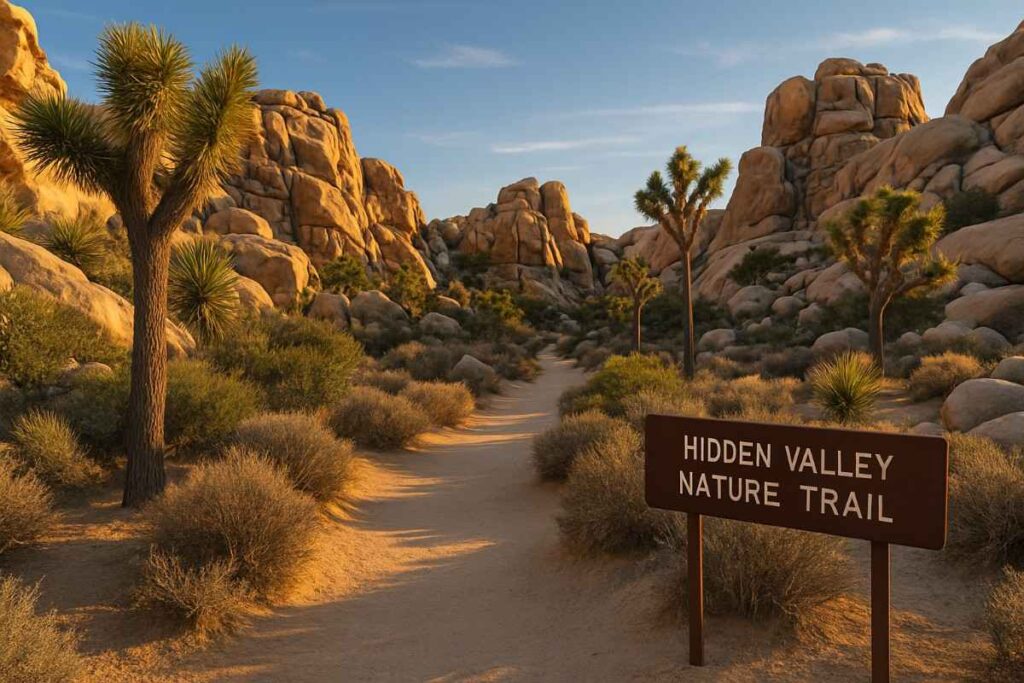
Introduction
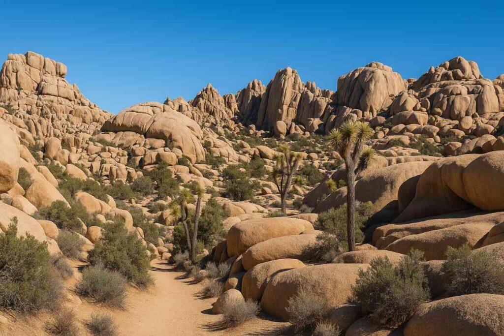
The Hidden Valley Nature Trail offers an iconic introduction to Joshua Tree’s unique geology, winding through a naturally enclosed valley framed by towering monzogranite boulders. This self-guiding loop was once rumored to be a hideout for cattle rustlers, giving it a rich human history alongside its dramatic rock formations. Along the way, interpretive signs detail the park’s diverse desert plants, from yuccas to junipers, making it one of the best short hikes in Joshua Tree National Park for both nature lovers and families. Rock climbers often dot the valley walls, lending a sense of adventure as you meander the sandy trail.
The trail’s sandy footing and occasional rocky steps provide a taste of desert hiking without intense scrambling. Despite its popularity, the loop maintains a feeling of solitude once you pass the initial entrance gap. Hidden Valley’s microhabitat supports an unusual mix of plants and animals not found together elsewhere in the park. It’s a photographer’s dream, with endless opportunities to capture Joshua trees against sweeping desert vistas.
Distance | Elevation Gain | Difficulty | Permit
- Distance: 1 mile
- Elevation Gain: 100 ft
- Difficulty: Easy
- Permit: 7-day Park Pass ($30/vehicle or $15 on foot)
Best Time to Visit
- Spring (March–May): Wildflower blooms and mild temperatures make this best short hike in Joshua Tree extra rewarding.
Personal Tips & Safety Precautions
- Early Start: Begin before 9 AM to beat both the crowds and midday heat (spring/summer).
- Navigation: Follow rock cairns closely—sandy conditions can obscure the path.
- Hydration: Carry at least 1 L water per person; desert microclimates can dehydrate you quickly.
- Footwear: Trail runners or lightweight hiking shoes with good grip for sandy and rocky sections.
2. Barker Dam Nature Trail
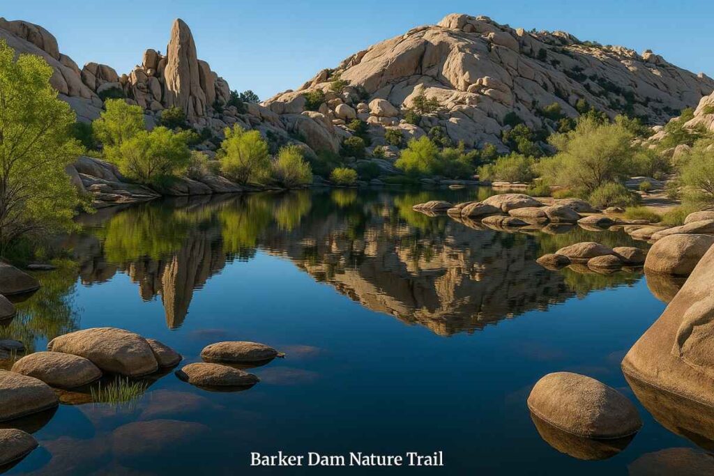
Introduction
The Barker Dam Nature Trail is a fascinating blend of natural history and water lore, leading hikers past a historic reservoir built by early cattlemen in the late 1800s. This short loop traverses the southern edge of the Wonderland of Rocks, showcasing expansive monzogranite formations reflected in the often water-filled dam. Interpretive exhibits along the path reveal Native American rock art and the park’s ranching past, adding depth to the top hikes in Joshua Tree experience. Wildlife enthusiasts celebrate Barker Dam for its birdwatching opportunities, from Gambel’s quail to desert bighorn sheep.
Rock scrambling sections offer playful detours for kids and climbers alike, and the dam’s reservoir, when filled, creates stunning mirror-like scenes. Despite minimal shade, shaded alcoves under boulders provide quick respite on warm days. Ideal for families and first-time visitors, this trail exemplifies one of the best family hikes in Joshua Tree.
Distance | Elevation Gain | Difficulty | Permit
- Distance: 1.1 miles
- Elevation Gain: 50 ft
- Difficulty: Easy
- Permit: 7-day Park Pass
Best Time to Visit
- Fall–Spring (October–April): Cooler temperatures enhance both rock art viewing and wildlife sightings.
Personal Tips & Safety Precautions
- Rock Art Respect: View petroglyphs from designated signage; do not touch or climb on them.
- Water Check: After rainstorms, check NPS alerts—reservoir may be full or dry depending on season.
- Footwear: Sturdy hiking shoes with rock-gripping soles for boulder sections.
- Parking Plan: Arrive before 10 AM on weekends to secure a spot in the crowded lot.
3. Ryan Mountain Trail
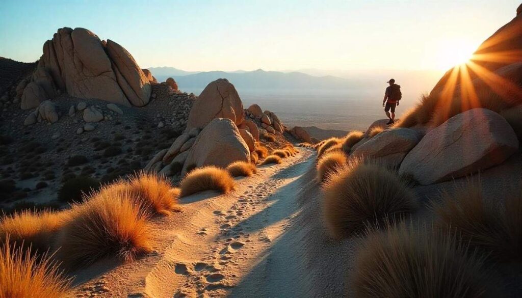
Introduction
For panoramic desert vistas and a true workout, the Ryan Mountain Trail ascends to one of Joshua Tree’s highest peaks at 5,456 ft, offering unmatched 360° views of Pinto Basin and distant San Jacinto. The uphill route includes well-crafted stone steps and rocky scrambles, making it one of the best moderate hikes in Joshua Tree. As you climb, pine trees and cacti transition into alpine-like terrain, showcasing the park’s biodiversity across elevations.
The summit’s geological intrigue is heightened by 1.8-billion-year-old Pinto Gneiss stripes, contrasting with lighter monzogranite below. Desert bighorn sheep occasionally appear near the summit, rewarding attentive hikers with wildlife encounters. A popular day hike for seasoned visitors, this trail demands respect but delivers a sense of accomplishment at the top.
Distance | Elevation Gain | Difficulty | Permit
- Distance: 3 miles (round-trip)
- Elevation Gain: 1,050 ft
- Difficulty: Moderate
- Permit: 7-day Park Pass
Best Time to Visit
- Fall–Spring (September–May): Cooler days reduce dehydration risk; winter snows can linger.
Personal Tips & Safety Precautions
- Pace Yourself: Break the ascent into sections—focus on reaching the next rock outcrop rather than the summit.
- Sun Shield: Wear a wide-brim hat and UV-blocking sunglasses; no shade exists above the tree line.
- Wind Warning: Summit winds can exceed 30 mph—secure hats and gear before the final push.
- Summit Snacks: Pack protein-rich snacks (nuts, jerky) to fuel both ascent and rewarding summit break.
4. Arch Rock Nature Trail
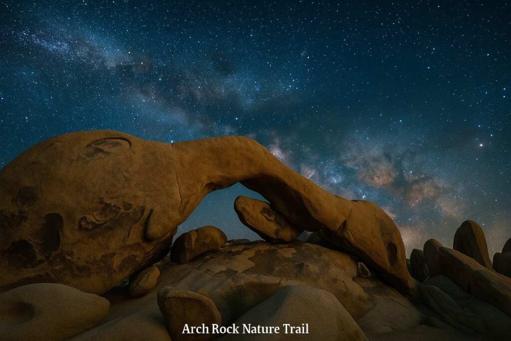
Introduction
The Arch Rock Nature Trail centers on a striking natural arch carved from monzogranite, reachable via a charming lollipop route that blends sandy washes and rocky steps. Starting at the Twin Tanks parking area, the straightaway leads to a short loop where interpretive signs detail local geology and desert flora, enriching the best short hikes in Joshua Tree experience.
Despite its simplicity, the trail’s loop section requires careful footing on uneven rock, adding just enough challenge to delight budding rock climbers. Photographers prize this arch for its perfect sunrise framing, when first light filters through the opening. The trail’s solitude after sunrise makes it a best sunrise hike in Joshua Tree for those seeking serene desert moments.
Distance | Elevation Gain | Difficulty | Permit
- Distance: 1.4 miles
- Elevation Gain: 100 ft
- Difficulty: Easy
- Permit: 7-day Park Pass
Best Time to Visit
- Fall–Spring (October–April): Moderate days and photogenic light enhance both comfort and visuals.
Personal Tips & Safety Precautions
- Golden Hour: Arrive 30 min before sunrise for soft light through the arch.
- Grip Footwear: Use approach shoes or trail runners with good traction for rocky loop.
- Water Station: No shade or water—carry at least 1 L per hiker.
- Trail Buddy: The loop can feel remote; hike with a partner for safety.
5. Oasis of Mara Loop
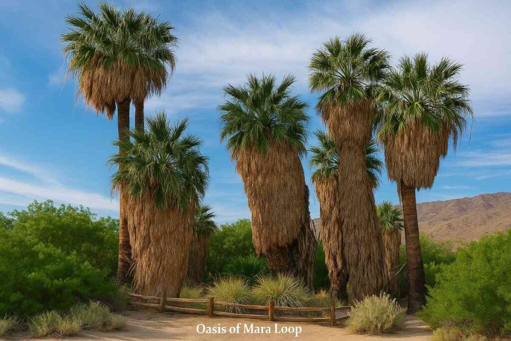
Introduction
The Oasis of Mara Loop is one of the park’s five rare fan palm oases, accessible via a paved half-mile stroll starting at park headquarters. This best easy hike in Joshua Tree immerses you in a verdant micro-ecosystem, complete with interpretive panels on Native American ethnobotany and desert wildlife. Benches along the path invite leisurely birdwatching—look for cactus wrens and Gambel’s quail under the towering palms. The shaded loop offers respite from harsher trails, making it perfect for families or those seeking best family hikes in Joshua Tree. The trail’s accessibility features ensure inclusive enjoyment for all visitors.
Distance | Elevation Gain | Difficulty | Permit
- Distance: 0.5 miles
- Elevation Gain: Minimal
- Difficulty: Very Easy (paved)
- Permit: Free (Park Pass Required)
Best Time to Visit
- Year-Round: Offers shade in summer and vibrant wildlife viewing in winter
Personal Tips & Safety Precautions
- Accessibility: Wheelchair and stroller-friendly—no rocky sections.
- Birdwatching Gear: Bring binoculars for close-up views of oasis-dependent species.
- Hydration Station: Use the nearby restrooms’ water fountain before you start.
- Cultural Respect: Read and reflect on ethnobotanical panels honoring local tribes.
6. Skull Rock Loop
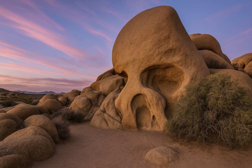
Introduction
The Skull Rock Loop winds around a naturally eroded rock that eerily resembles a skull, offering both geological wonder and easy desert exploration. This loop weaves through oak woodlands and sandy washes, punctuated by interpretive signs detailing local cacti like hedgehog and Mojave mound species. Crossing Park Boulevard adds variety, leading you into Jumbo Rocks campground and back through more monzogranite formations, making it one of the best day hikes in Joshua Tree for mixed scenery.
The trail’s proximity to the campground means you can extend your adventure onto the adjacent Discovery Trail for additional exploration. Families appreciate the manageable length and interactive placards, solidifying its status among best family hikes in Joshua Tree.
Distance | Elevation Gain | Difficulty | Permit
- Distance: 1.8 miles
- Elevation Gain: 120 ft
- Difficulty: Easy
- Permit: 7-day Park Pass
Best Time to Visit
- Spring–Fall (March–November): Mild weather and blooming cacti flowers enhance the loop.
Personal Tips & Safety Precautions
- Crossing Caution: Watch for vehicles when crossing Park Boulevard
- Campground Detour: Stop by Skull Rock campground restroom before starting
- Sunset Option: Loop offers west-facing views for stunning desert sunsets
- Interpretive Reading: Pause at each sign to learn about local ecology and geology
7. Keys View Short Trail
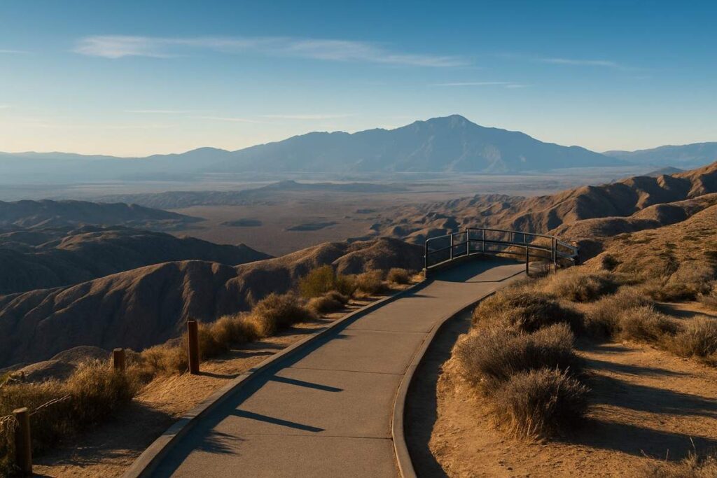
Introduction
The Keys View Short Trail rewards minimal exertion with maximum payoff—a paved 0.25-mile loop perched at 5,185 ft overlooking the Coachella Valley and Salton Sea below. As the park’s highest paved viewpoint, Keys View is a must-do day trip destination for sweeping panoramas of Mount San Gorgonio and the San Andreas Fault. On clear winter mornings, you can even glimpse Signal Mountain in Mexico 95 mi away, making it one of the best scenic hikes in Joshua Tree.
The loop’s gentle grade and interpretive panels make it ideal for all fitness levels, from families to seasoned photographers chasing golden-hour light. The stark contrast of the valley floor’s greenery against the snowy peaks creates an otherworldly vista unmatched elsewhere in the park.
Distance | Elevation Gain | Difficulty | Permit
- Distance: 0.25 miles
- Elevation Gain: 25 ft
- Difficulty: Very Easy (paved)
- Permit: 7-day Park Pass
Best Time to Visit
- Winter–Spring (December–April): Crisp air and clear skies maximize visibility.
Personal Tips & Safety Precautions
- Wind Chill: Even summer mornings can be breezy—carry a light windbreaker.
- Photo Strategy: Arrive at sunrise for softer lighting and fewer visitors.
- Restroom Check: Vault toilets available near the Upper Keys View parking lot.
- Safety Buddy: The overlook drop-off is steep—keep children and pets close.
8. Chasm of Doom Trail
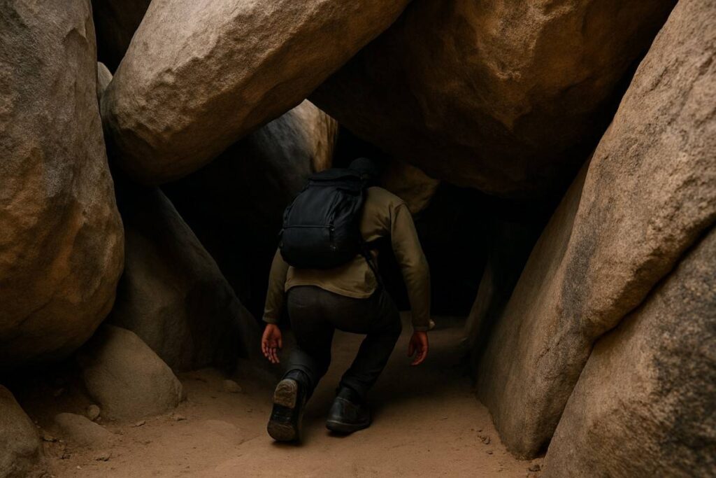
Introduction
The Chasm of Doom Trail is a hidden slot-canyon scramble tucked into the heart of Hidden Valley, offering a thrilling maze of tunnels and tight squeezes through granite boulders.. Despite its ominous name, no technical climbing gear is required—just some careful scrambling and a sense of adventure as you twist through narrow passages. This off-trail gem reveals an otherworldly subterranean world where daylight peeks through cracks overhead, creating dramatic light beams on the rocky floor. Local experts recommend tackling it at a leisurely pace to enjoy the unique geology and avoid knee strain on steep sections.
Though unmarked, the entrance sits just off the Hidden Valley Loop—you’ll spot a low granite window and a lone palm that mark the way in. Inside, “The Coffin,” a flat horizontal crawlway, challenges you to squeeze through a 1 ft-high, 6 ft-long corridor before emerging into a vaulted chamber . Veterans of the route sometimes revisit at dusk with headlamps for a spooky moonlit experience, but first-timers should stick to daylight.
Distance | Elevation Gain | Difficulty | Permit
- Distance: 1.6 miles
- Elevation Gain: 197 ft
- Difficulty: Moderate scramble
- Permit: 7-day Park Pass (vehicle: $30; foot: $15)
Best Time to Visit
- Spring & Fall: Mild temperatures make crawling and scrambling far more comfortable.
Personal Tips & Safety Precautions
- Headlamp Ready: Even daytime shadows can get deep—carry a reliable light source.
- Glove Up: Thin climbing gloves protect your hands from rough granite surfaces.
- Claustrophobia Check: Skip this if tight squeezes trigger anxiety .
- Spotter System: Hike with a buddy and guide each other through tricky spots.
9. Maze Loop Trailhead
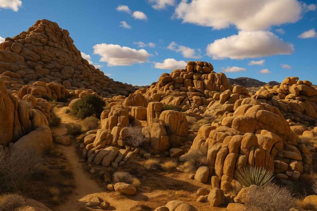
Introduction
The Maze Loop Trailhead is a 4.9-mile circuit that winds through the Wonderland of Rocks, delivering an immersive tour of Joshua Tree’s signature monzogranite towers and hidden canyons. Its moderate difficulty comes from sandy washes that shift underfoot and occasional boulder fields demanding simple rock-hopping. As you traverse the loop, you’ll pass through narrow corridors carved by wind and water over eons, surrounded by an almost cathedral-like assembly of boulders. Early hikers praise the morning light filtering between rock fins, creating dramatic shadow play on ancient surfaces.
Unlike busier loops, the Maze often feels solitary—ideal for reflection and wildlife spotting if you start before sunrise. Navigation is straightforward with cairns marking junctions, but carry a map or GPS backup in case of low visibility.
Distance | Elevation Gain | Difficulty | Permit
- Distance: 4.9 miles
- Elevation Gain: 862 ft
- Difficulty: Moderate
- Permit: 7-day Park Pass
Best Time to Visit
- October–April: Cooler days and mild nights make this best long hike in Joshua Tree comfortable.
Personal Tips & Safety Precautions
- GPS Backup: Keep offline trail data in case cell service drops.
- Sand Stakes: Use gaiters to keep abrasive sand out of shoes.
- Wildlife Watch: Dawn and dusk bring out bighorn sheep near rock outcrops.
- Photo Pitstop: Stop at the narrowest narrows for striking rock-wall portraits.
10. Whispering Pines Trail
Introduction
The Whispering Pines Trail may technically lie just outside Joshua Tree National Park, but its serene loop through pine-shaded canyons provides a refreshing contrast to desert hikes. This brief 0.4-mile path immerses you in a miniature conifer forest, where wind currents create a constant, gentle rustling that inspired its name. Interpretive signs explain the critical role these pines play in local hydrology, anchoring soil and shading ephemeral streams after desert rains. At midday, filtered sunlight through needles forms dappled patterns that delight photographers and calm walkers alike. Local hiking clubs recommend pairing it with a longer eastern out-and-back to experience nearby oak groves and switchbacks.
Distance | Elevation Gain | Difficulty | Permit
- Distance: 0.4 miles
- Elevation Gain: 50 ft (approx.)
- Difficulty: Easy
- Permit: None (free access)
Best Time to Visit
- Year-Round: Pine canopy ensures shade in summer and scenic foliage in winter.
Personal Tips & Safety Precautions
- Trail Extension: Connect to nearby switchbacks for a 2-mile loop.
- Stream Check: After rains, watch for wet, slippery sections under pines.
- Insect Repellent: Mosquitoes can gather near moist ground—apply before starting.
- Quiet Hours: Early morning brings the best bird calls—hike in silence to spot wrens.
11. Black Rock Canyon Loop
Introduction
The Black Rock Canyon Loop begins at the Black Rock Campground and circles through pinyon-juniper woodlands before ascending ridge tops with sweeping valley views. This 4-mile loop is celebrated for its balance of shaded stretches under oak trees and exposed panoramas of desert floor and distant peaks. Along the way, interpretive markers identify native plants and geological layers, deepening your Joshua Tree day trip experience. Mid-loop, a steep spur to Eureka Peak offers bird’s-eye perspectives for rewarded climbers. Backcountry backpackers often extend here for overnight trips, linking to the California Riding and Hiking Trail.
Distance | Elevation Gain | Difficulty | Permit
- Distance: 4 miles
- Elevation Gain: 522 ft
- Difficulty: Moderate
- Permit: 7-day Park Pass; backpacking permits for overnight
Best Time to Visit
- March–May & September–November: Optimal shade in spring; crisp air in fall.
Personal Tips & Safety Precautions
- Campground Start: Use nearby flush toilets and water spigots before departure.
- Layer Up: Ridge winds can chill even warm days—carry a light jacket.
- Plant ID: Look for sagebrush and desert ceanothus; markers point out key species.
- Backpacking Link: Combine with CRHT for a multi-day loop—reserve permits early.
12. Wonderland of Rocks Hike
Introduction
The Wonderland of Rocks Hike, often called the Wonderland Connection, navigates a labyrinth of stacked monzogranite boulders over a 5.5-mile point-to-point route between Covington Flats and Queen Valley. Rated highly challenging, it demands careful route-finding as you ascend through tight slots and across sandy saddles. Frequent hikers praise the surreal terrain—neck-high boulder walls form towering alleys that open to sky-lit chambers. Early morning hikes reveal wildlife like kit foxes and roadrunners darting between rocks. This is one of the best backpacking overnight hikes in Joshua Tree when paired with a spring water cache at Queen Valley.
Distance | Elevation Gain | Difficulty | Permit
- Distance: 5.5 miles
- Elevation Gain: 800 ft (approx.)
- Difficulty: Hard
- Permit: Wilderness backpacking permit required
Best Time to Visit
- March–May & October: Avoid summer heat; winter nights can be very cold.
Personal Tips & Safety Precautions
- Water Cache: Pre-stow water at Queen Valley & Covington Flats (use NPS cache guidelines).
- GPS Waypoints: Mark key waypoints on a handheld GPS to avoid getting lost.
- Solo Caution: This remote route benefits from group travel—plan accordingly.
- Night Prep: If backpacking, carry a warm bag and insulated pad for sub-30 °F winter lows.
13. Fortynine Palms Oasis Trail
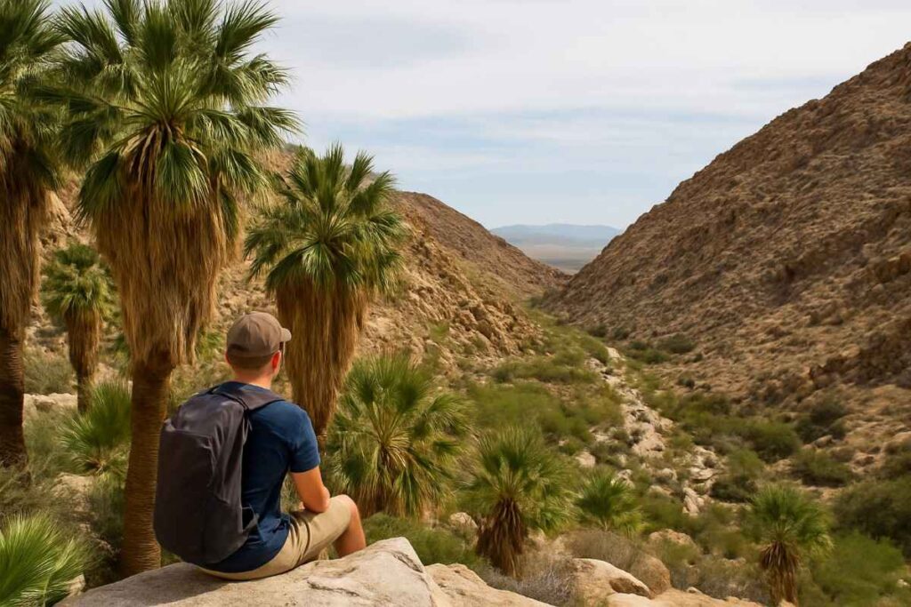
Introduction
The Fortynine Palms Oasis Trail delivers a classic desert-to-palm oasis experience on a 3-mile out-and-back trek through rocky washes and boulder fields. Once open cattle range, this northern park corridor offers a serene palm-fringed respite, where dripping fronds and trickling springs feel astonishing in the arid landscape. Dramatic canyon walls frame the oasis, and interpretive signs explain how this rare water source sustains migratory birds and lizards Local trail runners set a brisk pace here, using sandy sections for speed training before the uphill return . It’s widely celebrated as one of the best day hikes in Joshua Tree for its contrast and ease of access .
Distance | Elevation Gain | Difficulty | Permit
- Distance: 3 miles
- Elevation Gain: 300 ft each way
- Difficulty: Easy to Moderate
- Permit: No special permit; Park Pass required
Best Time to Visit
- October–April: Oasis pools often dry in summer—visit fall through spring for water sightings.
Personal Tips & Safety Precautions
- Pool Respect: Stay on markers to avoid trampling fragile oasis vegetation .
- Early Bird: Arrive before 9 AM to secure limited parking and enjoy solitude.
- Trail Snacks: Pack salty snacks to replenish electrolytes on the uphill return .
- Sun Shield: No shade—apply SPF 50 and wear a hat for desert sun protection.
14. Lost Palms Oasis (Backpacking Overnight)
Introduction
The Lost Palms Oasis route is a quintessential backcountry challenge, leading you 7.5 miles each way into a remote canyon to discover one of Joshua Tree’s largest fan palm groves. Negotiating sandy washes and rolling ridges, hikers experience true solitude and witness how this oasis sustains life in the Mojave. On arrival, a lush pocket of palms offers grassy shade and seasonal water pools—an unexpected refuge amidst stark desert hills. Backpackers recommend caching gear and water at the canyon rim to lighten loads for the final descent. At night, the clear skies above the palms make for an unforgettable stargazing camp.
Distance | Elevation Gain | Difficulty | Permit
- Distance: 7.5 miles
- Elevation Gain: 500 ft
- Difficulty: Hard (backpacking)
- Permit: Wilderness backpacking permit required
Best Time to Visit
- February–April & October: Cooler days reduce dehydration risk; summer heat is extreme.
Personal Tips & Safety Precautions
- Water Planning: Carry 4 L per person or cache at Rendezvous Canyon.
- Light Pack: Use ultralight gear—sandy terrain makes heavy loads feel double.
- Canyon Rim Cache: Store spare food/gear at the rim to lighten the final descent.
- Leave No Trace: Pack out all waste; oasis ecosystems are fragile.
Quick Comparison Table: Best Hikes in Joshua Tree National Park
| Trail Name | Distance | Elevation Gain | Difficulty | Best Time to Visit | Permit Required |
|---|---|---|---|---|---|
| Hidden Valley Nature Trail | 1.0 mi | 100 ft | ⭐️⭐️☆☆☆ Easy | Fall, Winter, Early Spring | No |
| Barker Dam Nature Trail | 1.3 mi | 100 ft | ⭐️⭐️☆☆☆ Easy | Fall, Winter, Early Spring | No |
| Ryan Mountain Trail | 3.0 mi | 1,070 ft | ⭐️⭐️⭐️⭐️☆ Moderate to Hard | Fall, Winter | No |
| Arch Rock Nature Trail | 0.5 mi | Minimal | ⭐️⭐️☆☆☆ Easy | Year-round | No |
| Oasis of Mara Loop | 0.5 mi | Minimal | ⭐️⭐️☆☆☆ Easy | Year-round | No |
| Skull Rock Loop | 1.7 mi | 150 ft | ⭐️⭐️☆☆☆ Easy to Moderate | Fall, Winter | No |
| Keys View Short Trail | 0.3 mi | Minimal | ⭐️⭐️☆☆☆ Easy | Fall, Winter | No |
| Chasm of Doom Trail | 2.3 mi | 500 ft | ⭐️⭐️⭐️⭐️☆ Moderate to Hard | Fall, Winter | No |
| Maze Loop Trailhead | 4.0 mi | 500 ft | ⭐️⭐️⭐️⭐️☆ Moderate to Hard | Fall, Winter | No |
| Whispering Pines Trail | 6.0 mi | 1,000 ft | ⭐️⭐️⭐️⭐️☆ Moderate to Hard | Fall, Winter | No |
| Black Rock Canyon Loop | 8.0 mi | 1,200 ft | ⭐️⭐️⭐️⭐️⭐️ Hard | Fall, Winter | No |
| Wonderland of Rocks Hike | 15.0 mi | 2,000 ft | ⭐️⭐️⭐️⭐️⭐️ Hard (Backpacking) | Fall, Winter | Yes (Backpacking) |
| Fortynine Palms Oasis Trail | 3.0 mi | 600 ft | ⭐️⭐️⭐️☆☆ Moderate | Fall, Winter | No |
| Lost Palms Oasis (Backpacking) | 8.0 mi | 1,200 ft | ⭐️⭐️⭐️⭐️⭐️ Hard (Backpacking) | Fall, Winter | Yes (Backpacking) |
Best Trails by Park Area
Hidden Valley & West Entrance Hikes
Hidden Valley sits just inside the West Entrance, making it one of the most accessible best hikes in Joshua Tree National Park for first-timers and families alike. Towering monzogranite walls create a sheltered amphitheater, while interpretive signs trace the valley’s ranching and rustler lore. This area also hosts the Arch Rock Nature Trail, where a graceful granite arch frames the desert skyline and offers an easy sampler of trails in Joshua Tree . Both loops are ideal spring outings, showcasing yucca stalks and desert wildflowers when the temperature is mild. Don’t miss picking up a park brochure at the West Entrance station for a map and tips on nearby parking—crowds gather early on weekends.
Barker Dam & Black Rock Canyon Area Hikes
Just a few miles east of Hidden Valley, the Barker Dam loop delivers top hikes in Joshua Tree that blend cultural history with wildlife viewing. Cattlemen’s dam remnants reflect monzogranite boulders, and nearby petroglyphs hint at ancient Native American presence. A short drive north brings you to Black Rock Canyon, where pinyon-juniper woodlands and ridgeline vistas reward those seeking the best moderate hikes in Joshua Tree. The Black Rock Canyon Loop weaves through shaded oaks before cresting a summit with broad desert panoramas—a perfect transition if you’re acclimating to higher elevations. Campers can start right from Black Rock Campground, linking easily to the California Riding and Hiking Trail for extended adventures.
Oasis of Mara & Cottonwood Spring Area Hikes
At the park’s South Entrance near Cottonwood Spring, Oasis of Mara offers the best easy hikes in Joshua Tree, with a paved loop under native fan palms and interpretive panels on desert ethnobotany . A few miles further south on I-10, Cottonwood Spring boasts bird-rich riparian pockets and the Lost Palms Oasis route for backpackers. Both areas offer relief from the rocky highlands, making them ideal if you’re seeking best family hikes in Joshua Tree with minimal elevation change .
Pinto Basin & Cholla Cactus Garden Hikes
In the park’s remote eastern Pinto Basin, the Cholla Cactus Garden dazzles at dawn, its silver-spined teddy-bear chollas glowing in golden light. This area has no maintained trails, but a short boardwalk loop guides you through thickets of cacti painted by sunrise hues. For more solitude, venture off-trail into neighboring washes—just carry a topographic map and GPS, as cell service is scarce. Expert hikers consider Pinto Basin treks among the best long hikes in Joshua Tree, rewarding those prepared for remote navigation with unbroken vistas and springtime wildflower carpets.
Experience-Based Hikes in Joshua Tree
Best Easy & Short Hikes for Beginners
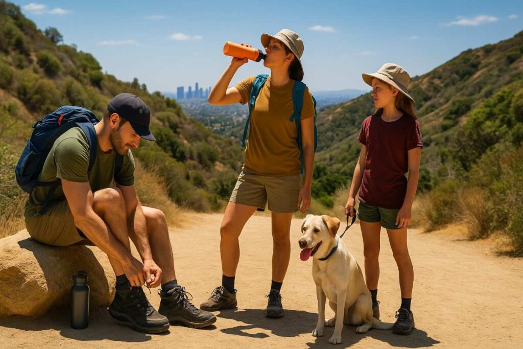
If you’re new to desert terrain, begin with Hidden Valley and Arch Rock—their compact loops (1–1.5 miles) offer interpretive signage, gently graded paths, and a real sense of Joshua Tree hike charm . Oasis of Mara’s paved palm oasis is wheelchair-friendly and perfect for those craving shade and wildlife viewing without challenging footing . Beginners should start hikes before 9 AM to avoid midday heat, carry 1 L of water per hour, and download the NPS app for offline maps .
Best Dog Friendly & Family Hikes
Joshua Tree doesn’t allow pets on trails, but families can swap dogs for young hikers on the Barker Dam and Skull Rock loops, both under 2 miles and dotted with interpretive signs to engage little legs . Pack snacks to share at shaded alcoves under boulders, and bring a frisbee for impromptu play near campground areas . Always leash up and follow campground pet rules, then switch to human-only trails where dogs aren’t permitted.
Best Moderate & Long Hikes
Crave more challenge? Tackle Ryan Mountain (3 miles round-trip, 1,050 ft gain) for a strenuous ascent through pines to a summit plateau . The Maze Loop (4.9 miles) threads through Wonderland of Rocks boulder mazes, demanding route-finding skills and sturdy footwear. Both rank among the best moderate hikes in Joshua Tree—carry 2 L of water, use gaiters to keep sand out of shoes, and update your planned route with rangers .
Best Scenic, Sunrise & Sunset Hikes
For sunrise glory, Arch Rock and Keys View deliver postcard panoramas—arrive 30 minutes early, set up your camera tripod, and enjoy the shifting colors . Skull Rock’s west-facing viewpoints make it a best sunset hike in Joshua Tree, as shadows lengthen across monzogranite spires . Bring headlamps for your descent and a windbreaker—the temperature often dips sharply once the sun slips below the horizon .
Best Backpacking & Overnight Routes
For epic solitude, Lost Palms Oasis and Wonderland Connection stand out as the best backpacking overnight hikes in Joshua Tree . Pre-cache water at designated spots, reserve a wilderness permit, and pack ultralight gear to manage sandy washes. Nights under the palms or between cathedral-like boulders reveal Joshua Tree’s world-class stargazing—carry a star chart or smartphone app to identify constellations in the darkest skies of Southern California.
Essential Gear & Preparation for Joshua Tree Hikes
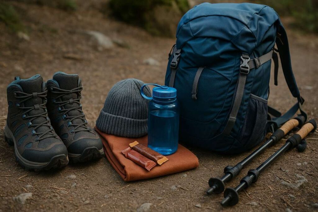
Footwear & Apparel for Desert Terrain
Choosing the right footwear is critical for any Joshua Tree hike, as trails range from sandy washes to monzogranite slabs. Opt for trail runners or lightweight hiking boots with aggressive lug patterns to maintain traction on loose sand and rocky steps—a must when scrambling around boulders on trails like Hidden Valley Nature Trail. Breathable, moisture-wicking socks prevent blisters in arid heat, while quick-dry, UPF-rated clothing shields your skin from harsh UV rays without overheating. Layering is key: mornings can be brisk, but midday desert sun demands breathable, long‑sleeved shirts and convertible pants to protect against sunburn and abrasive vegetation.
Hydration, Water Storage & Nutrition Tips
In Joshua Tree’s desert climate, dehydration happens quickly—plan on at least 1 L of water per hour of hiking. A hydration bladder or multiple insulated bottles keep water cool, and adding electrolyte tablets helps replenish salts lost through sweat. For nutrition, pack high‑energy, non‑perishable foods—nuts, energy bars, and dried fruit offer quick calories without weighing you down.
Sun Protection & Heat Safety
Joshua Tree’s UV index often exceeds 9, posing a serious sunburn and heat‑illness risk—even on cloudy days. Wear a wide‑brimmed hat, UV‑blocking sunglasses, and apply broad‑spectrum SPF 50+ sunscreen every two hours, focusing on ears and neck. Lightweight, long‑sleeved shirts with UPF 30+ and breathable neck gaiters provide additional coverage without bulk. On summer hikes, start before sunrise, take shaded breaks under boulders or palms, and carry a small spray bottle to mist yourself for evaporative cooling.
Navigation, Trail Maps & Apps
Although some Joshua Tree trails are well‑marked, many routes—especially in Pinto Basin—require reliable navigation tools. Download the official NPS App, which offers offline interactive maps and ranger‑verified trail data for each park sector. Always carry a paper USGS topo map and compass as GPS can fail in remote washes. Before setting out, share your planned route and expected return time with rangers at the nearest visitor center to ensure a swift response if you run into trouble.
Leave No Trace & Wildlife Awareness
Protecting Joshua Tree’s fragile desert ecosystem requires practicing the seven principles of Leave No Trace—stay on durable surfaces, pack out all trash, and leave natural features untouched. Never pick wildflowers or disturb cultural sites; even a single trampling can damage delicate annual blooms. Respect wildlife by observing from a distance—do not feed or approach desert bighorn sheep, coyotes, or horned lizards. Finally, dispose of human waste in catholes at least 6 inches deep and 200 ft from water sources to prevent pollution.
Seasonal Hiking in Joshua Tree
Spring Hiking: Wildflowers & Bloom
From January through mid‑April, lower elevations explode with color as desert annuals, including Desert Gold and California poppies, carpet alluvial fans and foothills—especially around Cottonwood Spring and Pinto Basin. Spring rains trigger germination, so plan your visit after a good winter storm for peak bloom. Morning hikes around Hidden Valley or Barker Dam offer mild temperatures and soft light for photography, while interpretive signs deepen your understanding of desert botany. Reserve campgrounds early, as spring is the park’s busiest season with limited parking and full sites.
Summer Hiking: Heat Safety & Early Starts
Summer temperatures frequently top 100 °F, transforming even easy loops into potential hazards. Start hikes like Arch Rock or Skull Rock before 6 AM to avoid peak sun, and plan to be off the trail by 10 AM when heat stress risk climbs. Carry extra water (1.5 L/hour), wear cooling neck gaiters, and use a spray bottle to mist your face—small strategies that can dramatically lower core temperature. Always check park alerts for extreme heat warnings and avoid canyon scrambles like Chasm of Doom during mid‑day when shaded relief is minimal.
Fall Hiking: Cooler Days & Foliage
October through November brings highs in the 70s–80 °F and crisply cool mornings, making it one of the best times to visit Joshua Tree. Days are ideal for moderate hikes in Joshua Tree such as Ryan Mountain, where rocky ridges offer sweeping views without the summer glare. Fall monsoon remnants can paint ephemeral washes with green and yellow blooms—carry gaiters to keep small debris out of your boots. This quieter season also offers better parking availability and more solitude on popular loops like Black Rock Canyon.
Winter Hiking: Mild Temperatures & Stargazing
Winter days average around 60 °F, perfect for exploring longer routes like the Maze Loop without overheating. Nights often dip below freezing at higher elevations, so pack an insulating layer for evening campfires and stargazing sessions. Joshua Tree’s designation as an International Dark Sky Park makes it one of the best backcountry stargazing destinations—use red‑lens headlamps to preserve night vision and bring a star map to identify constellations under pristine desert skies
Conclusion: Make the Most of Your Joshua Tree Adventure
Joshua Tree National Park offers an extraordinary array of best hikes in Joshua Tree National Park, from easy nature loops to demanding backcountry routes, ensuring every visitor—from families to seasoned backpackers—finds an adventure that speaks to them. Planning ahead with the NPS “Plan Your Visit” guide helps you secure permits, understand entrance fees, and align your trip with seasonal conditions, whether you aim for wildflower blooms or starlit campsites. Equipping yourself with the right gear—sturdy trail runners or hiking boots recommended by experts, breathable UPF clothing, and reliable navigation tools—provides both comfort and safety on desert terrain.
Staying hydrated is critical in the high-desert environment; carrying at least one liter of water per hour and using electrolyte tablets helps prevent heat-related issues, especially on longer hikes like Lost Palms Oasis. Sun protection measures—wide-brimmed hats, UV-block sunglasses, and regular SPF 50+ application—guard against the park’s intense ultraviolet exposure year-round. Practicing Leave No Trace ethics preserves the fragile desert ecosystem for future generations: pack out all waste, stay on durable surfaces, and view wildlife from a respectful distance.
Seasonal timing transforms your Joshua Tree experience: spring’s carpets of Desert Gold and Brittlebush burst to life across Hidden Valley and Pinto Basin, drawing photographers and botanists alike. Summer demands early starts before temperatures climb above 100 °F—target shaded trails or brief nature loops to minimize exposure. Fall brings cooler days and fewer crowds, making it one of the best times to visit Joshua Tree, with comfortable highs in the 70s–80s °F for moderate treks like Ryan Mountain. Winter nights drop below freezing at higher elevations, rewarding winter hikers and backpackers with crystal-clear skies in this International Dark Sky Park.
Whether you’re chasing sunrise vistas at Arch Rock, exploring hidden slot canyons like Chasm of Doom, or embarking on an overnight journey to Lost Palms Oasis, Joshua Tree’s diverse trails deliver unforgettable landscapes and personal challenges. By coupling expert insights—practical trail tips, safety guidelines, and seasonal advice—with careful preparation and stewardship, you’ll not only conquer the best day hikes in Joshua Tree but also leave the park’s wild beauty intact for those who follow. Pack wisely, respect the desert, and get ready for an adventure that will linger in your memories long after you leave its monzogranite walls behind.
Ethan Marlowe is an experienced hiker and outdoor gear specialist based in Colorado. With over 7 years of hands-on experience trekking through the Rockies, Pacific Northwest, and East Coast trails, he delivers practical advice, expert gear reviews, and survival insights. His goal is to help hikers of all levels make smarter decisions on and off the trail.