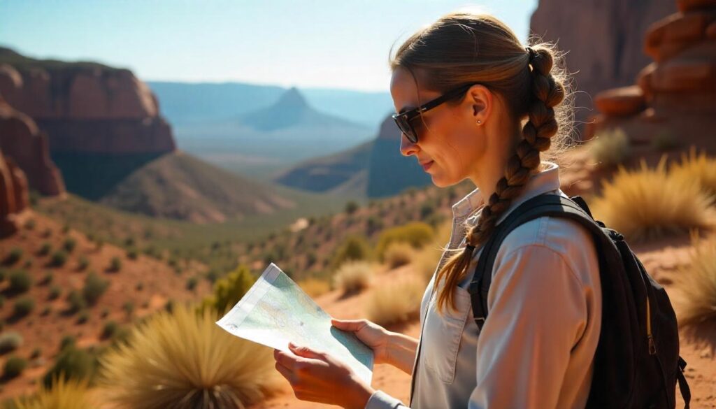
Introduction to Canyonlands Hiking
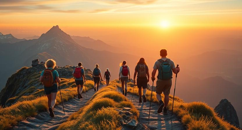
Why Canyonlands Best Hikes Are Unforgettable
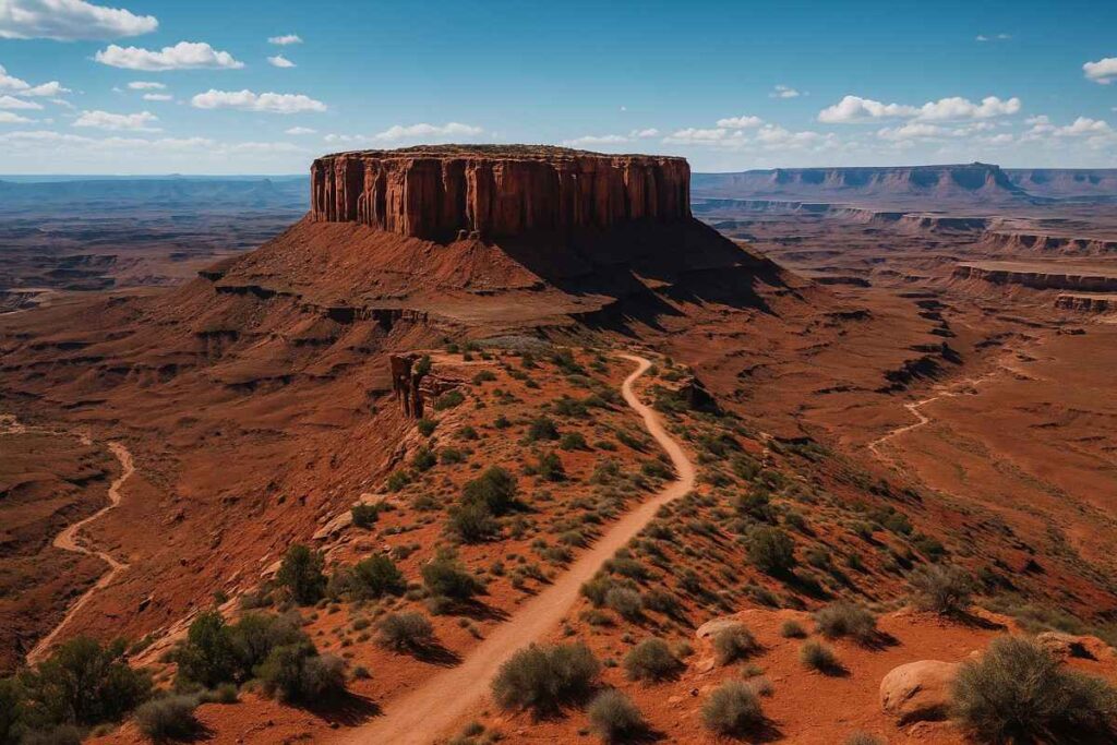
Canyonlands’ dramatic landscapes—sheer cliffs, natural arches, and endless vistas—create a hiking playground unlike any other, where each turn reveals a new geological wonder. Trails like Mesa Arch frame sunrise spectacles across the canyon floor, while remote backcountry routes such as the Chesler Park Loop immerse you in cathedral-like rock formations with minimal crowds. The convergence of rivers, layered sandstone, and high-desert flora fosters rich biodiversity, so hikers often spot desert bighorn sheep, ravens, and spiny lizards along the path. Whether you’re snapping photos of the glowing canyon walls at Golden Hour or finding solitude miles from the nearest 4×4 road, these are truly the Canyonlands best hikes for every adventurer.
Canyonlands Elevation & Climate Insights
Canyonlands sits at elevations from approximately 3,700 ft along the Green River to over 7,100 ft at Cathedral Point in the Needles District, resulting in significant temperature and weather variations. The park’s cold semi-arid climate means low annual precipitation (around 9.2 inches) and extreme diurnal swings—summer highs can breach 100 °F, while winter lows sometimes dip below 0 °F. Monsoon storms from late July to August pose flash-flood risks in narrow canyons, and light winter snows can make trails slippery—both factors that demand careful seasonal planning for your Canyonlands National Park trails outings.
Things to Do in Canyonlands National Park Beyond Trails
While hiking is the park’s centerpiece, Canyonlands also offers world-class stargazing under its International Dark Sky designation—bring a red-light headlamp and a star map to identify constellations above the canyon rims. Off-road enthusiasts can conquer the legendary Shafer Trail and its switchbacks, descending into White Rim Canyon for dramatic views and solitude. Archeology buffs flock to Horseshoe Canyon to view ancient Fremont rock panels accessible via a 3-mile round-trip hike. For a water-based perspective, guided rafting trips down the Colorado River reveal remote canyon walls and hidden side gullies unreachable by foot.
Top 12 Canyonlands Best Hikes You Must Visit
1. Mesa Arch (Island in the Sky District)

Introduction
Perched on the rim of the Island in the Sky mesa, Mesa Arch delivers one of the most iconic sunrise experiences in the entire park. As first light filters through the 6-foot-wide natural sandstone arch, the canyon depths and distant La Sal Mountains ignite in a fiery glow—an image that epitomizes Canyonlands best hikes. Despite its cinematic appeal, the trail to Mesa Arch remains wonderfully accessible: a gentle path weaves through windswept pinyon pines and flats of slickrock, providing a preview of the sweeping Canyonlands National Park trails ahead.
Geologically, the arch sits on Navajo Sandstone carved by millennia of freezing and thawing, making each sunrise shot a lesson in desert erosion and light interplay. Though crowds gather at dawn, the surrounding overlooks toward Monster Tower and Washer Woman Arch offer quieter vantage points for reflection and photography. In just a few steps, hikers transition from flat mesa scrub to a dramatic cliff-edge view—an exhilarating reminder of why this is a must-experience Canyonlands hike for both novices and veterans.
Distance | Elevation Gain | Difficulty | Permit
- Distance: 0.7 miles round-trip
- Elevation Gain: ~100 ft
- Difficulty: Easy
- Permit: 7-day park pass required ($30/vehicle; $15 foot/bike)
Best Time to Visit & Seasonal Tips
Spring & Fall (March–May, Sept–Nov): Mild temperatures and stable weather make for comfortable pre-dawn waits and colorful sky displays. Avoid mid-summer’s heat and winter’s icy mornings unless you have traction devices.
Insider Tips & Safety Precautions
- Arrive Early: Park closes at dark; arrive at least 30 min before sunrise to snag a spot and set up.
- Headlamp & Layers: Bring a red-light headlamp for the walk in, plus a windbreaker—desert temperatures can drop quickly after dawn.
- Photography Angle: Step left of the arch center to include canyon depths in your frame; use a wide-angle lens for dramatic foreground-background contrast.
- Stay Behind Ropes: Respect posted barriers—unstable edges can crumble underfoot.
2. Syncline Loop Trail (Island in the Sky)
Introduction
For hikers seeking solitude and raw geology, the Syncline Loop Trail circles the enigmatic Upheaval Dome through narrow canyons and steep slickrock ledges. This strenuous 8.1-mile circuit demands route-finding skills as cairns vanish amidst boulder fields, rewarding perseverance with rarely seen vignettes of concentric rock folds that hint at either a meteor impact or salt-dome uplift. The clockwise approach begins with a heart-pounding descent into the crater’s rim—perfect for cooler afternoon ascents—and traverses remote washes where even seasoned Canyonlands National Park hikers feel delightfully off-grid.
Wildlife sightings—desert bighorn sheep and red-tailed hawks—are common on the quiet return, reminding you why this is among the Canyonlands best hikes for adventurous souls. Though most park rescues occur here, proper preparation transforms this trail into the ultimate Island in the Sky challenge
Distance | Elevation Gain | Difficulty | Permit
- Distance: 8.1 miles loop
- Elevation Gain: 1,516 ft
- Difficulty: Strenuous
- Permit: 7-day park pass required; no overnight camping without backcountry permit
Best Time to Visit
March–May & Sept–Oct: Cooler temperatures reduce heat stress; avoid monsoon season (July–Aug) when flash floods can fill side canyons.
Personal Tips & Trail Notes
- Water Reserves: Carry ≥1 gal (4 L) per person; no reliable sources on route.
- Navigation Prep: Download offline GPS track and carry a topo map—trail markers are sparse.
- Pacing Strategy: Start clockwise to tackle the steepest descent first and gain shade during the return climb.
- Emergency Plan: Let rangers know your itinerary; cell coverage is spotty, and this trail records the highest rescue rate in Canyonlands.
3. Grand View Point Trail (Island in the Sky)
Introduction
Stretching to the very edge of Island in the Sky, the Grand View Point Trail treats hikers to an uninterrupted panorama of Monument Basin, the Needles, and White Rim Road—visible in brilliant clarity on clear days. Unlike viewpoints reached by car, this 1.8-mile out-and-back trail follows a slightly rolling rim walk, peppered with blocky slickrock steps that keep your legs engaged without surprise scrambling. The real magic happens at the tip: a narrow promontory where you stand above a 2,000-ft abyss, gazing into a labyrinth of red rock spires and river-carved chasms.
Seasoned Canyonlands hikers praise this as one of the best hikes in Canyonlands National Park for its balance of ease, safety, and jaw-dropping views. Families with older kids can venture beyond the paved section, while photographers linger for sunset’s warm glow on sculpted ridges.
Distance | Elevation Gain | Difficulty | Permit
- Distance: 1.8 miles round-trip
- Elevation Gain: ~70 ft net descent/ascent
- Difficulty: Easy–Moderate
- Permit: 7-day park pass required ($30/vehicle)
Best Time to Visit & View Highlights
Year-round (Nov–Mar preferred): Cooler air and lower sun angles enhance distant visibility; watch for summer haze that blurs the Needles District horizon.
Safety Tips for Cliff Edge Views
- Stay Back: Rock edges can crumble—keep a safe distance, especially with children.
- Footwear: Trail runners with good grip prevent slips on smooth sandstone.
- Wind Alert: Rim winds can gust unexpectedly—secure loose hats and gear.
- Hydration: No shade; carry ≥1 L water and sip frequently to avoid dizziness near edges.
5. Shafer Trail & Shafer Switchbacks
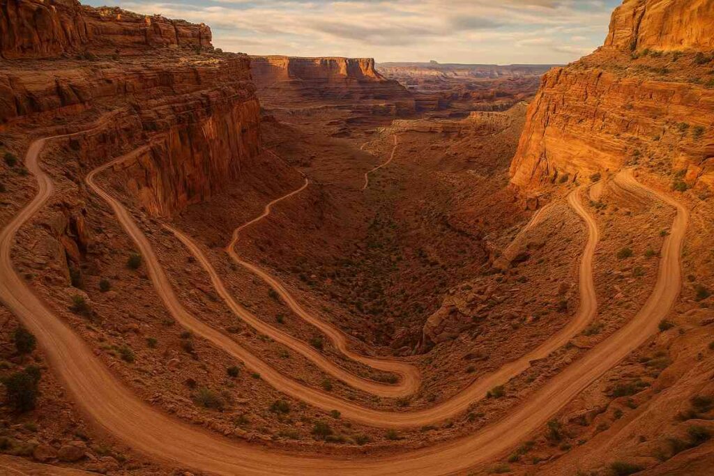
Introduction
The Shafer Trail—better known for its hairpin Shafer Switchbacks—delivers adrenaline and epic views as it descends nearly 1,200 ft from Island in the Sky down to White Rim Road. While most visitors tackle it by 4×4, adventurous hikers can ascend on foot, earning solitude and a unique perspective of the canyonlands trails carved by millennia of river erosion. The switchbacks’ steep sandstone walls feel almost claustrophobic at points, then suddenly open to vast panoramas of the Colorado River Basin below.
Vegetation shifts dramatically along the grade, from hardy pinyon and juniper at the top to desert varnish–coated slickrock near the bottom. Wildlife—including bighorn sheep—often roam the upper reaches, offering surprising encounters in this otherwise stark landscape. Tackling Shafer Switchbacks on foot is one of the best Canyonlands hikes for those seeking raw, unfiltered backcountry intensity.
Distance | Elevation Gain | Difficulty | Permit
- Distance: 8 miles round-trip (road mileage)
- Elevation Gain: ~1,200 ft
- Difficulty: Strenuous (road grade)
- Permit: 7-day park pass; 4×4 access recommended
Best Time to Drive vs. Hike
- Spring & Fall: Cooler air makes the uphill hike manageable and the drive safer on slickrock grades.
- Summer: Reserve for early morning drives—hiking can be dangerous above 90 °F.
- Winter: Frost can make road surfaces treacherous; check NPS alerts before visiting.
Vehicle Requirements & Safety
- High Clearance 4×4: Essential for driving; low vehicles risk undercarriage damage on ledges.
- Hiking Gear: If on foot, pack 2–3 L water, trekking poles for stability, and sun protection.
- Spotter System: Hike with a partner to warn of loose sections and assist on steep steps.
- Emergency Plan: No cell service—carry a satellite communicator or file a trip plan with rangers.
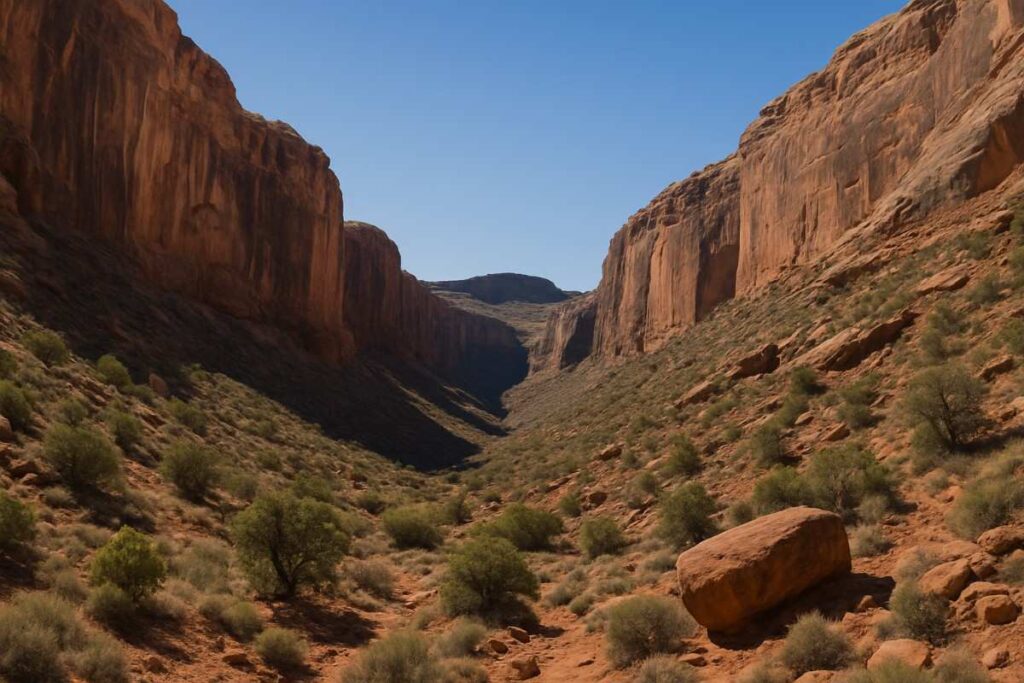
6. Druid Arch via Elephant Canyon

Introduction
Druid Arch stands as a monumental sandstone gateway hidden deep within The Needles, reached by a rugged route through Elephant Canyon and Chesler Park. This strenuous trek immerses you in narrow washes, deep sand, and loose rock before rewarding you with a 150-ft-tall fin that frames the alpine-shaped arch—a sight that feels almost mythical. The final section requires one ladder ascent and moderate scrambling, adding an element of adventure that few Canyonlands hikes match.
Surrounding the arch, alcoves carved by ancient springs once sheltered Fremont people, creating an echo of human history amid stark geology. The trail’s remoteness ensures fewer crowds, so arriving at Druid Arch at dawn often means solitary contemplation and perfect light for photography.
Distance | Elevation Gain | Difficulty | Permit
- Distance: 14 miles round-trip
- Elevation Gain: 1,300 ft
- Difficulty: Strenuous (off-trail navigation
- Permit: 7-day park pass; backcountry permit for overnight stays
Best Season & Water Sources
- Spring & Fall: Avoid extreme summer heat; winter nights drop below freezing.
- Water Cache: No reliable water—pre-cache supplies at Elephant Canyon trailhead per NPS guidelines.
Navigation & Route Finding Tips
- Topo Map & Compass: GPS may fail in narrow canyons—learn to read contour lines to stay on course.
- Cairns: Follow stacked-rock markers where available, but don’t rely solely on them.
- Buddy System: Navigational challenges and remoteness make group travel safer.
- Emergency Shelter: Carry a lightweight bivy for sudden weather changes in exposed sections.
7. Aztec Butte Loop
Introduction
The Aztec Butte Loop combines cultural history with desert panoramas, winding past ancient Puebloan granaries built into sandstone alcoves. Along this easy mesa-top trail, pegmatite dikes slice across the landscape, creating striking linear features that frame views of the Needles formations in the distance. Interpretive signs explain how Indigenous peoples stored food and medicines here, offering a palpable connection to centuries of desert survival.
The loop’s gentle elevation changes make it one of the best hikes in Canyonlands Utah for families and history enthusiasts sensitive to strenuous grades. Wind-sculpted rock pillars dot the horizon, adding a sculptural quality to the otherwise flat mesa and rewarding attentive hikers with endless photographic opportunities.
Distance | Elevation Gain | Difficulty | Permit
- Distance: 1.4 miles round-trip
- Elevation Gain: 222 ft
- Difficulty: Easy–Moderate
- Permit: 7-day park pass required
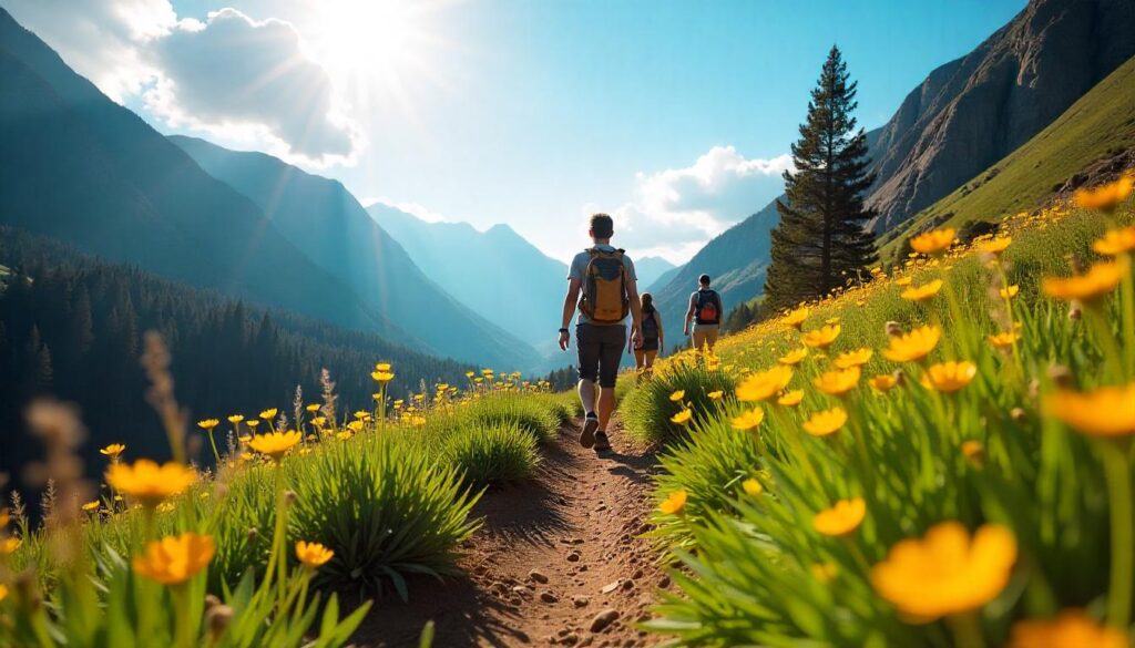
Best Time to Catch Wildflowers
March–April: Spring rains coax brittlebrush and evening primrose blossoms, adding color to sandy washes and alcoves.
Leave No Trace Guidance
- Granary Respect: View but do not touch historic rock structures; they’re fragile and protected.
- Pack It In, Pack It Out: Desert soils regenerate slowly—carry out all trash and food scraps.
- Stay on Route: Avoid off-trail shortcuts that can damage cryptobiotic crusts.
- Cultural Sensitivity: Read signage to understand local Indigenous history and preserve site integrity.
8. Elephant Hill Trailhead
Introduction
The Elephant Hill Trailhead serves as both a 4×4 challenge and strenuous hiking route, ascending from the Needles Visitor Center into a rugged canyon known as “The Grabens”. Hikers choosing to go on foot face steep sandstone steps and loose rock, earning panoramic vistas of the Needles formations and distant La Sal peaks. Early sections wind through juniper groves, while the halfway point reveals vast dunes of fine sand that test your resolve and traction.
At the ridge, the trail opens onto a broad bench where towering spires—resembling elephant tusks—rise dramatically against sky, giving the area its name. This dual-purpose trail ranks among the Canyonlands National Park hikes that deliver raw terrain and rewarding summit moments.
Distance | Elevation Gain | Difficulty | Permit
- Distance: 2.6 miles round-trip
- Elevation Gain: ~850 ft
- Difficulty: Strenuous
- Permit: 7-day park pass; high-clearance vehicle required for road access
Best Sunrise & Sunset Photography Spots
- Sunrise: East-facing dunes glow pink as first light spills into the canyon.
- Sunset: Tusklike spires cast long shadows—arrive early to scout compositions.
- Polarizing Filter: Helps cut glare on sandstone surfaces for richer colors.
- Tripod Use: Essential for low-light golden-hour shots, especially on uneven rock benches.
Personal Safety & Heat Prep
- Sandals Beware: Fine sand can bury shoe treads—wear closed, grippy footwear.
- Hydration: 1.5 L water per hour; there’s no shade on final ridge.
- Headlamp Return: If staying for sunset, carry light for the descent in darkness.
- Group Travel: Loose terrain and remote location merit a hiking partner.
9. Cave Spring Trail (Scorpion Canyon Park)
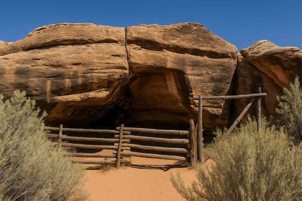
Introduction
Within the Needles district’s Scorpion Canyon, the Cave Spring Trail unveils a shaded microcosm of desert history and geology. This short loop guides you past a historic cowboy camp—complete with remnants of corral fences—and prehistoric petroglyphs etched into cliff walls, offering layers of human narrative against the backdrop of limestone overhangs. Two ladders add playful challenge, while the spring-fed seep below supports lush vegetation, a striking contrast to the park’s arid surroundings. Interpretive panels invite reflection on early 20th-century ranching life, making this one of the best Canyon hikes for families and history buffs.
Distance | Elevation Gain | Difficulty | Permit
- Distance: 0.6 miles loop
- Elevation Gain: ~50 ft
- Difficulty: Easy
- Permit: 7-day park pass required
Best Time to Explore Pictographs
Year-Round: Morning light (8–10 AM) best illuminates rock markings without harsh shadows.
Gear & Water Carry Tips
- Light Pack: No scrambling beyond ladders—carry minimal gear to keep hands free.
- Water Bottle: 0.5 L sufficient given loop’s brevity; refill at visitor center before departure.
- Hat & Shade: Overhangs provide relief, but sun exposure reaches trailhead parking.
- Petroglyph Respect: View from a distance—do not touch or lean on rock art surfaces.
10. Maze Loop & Chesler Park Backcountry
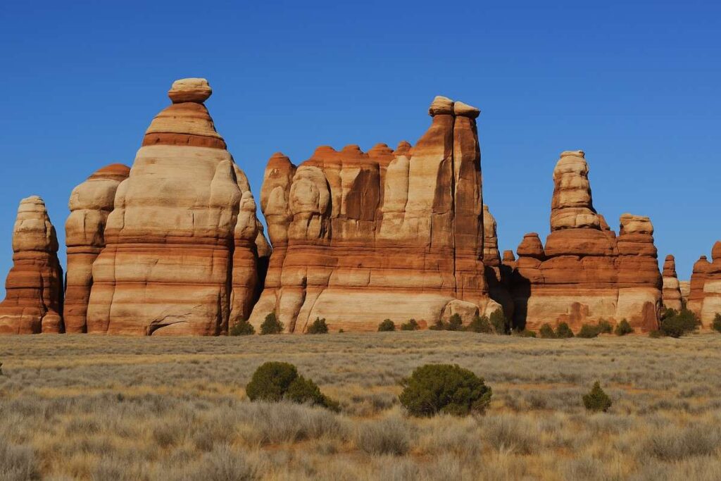
Introduction
For a true backcountry odyssey, the Maze Loop & Chesler Park combines The Maze district’s remoteness with the Needles’ iconic spires in a challenging 27-mile route. Few visitors venture here due to the Maze’s rugged 4×4 access and lack of maintained trails, making every step a lesson in self-reliance and solitude. After navigating narrow canyons and crossing deep sand, you emerge onto Chesler Park’s cathedral of multicolored sandstone fins—sunset here bathes the fins in warm gold, an experience few Canyon hikes rival.
Backpackers often split the trek over 3–4 days, camping under starlit skies with no artificial light for true wilderness immersion. The joint trail section winds through breathtaking slot canyons reminiscent of nearby national parks but far less crowded.
Distance | Elevation Gain | Difficulty | Permit
- Distance: 27 miles point-to-point
- Elevation Gain: ~1,200 ft cumulative
- Difficulty: Hard (remote, self-supported)
- Permit: Wilderness backcountry permit required
Best Overnight Backpacking Windows
March–May & Sept–Oct: Favorable temperatures and stable weather reduce heat and flash-flood risks.
Wilderness Safety & Permits
- Self-Sufficiency: Carry ≥4 L water per day, stove, and bear canister for food.
- Navigation Expertise: GPS, map, compass, and proficiency in desert orienteering essential.
- Leave No Trace: Camp on durable surfaces; pack out human waste in waste bags.
- Itinerary Filing: Provide trip plan to rangers—rescue response in The Maze can take days.
11. Upheaval Dome Overlook
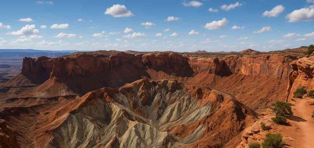
Introduction
The Upheaval Dome Overlook Trail reveals one of Canyonlands’ greatest geological mysteries—a concentric crater whose origin sparks debates between impact and salt-dome hypotheses. Hikers follow a 1.2-mile path to two viewpoints: the first offers broad pond-shaped impressions, while a steeper spur ascends 114 ft to a secondary overlook perched on the inner rim. Along the way, interpretive signs distill complex geological science into engaging narratives, making this one of the Canyonlands National Park hikes that educates as much as it thrills.
The layered sandstone and dolomite walls display stunning cross-section views of deformed strata, providing a hands-on geology lesson unparalleled in the park Early morning light reveals the crater’s depth in sharp relief, while afternoon shadows highlight the dome’s circular symmetry.
Distance | Elevation Gain | Difficulty | Permit
- Distance: 1.2 miles round-trip
- Elevation Gain: 114 ft
- Difficulty: Moderate
- Permit: 7-day park pass required
Best Geological Information Stops
- First Viewpoint: Broad overview of Upheaval Canyon—ideal for group photos.
- Second Overlook: Steeper climb rewards with inner crater perspective and detailed strata views.
- Interpretive Panels: Stop at each sign to understand rock deformation processes.
- Audio Guide: Download NPS audio tour for enriched geological commentary.
Trail Conditions & Timing
- Season: Late spring and fall provide mild conditions; winter snow can obscure cairns.
- Footwear: Sturdy boots with ankle support for rocky, sometimes icy sections.
- Wind Check: Rim winds can be strong—secure hats and loose items.
- Hydration: No shade—carry ≥1 L water for this short but exposed trail.
12. Green River Overlook Canyonlands
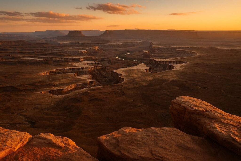
Introduction
The Green River Overlook crowns the Island in the Sky district, offering a vertigo-inducing vista of the Green River carved 1,300 ft beneath your feet . A paved half-mile path leads to a wheelchair-accessible platform, making this one of the best Canyonlands trails for inclusive, awe-inspiring views. From here, you can trace the river’s winding path through the White Rim Basin, spot distant features of The Maze, and even glimpse the Colorado River where the two converge.
Golden-hour lighting accentuates the richly colored canyon walls, turning this overlook into a watercolor of reds, oranges, and purples. Interpretive kiosks explain the river’s role in sculpting the canyon, enhancing your understanding of why this qualifies as one of the best Canyonlands hikes despite its minimal effort.
Distance | Elevation Gain | Difficulty | Permit
- Distance: 0.5 miles round-trip
- Elevation Gain: Minimal (accessible grade)
- Difficulty: Very Easy
- Permit: 7-day park pass required
Best Golden Hour Views
- Sunrise: East horizon glows pink; river reflections intensify the effect.
- Sunset: West-facing platform captures deep shadows and warm light on canyon walls.
- Tripod-Friendly: Paved surface allows stable long exposures for river reflections.
- Weather Check: Clear skies maximize color contrast; haze can soften details.
Safety Near Cliff Edges
- Guardrails: Observe posted boundaries, especially with children or pets.
- Wind Caution: High summit winds can create balance challenges—maintain low center of gravity.
- Footwear: Non-slip shoes essential on smooth pavement near drop-offs.
- Emergency Call: Nearest help is at Island in the Sky visitor center; note your location code.
Quick Comparison Table: Best Hikes in Canyonlands National Park
| Trail Name | Distance | Elevation Gain | Difficulty | Best Time to Visit | Permit Required |
|---|---|---|---|---|---|
| Mesa Arch | 0.5 mi | 50 ft | ⭐️☆☆☆☆ Easy | Year-round (Best at sunrise) | No |
| Syncline Loop Trail | 8.3 mi | 1,630 ft | ⭐️⭐️⭐️⭐️☆ Hard | Spring & Fall | Recommended |
| Grand View Point Trail | 2.0 mi | 200 ft | ⭐️⭐️☆☆☆ Moderate | Year-round | No |
| Shafer Trail & Switchbacks (Drive/Hike) | 18 mi | 1,500 ft | ⭐️⭐️⭐️☆☆ Moderate (if hiking) | Spring, Fall, Summer (Drive) | Permit for Drive |
| Druid Arch via Elephant Canyon | 10.8 mi | 1,600 ft | ⭐️⭐️⭐️⭐️☆ Hard | Spring & Fall | Yes |
| Aztec Butte Loop | 2.0 mi | 250 ft | ⭐️⭐️☆☆☆ Moderate | Spring | No |
| Elephant Hill Trailhead (Various routes) | Varies | Varies | ⭐️⭐️⭐️☆☆ Moderate–Hard | Sunrise/Sunset | Required |
| Cave Spring Trail | 0.6 mi | 50 ft | ⭐️☆☆☆☆ Easy | Spring & Fall | No |
| Maze Loop & Chesler Park | 11–15 mi | 1,200+ ft | ⭐️⭐️⭐️⭐️☆ Hard (Backcountry) | Fall & Spring | Yes (Backcountry) |
| Upheaval Dome Overlook | 1.7 mi | 300 ft | ⭐️⭐️☆☆☆ Moderate | Year-round | No |
| Green River Overlook | 0.3 mi | Minimal | ⭐️☆☆☆☆ Easy | Sunset (Golden Hour) | No |
Best Trails by District
Island in the Sky District Hikes
The Island in the Sky Mesa offers sweeping overlooks of deep canyon country, making it a primer for Canyonlands best hikes with minimal hiking effort. Short, paved trails like Mesa Arch and Grand View Point deliver iconic panoramas of the Colorado and Green Rivers carving the landscape, perfect for photographers and families alike. For more strenuous Canyonlands National Park trails, the Syncline Loop descends into the Upheaval Dome structure, rewarding hikers with remote vistas of concentric geologic folds. The 100-mile White Rim Road also circles below the mesa’s edge, accessible by high-clearance vehicles and popular with mountain bikers seeking extended Canyonlands hikes.
Needles District Trails (Needles Visitor Center)
The Needles District showcases over 60 miles of interwoven trails through towering sandstone “Needles” and Chesler Park’s cathedral-like fins, representing some of the best hikes in Canyonlands National Park. From the short, interpretive Cave Spring Trail with its historic pictographs to the challenging Druid Arch route via Elephant Canyon, the Needles district caters to every level of hiking in Canyonlands. The Needles Visitor Center provides detailed maps and trail guides, and the on-site campground offers year-round tent sites for early starts on Canyonlands hikes. Adventurous backpackers often extend into the Joint Trail/Chesler Park Loop to experience remote spires and slot canyons with minimal crowds.
The Maze & Chesler Park Long Routes
The Maze district is the park’s most remote area, accessible only by rugged 4×4 roads or multi-day backpacking. Paired with the adjoining Chesler Park Loop, the combined 27-mile route rewards those prepared for self-sufficient travel with sweeping fins, narrow slots, and total solitude. No formal trail markers or facilities exist here, so proficient navigation with map, compass, and GPS is essential for these Canyonlands best hikes. Permits are required for overnight stays in Maze and Needles backcountry zones, ensuring group sizes remain small and Wilderness character is preserved.
Backpacking & Camping in Canyonlands

Backpacking Canyonlands No Permit Zones
Virtually all overnight backcountry travel in Canyonlands requires a wilderness permit, but Island in the Sky’s “at-large” zones have no designated campsites—campers may choose their own sites 1 mile from any road and 300 ft from water or archaeological features. These at-large zones allow greater flexibility in campsite selection, though strict Leave No Trace practices are mandatory to protect cryptobiotic soils and cultural sites. Permits are free but limited—during spring and fall you may need to reserve up to four months in advance, so plan early for camping Canyonlands National Park Utah adventures. For the Maze district, permits also regulate group size and route corridor, preserving the park’s remote character on these Canyonlands trails.
Camping Canyonlands National Park Utah
Canyonlands offers two front-country campgrounds: Island in the Sky’s Willow Flat and The Needles Campground, each charging $15–$20 per night with limited amenities (toilets, picnic tables, fire rings). Sites fill quickly from March through October, so reservations via Recreation.gov are strongly recommended to secure spots for best hikes in Canyonlands Utah. Backcountry camping is allowed only with a permit; no firewood collection is permitted, so campers must bring their own fuel or use provided fire rings in designated sites. Nearby BLM and private campgrounds around Moab provide overflow options for those unable to book within the park, ensuring camping in Canyonlands National Park remains accessible
Canyonland Tours & Guided Expeditions
Guided hiking and 4×4 tours provide safe, curated access to remote Canyonlands National Park hikes—operators like Canyonlands by Day offer half- and full-day trips in all districts, blending expert interpretation with logistical support. For multi-day backpacking, companies such as Utah Hiking Guides and Monticello’s Canyonlands Adventures supply gear, backcountry permits, and seasoned guides who navigate Maze’s labyrinthine canyons or Needles’ spire-choked trails. Rafting excursions down the Colorado River combine water travel with shoreline hikes, presenting a unique Canyonlands National Park experience . Tour bookings peak in spring and fall; secure spots early for the best availability and personalized service.
Essential Gear & Desert Preparation

To get the comfortable experience of Canyonlands best hikes, essential gears and apparel are essential elements.
Footwear & Apparel for Rocky Trails
- Sturdy Hiking Boots or Trail Runners: Choose footwear with aggressive lug patterns and ankle support to handle slickrock slabs and loose gravel on Canyonlands trails. This prevents slips on steep riprap and provides stability when scrambling.
- Moisture-Wicking Socks: Merino wool or synthetic blends reduce friction and manage sweat in the park’s arid climate, minimizing the risk of blisters on longer Canyonlands hikes.
- Breathable, Quick-Dry Clothing: Opt for UPF-rated shirts and convertible hiking pants that protect against sun exposure yet ventilate heat, crucial when temperatures soar above 90 °F.
- Layered Outerwear: Lightweight fleece or windbreaker for morning chill atop Island in the Sky, and a packable shell for sudden monsoon breezes or winter cold snaps on Canyonlands National Park hikes.
Hydration, Sun Protection & Navigation Tools
- Hydration System: Carry a 2–3 L hydration bladder or multiple insulated water bottles; plan for at least 1 L/hour on strenuous routes like Shafer Switchbacks or Elephant Hill .
- Electrolyte Supplements: Tablets or powders replace lost salts during long spells in the sun, helping prevent cramps on backcountry loops such as Maze & Chesler Park.
- Sun Protection: Broad-spectrum SPF 50+ sunscreen, a wide-brim hat, and UV-blocking sunglasses shield against the park’s intense UV index, especially on exposed overlooks like Green River Overlook.
- Navigation Tools: Download the official Canyonlands NP map in the NPS app for offline use, and carry a paper topographic map plus compass—GPS can fail in narrow slots.
Remote Trail Safety Precautions
- Trip Plan Filing: Always register your itinerary, expected return time, and emergency contacts with the Island in the Sky or Needles visitor center to aid rangers if you don’t check out.
- Satellite Communicator: A device like Garmin inReach ensures you can call for help off-grid, essential on remote Canyonlands hikes like Syncline Loop or Upheaval Dome.
- First-Aid Kit: Include blister care, snake-bite bandages, and a lightweight emergency blanket—desert temperatures can swing from 100 °F to below freezing.
- Group Travel & Pace: Hike with at least one partner and set a realistic pace; dehydration and heat illness risk increase when you push too fast on strenuous routes such as Druid Arch.
If you’re new to hiking then you must be aware of beginners hiking guide.
Final Thoughts on Canyonlands Best Hikes
Canyonlands National Park stands as a testament to the power of wind, water, and time to sculpt some of the most awe-inspiring landscapes on Earth. From the iconic sunrise at Mesa Arch in the Island in the Sky Canyonlands National Park district to the remote spires of Chesler Park in The Maze, every path tells a geological story that rewards the curious hiker. Whether you’re embarking on a short, family-friendly loop like the Arch Rock Nature Trail, pushing your limits on the Syncline Loop Trail, or embracing true solitude on the 27-mile Maze Loop & Chesler Park Backcountry route, these are the Canyonlands best hikes that define the very essence of desert adventure.
Preparation remains the cornerstone of any successful Canyonlands outing. Start by consulting the official Canyonlands National Park map and familiarize yourself with elevation changes—ranging from roughly 3,700 ft along the Green River to over 7,100 ft at Cathedral Point—to choose hikes that suit your fitness and interests. Invest in sturdy, traction-oriented footwear and moisture-wicking apparel to handle slickrock and sandy washes. Carry at least one liter of water per hour, use broad-spectrum sunscreen, and leverage both GPS-enabled and paper maps to stay on track, especially in areas without marked trails like The Maze.
Seasonal timing amplifies the magic of each trail: spring unleashes carpets of desert marigolds and ephemeral water flows at Cave Spring Trail, while summer dawns let you conquer Canyon hikes before the heat peaks. Fall offers cooler days, fewer crowds, and heightened visibility over the sprawling White Rim Road, and winter’s crisp air and occasional snow transforms the landscape into a silent, crystalline expanse perfect for stargazing.
Beyond hiking, Canyonlands invites exploration through guided Canyonland tours, backcountry camping under pristine skies, and river paddling on the Colorado and Green Rivers. If you’re seeking the best hikes in Canyonlands Utah, remember to file a backcountry permit, adhere to Leave No Trace ethics, and respect the park’s delicate cryptobiotic soils and cultural sites.
Above all, approach each trail with curiosity and respect. Let the shifting shadows on the red rock walls, the hush of remote canyons, and the spectacle of desert sunrise kindle your sense of wonder. These Canyonlands best hikes are not just walks in the park—they’re journeys through deep time, offering lessons in geology, ecology, and the enduring beauty of the American Southwest. Pack wisely, plan thoroughly, and prepare to be changed by the Canyonlands’ vast and unforgettable wilds.
Ethan Marlowe is an experienced hiker and outdoor gear specialist based in Colorado. With over 7 years of hands-on experience trekking through the Rockies, Pacific Northwest, and East Coast trails, he delivers practical advice, expert gear reviews, and survival insights. His goal is to help hikers of all levels make smarter decisions on and off the trail.