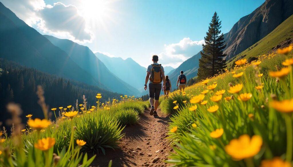
Introduction to Hiking in Scottsdale
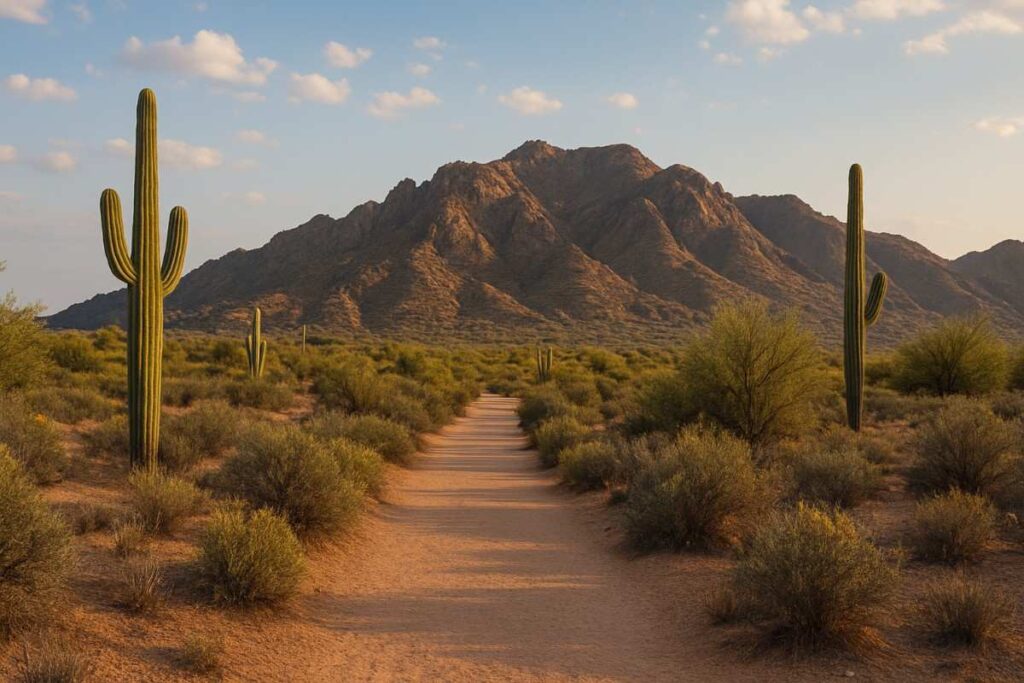
Scottsdale sits in the Sonoran Desert with hundreds of miles of trails at the base of the McDowell Mountains. The city enjoys about 314 sunny days a year, so hikers can plan trips almost year-round. Scottsdale’s McDowell Sonoran Preserve is the largest urban wilderness in the U.S. (over 60 mi of multi-use trails). From desert strolls among saguaro cactus to challenging ridge hikes, hiking in Scottsdale Arizona offers something for everyone. This guide covers trail highlights, planning tips, and expert advice for a safe, fun adventure.
Hiking in Scottsdale Arizona Overview
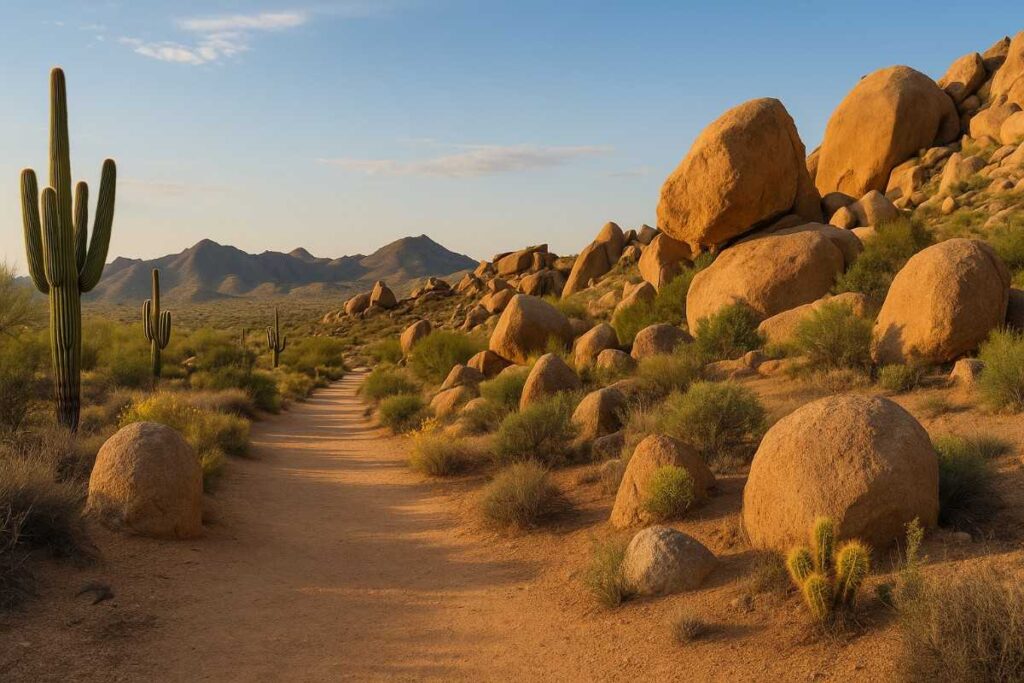
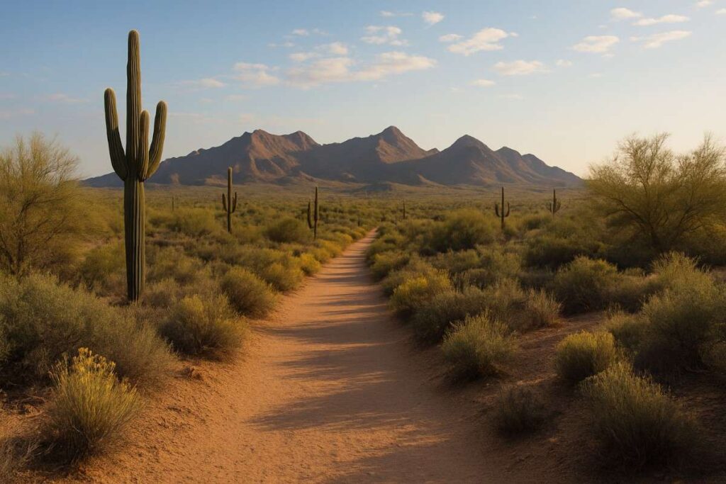
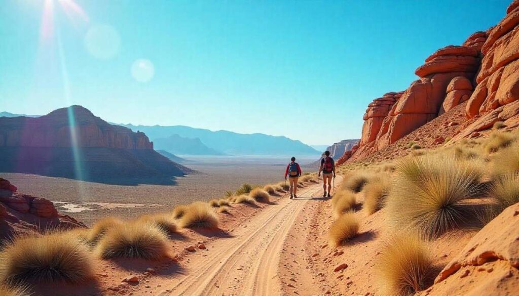
Scottsdale has trails for all levels, from flat desert loops to steep mountain climbs. Easy routes include the Gateway and Lost Dog Wash trails in the McDowell Sonoran Preserve, which meander through cacti and over sandy washes. More vigorous hikes include Tom’s Thumb (a 4–5 mi loop with rocky ridges) and Pinnacle Peak Park (a 3.2 mi out-and-back to a 3,169 ft summit). Just west of town, Camelback Mountain (2,704 ft) offers a very popular 5 mi hike with exposed rock steps. In fact, Scottsdale’s trails are part of a huge network of desert paths: the city conservancy reports 230+ miles of trails in the preserve alone. You’ll see unique desert flora and fauna (the park is a permanently protected habitat, so expect breathtaking views and possibly wildlife on any hike.
Scottsdale Nature Area & Beautiful Scottsdale AZ
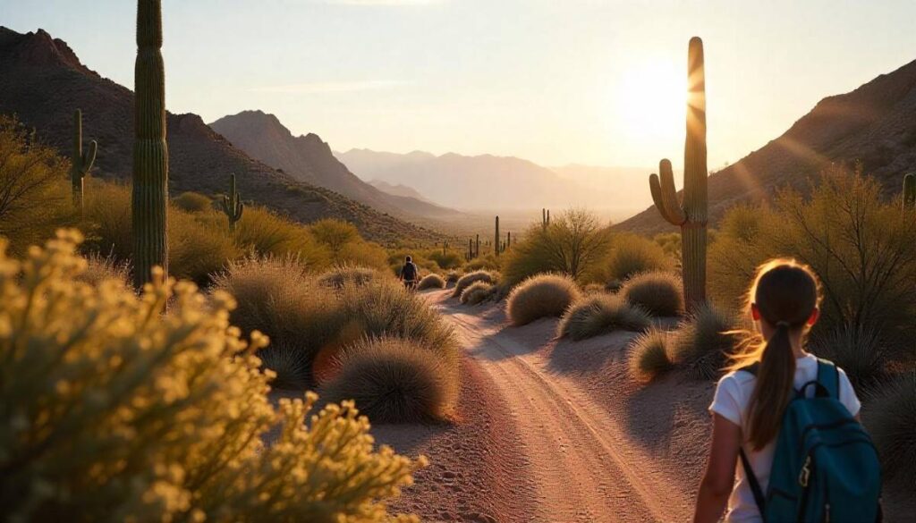
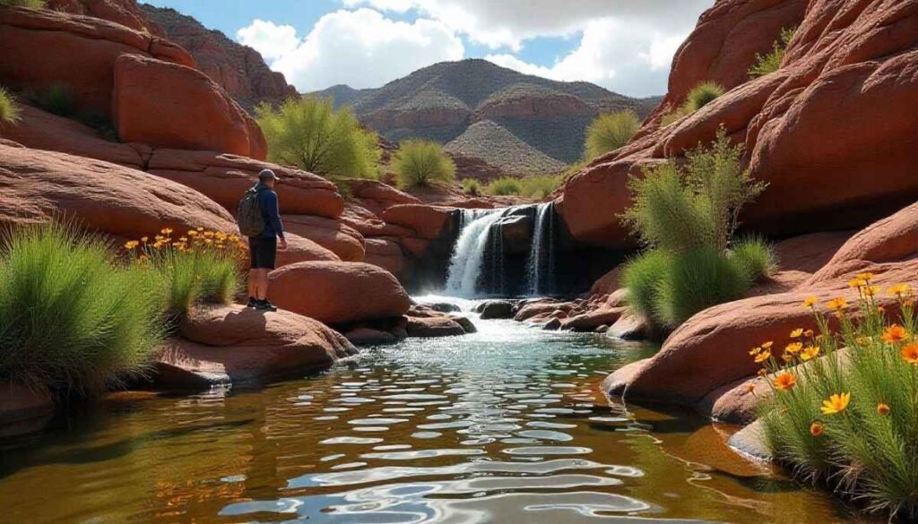
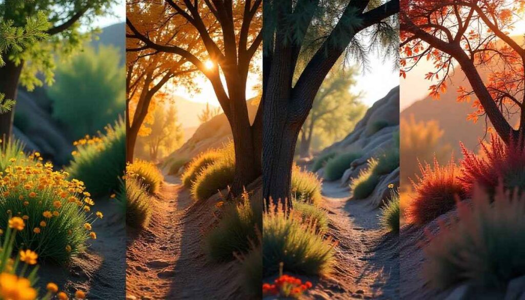
Scottsdale is known for its stunning desert scenery. A local guide stated that city is “located in the beautiful Sonoran Desert at the foot of the scenic McDowell Mountains”, so the backdrop of tall saguaros, rocky washes, and sunrise colors is spectacular. McDowell Sonoran Preserve’s 60+ miles of trails wind through protected desert habitat, where you may spot javelina, coyotes, hawks, and other wildlife. In spring, wildflowers and ocotillo blooms paint the desert floor; summer monsoon clouds can create dramatic storm vistas (just bring a rain poncho). Even the city outskirts feature cacti-dotted hills and panoramic views (as shown above). This mix of rugged mountains and wide desert valleys makes Scottsdale exceptionally scenic and enjoyable for hiking.
Planning Your Hiking in Scottsdale Adventure

Proper planning is key for a safe, enjoyable hike in Scottsdale. Check trail maps and weather before you go, and let someone know your route and return time. Below are expert tips on timing, gear, and safety to help you prepare for your Arizona desert.
What to Pack for Hiking in Scottsdale
- Water & Hydration: Desert hiking demands plenty of water. Plan on at least 1 liter per hour of hiking in the heat. Use a hydration bladder or carry multiple bottles. Always bring extra in case of delays.
- Sun & Skin Protection: Pack broad-spectrum sunscreen (SPF 30+), lip balm with SPF, and plenty of it! Sunglasses are essential to protect your eyes. A wide-brimmed hat or cap is a must. You may even attach a “sun cape” or neck flap to shade your neck.
- Navigation & Safety: Carry a map of the trail or park and a compass/GPS. Phone service can be spotty on remote trails, so don’t rely on it alone. A whistle, headlamp/flashlight, and a lightweight first-aid kit are highly recommended.
- Food & Snacks: Bring high-energy snacks like trail mix, nuts, or energy bars. This helps replace electrolytes lost in sweat (consider a sports drink or salt tablets for long hikes).
- Emergency Gear: If hiking alone or late in the day, pack extra warm layers, an emergency blanket, and a portable phone charger.
- Foot Care: Consider blister-bandages or tape for hot spots. If you have trekking poles, they can ease strain on steep descents.
What to wear for Hiking in Scottsdale
- Sun-Protective Clothing: Wear lightweight long-sleeve shirts and pants made of breathable, quick-dry fabric (synthetic or merino wool). These give UPF protection and wick sweat. Avoid cotton, which traps moisture and can cause chafing.
- Hiking Boots/Shoes: Choose sturdy hiking shoes or boots with good traction for rocky, sandy terrain. Make sure they’re well broken-in to avoid blisters. Consider hiking socks (wool or synthetic) to wick moisture.
- Hat & Sunglasses: As noted above, a wide-brimmed hat or cap is crucial. Pair it with UV-blocking sunglasses to protect your eyes.
- Layers: Even on a hot day, pack a lightweight fleece or hoodie. Desert temperatures can drop quickly after sunset, and a layer or light rain jacket can help if a storm rolls in.
- Extras: In summer, a cooling neck gaiter or bandana can help (soak it in water at a stream crossing). In winter, add gloves and a beanie for early-morning warmth.
Safety Tips for Hiking in Scottsdale
- Stay Hydrated & Sun-Safe: Drink water regularly – don’t wait until you feel thirsty. Apply sunscreen before the hike and reapply often. Start hikes early (sunrise) to avoid the midday sun when possible. Rest in shaded areas and consider a hat-lined rest instead of a roadside break.
- Check Weather & Plan: Always check the forecast. In summer, monsoon storms can develop fast. Never hike alone, especially on remote trails. Tell someone your route and expected return time. Watch sunrise/sunset times – plan to finish long hikes well before dark.
- Wildlife Awareness: Keep alert for wildlife. Rattlesnakes are common in desert and preserve areas. If you hear a rattle, freeze, then slowly back away. Do not chase or attempt to handle snakes. Also watch for scorpions or spiders on warm nights. Javelinas or coyotes usually give hikers a wide berth – do not approach wildlife.
- Stay on Trails: Scottsdale’s parks are well-marked. Straying off established trails increases your risk of injury and getting lost. Flash floods: during a storm, avoid washes and canyons. Never attempt to cross a flooded arroyo– water can rise unexpectedly fast.
- Emergency Prep: Know basic first-aid (for heat illness, snakebite protocols, etc.). Carry a phone and portable charger. If you get lost, stay calm, stay put, and use a whistle or phone to signal for help.
Hiking Stores in Scottsdale AZ & Gear Essentials
Local retailers can help you gear up for Scottsdale hikes. Arizona Hiking Shack (Phoenix) specializes in desert hiking gear, and chain stores like Sun & Ski Sports, REI (Paradise Valley), and Scheels (Chandler) also carry quality outdoor equipment. Even major sports stores (like DICK’s Sporting Goods) stock hiking boots and apparel. Key gear essentials to have are a good daypack with a hydration bladder, sturdy hiking shoes, sun-protective clothing, and layers. Make sure your pack holds all of the items above. Local shops typically carry top brands in boots, moisture-wicking clothing, hydration packs (e.g. CamelBak), trekking poles, and first-aid supplies – don’t hike without these basics.
Hiking Groups in Scottsdale, Hiking Clubs in Scottsdale & Hiking Clubs in Scottsdale AZ
Joining a group is a great way to learn trails and meet people. Scottsdale and nearby Phoenix have many active hiking clubs. For example, Meetup.com shows groups like the “Hiking Hikers (3H) Hiking Group” and “Phoenix Valley Explorers” organizing Scottsdale-area hikes. The Arizona Mountaineering Club (founded 1964) also leads hikes and climbing trips nearby.
Women’s hiking groups (such as Phoenix Soul Sisters) and 50+ clubs hold regular outings too. You can also find smaller informal groups on Facebook or Instagram (for example, “Scottsdale Hiking Club” pages). If you prefer guided treks, local outfitters (e.g. Mad Desert Hikes) offer paid hikes with leaders.
Top 10 Best Hikes in Scottsdale You Can’t Miss
1. Marcus Landslide Trail
Introduction
Marcus Landslide is a gentle, interpretive trail in Scottsdale’s McDowell Sonoran Preserve. It starts at the Tom’s Thumb trailhead and leads to a massive ancient rockslide site. This 4-mile out-and-back hike is easy to moderate, mostly flat until a short climb at the landslide itself. Along the way you’ll see striking granite boulder fields and desert plants. It’s often quiet and great for families or first-timers.
Distance | Elevation Gain | Difficulty | Permit
· Distance: ~4 miles (out-and-back)
· Elevation Gain: ~400 ft (gentle climb at the landslide)
· Difficulty: Easy to Moderate (family-friendly)
· Permit: No permit needed (free city preserve)
Best Time to Visit
Winter and spring are ideal on this Arizona hiking trail. Daytime highs are milder and wildflowers may bloom. As one hiker notes, “I recommend hiking this trail in the winter and spring months because no shade is available along the path”southwesternusahiking.com. Try sunrise or late afternoon for cooler temps and soft light.
Personal Tips & Safety Precautions
- Start early to avoid midday heat
- Read the interpretive signs along the way for geological context
- Wear sturdy shoes for the short rock scramble at the end
- Watch for cacti and small wildlife; keep dogs leashed and stay on trail
- Take it slow on loose gravel; enjoy views of Four Peaks & Superstition Mountains
2. Brown’s Ranch Trail
Introduction
Brown’s Ranch Trailhead is a popular gateway to open desert hiking. This easy, 3.1-mile loop follows the old ranch road through rolling terrain. You’ll pass historic corral remains, rusted artifacts and wide vistas of saguaros and mountains. The trail is wide and mostly flat, making it great for all skill levels. It’s especially beautiful in spring when wildflowers bloom.
Distance | Elevation Gain | Difficulty | Permit
· Distance: ~3 miles (loop)
· Elevation Gain: ~100 ft (mostly flat)
· Difficulty: Easy (family-friendly)
· Permit: No permit needed (free city preserve)
Best Time to Visit
Brown’s Ranch is best in cooler months. Late fall through early spring offers mild weather and fewer snakes. Photographers love the ranch at dawn or dusk for dramatic skies. In summer, do very early hikes or skip this trail (temperatures get dangerously high).
Personal Tips & Safety Precautions
- Bring water, sunglasses & a hat (minimal shade)
- Wear closed-toe shoes; rattlesnakes may lurk among spring wildflowers
- Stay on the main loop to avoid cactus patches
- Secure food—javelina & deer roam here
- Explore the historic corral ruins with kids, but pack out all trash
3. Granite Mountain Loop

Introduction
This 6.1-mile loop circles the base of rugged Granite Mountain in the north preserve. Starting at the Granite Mountain Trailhead, the hike follows Bootlegger and Saddlehorn trails before linking the Granite Mountain Loop Trail. Expect tall boulders, narrow canyons and dense saguaros. The scenery is dramatic and the trail is well-built but winds around rocky slopes.
Distance | Elevation Gain | Difficulty | Permit
· Distance: ~6.1 miles (loop)
· Elevation Gain: ~330 ft (rocky footing)
· Difficulty: Moderate (length + uneven terrain)
· Permit: No permit needed (free preserve)
Best Time to Visit
The loop can be hiked year-round, but spring and fall are most pleasant.
Personal Tips & Safety Precautions
- Wear sturdy shoes; use trekking poles on loose gravel
- Carry ≥ 2 L of water
- Picnic at the “Scenic View” overlook of Verde River valley
- Watch for mountain bikers and follow trail junction signs
- Snack often to maintain energy; cell service is spotty—hike with a buddy
4. Fraesfield Loop Trail
Introduction
The Fraesfield Loop connects three scenic canyons just east of Brown’s Ranch. Starting from Fraesfield Trailhead, the route follows Whiskey Bottle, Turpentine and Black Hill Trails in a large loop around Fraesfield Mountain’s lower slopes. You’ll hike through rolling washes and see interesting rock piles and desert plants. This trail is quieter and feels more “backcountry.”
Distance | Elevation Gain | Difficulty | Permit
· Distance: ~4.7 miles (loop)
· Elevation Gain: ~300 ft (rolling washes)
· Difficulty: Easy to Moderate (quiet backcountry)
· Permit: No permit needed (free preserve)
Best Time to Visit
Like all Scottsdale desert hikes, fall through spring is ideal. After rains (winter/spring), wildflowers and cacti bloom. Summer rains can make the washes green briefly, but also cause flash flood risk – avoid trail during heavy storms. Morning hikes beat the heat and crowds.
Personal Tips & Safety Precautions
- Carry ample water; wear breathable layers in the sun
- Bring a map or GPS—junctions can be confusing
- Look for lush washes and seasonal vegetation
- Apply sunscreen & lip balm; watch for rattlesnakes in rocky areas
- Pack out trash and secure snacks—black bears occasionally wander here
5. Desert Park Trail
Introduction
Desert Park Trail is a hidden gem starting behind Scottsdale’s Silverleaf neighborhood. You can begin at Cooper Ridge Elementary School parking. The trail climbs steadily into the McDowell Preserve, connecting to the Gateway Loop. Along the first half-mile you’ll pass views of luxury homes and golf courses to the left, desert preserve hills to the right. As you enter the preserve, the trail levels out and leads to open vistas and saguaro forests.
Distance | Elevation Gain | Difficulty | Permit
· Distance: ~6 miles (out-and-back)
· Elevation Gain: ~680 ft (steady initial climb)
· Difficulty: Moderate (urban preserve terrain)
· Permit: No permit needed (free preserve)
Best Time to Visit
This trail can get very hot; best done in fall, winter or spring. Hike at sunrise or late afternoon to enjoy cooler temperatures and softer light.
Personal Tips & Safety Precautions
- Pace yourself on the initial 1–2 miles uphill; hydrate frequently
- Option to loop into Gateway trails for more mileage
- Be rattlesnake-aware; keep dogs leashed
- Carry a flashlight if you’ll finish at dusk
6. Jane Rau Interpretive Trail

Introduction
The Jane Rau Trail is a very short accessible loop near Brown’s Ranch. It’s a nature/interpretive trail built to ADA standards, with wide hard surface, benches and signs about local ecology and history. The loop explores desert plants and rock features just south of the Brown’s Ranch Trailhead. It’s perfect for beginners, children or anyone who wants a quick nature walk.
Distance | Elevation Gain | Difficulty | Permit
· Distance: ~0.4 miles (loop)
· Elevation Gain: ~20 ft (nearly flat)
· Difficulty: Easy (accessible, paved)
· Permit: No permit needed (free preserve)
Best Time to Visit
Because it’s so short, you can visit Jane Rau Trail any time the preserve is open (sunrise–sunset). It’s mostly shaded, so summer midday is tolerable here. Fall and spring still offer the best plant-viewing.
Personal Tips & Safety Precautions
- Perfect for cameras or sketchbooks—interpretive panels explain flora & geology
- Fully wheelchair & stroller accessible
- Stay on the paved path to protect delicate desert plants
- Extend your hike onto Brown’s Ranch Loop if time allows
7. Go John Trail (Cave Creek)
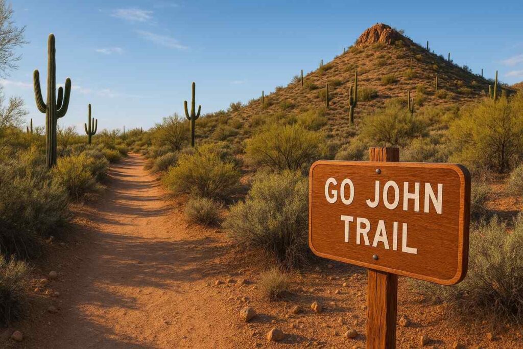
Introduction
This is a rugged 5.6-mile loop up Go John Mountain. It climbs steadily through the desert and offers summit views of Phoenix and the surrounding valley. The trail passes rocky ridges and even an old mine shaft. It’s very scenic but quite strenuous.
Distance | Elevation Gain | Difficulty | Permit
· Distance: ~5.6 miles (loop)
· Elevation Gain: ~804 ft (steady ascent)
· Difficulty: Moderate to Hard (strenuous start)
· Permit: Day-use fee required ($7 per vehicle)
Best Time to Visit
Go John is best tackled in winter or early spring. The trail crosses open ridges, making hot weather punishing. Spring wildflowers can add color; summer monsoon storms can produce lightning, so avoid afternoon storms. Aim to reach the summit by sunrise for spectacular light on the city below.
Personal Tips & Safety Precautions
- Start 1–2 hours before peak temperatures; carry ≥ 3 L of water
- Wear sturdy trail shoes for rocky terrain
- Use a offline map—service is unreliable; hike with a partner if possible
- Watch for rattlesnakes & scorpions; never reach under rocks
- Rest at the summit bench and pack out all trash
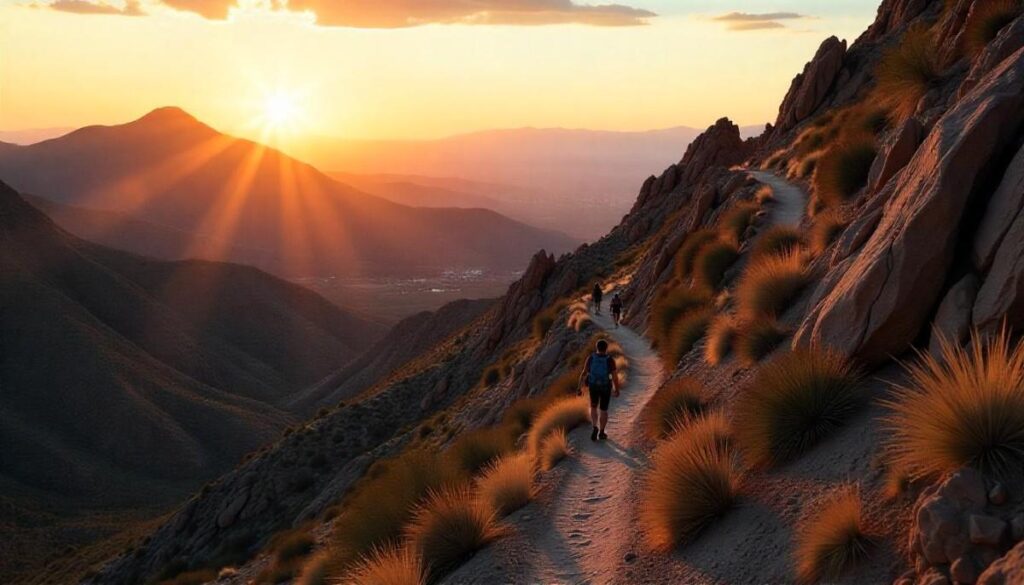
8. Sunrise Trail
Introduction
Sunrise Trail is a short but steep climb up a 3,000-ft peak just north of Scottsdale. The 3.7-mile round-trip trail begins in a residential area (east end of Via Linda) and zigzags up to a high ridge. Along the way, hikers enjoy expansive views over Phoenix and Four Peaks. The last stretch is a steep scramble to the summit. This trail lives up to its name: if you time it right, you’ll be standing above the city at dawn.
Distance | Elevation Gain | Difficulty | Permit
· Distance: ~3.7 miles (out-and-back)
· Elevation Gain: ~1,100 ft (steep scramble)
· Difficulty: Strenuous (summit climb)
· Permit: No permit needed (free preserve)
Best Time to Visit
Many hikers aim for a Sunrise summit – you’ll get the best 360° panorama over Phoenix and Scottsdale (including Four Peaks, Superstition Mtns, and Camelback). Fall through spring mornings are ideal, with clear views and comfortable temperatures. Summer sunrise is very early and still quite hot, so be sure to bring extra layers and water.
Personal Tips & Safety Precautions
- Wear sturdy boots; poles help on the rocky scramble
- Carry ≥ 2 L of water and stop every 10–15 minutes on switchbacks
- Use a headlamp for pre-dawn starts; bring a windbreaker for summit breezes
- Mind loose gravel near the top; respect narrow trail etiquette
- Wildlife sightings possible (javelina, coyotes)
9. Pima/Dynamite Trailhead
Introduction
The new Pima/Dynamite area (north Scottsdale) is a network of recently opened trails. At the paved Pima Road & Dynamite trailhead, you can choose several loop options. For example, the Latigo–Sidewinder Loop is an easy 2.7-mile hike through open desert. This corridor features rolling terrain, many saguaros, and a famous crested saguaro (a rare “candelabra” cactus) right on the trail. More adventurous hikers can explore Axle Grease or Beeline trails for added length.
Distance | Elevation Gain | Difficulty | Permit
· Distance: ~2.7 miles (loop)
· Elevation Gain: ~200 ft (rolling terrain)
· Difficulty: Easy (family-friendly)
· Permit: No permit needed (free preserve)
Best Time to Visit
These north-area trails are great all year, but especially nice in spring when wildflowers appear.
Personal Tips & Safety Precautions
- Follow well-signed trails; look for the rare crested saguaro
- Wear a hat & sunscreen—very little shade
- Explore side trails for extra challenge and vistas
- Watch for mountain bikes on multiuse singletrack
- Carry water & snacks—even short loops can expand with side trails
10. Granite Mountain Scenic Hike
Introduction
This short 3-mile hike is a “scenic spur” off the Granite Mountain Loop. You’ll use the same starting Bootlegger Trail as before, but only go to the official Scenic View point on the west side of the mountain. The final viewpoint sits on a rocky outcrop with panoramic vistas of the Verde River valley and distant mountain ranges.
Distance | Elevation Gain | Difficulty | Permit
· Distance: ~3 miles (out-and-back)
· Elevation Gain: ~200 ft (gentle grade)
· Difficulty: Easy to Moderate (short spur)
· Permit: No permit needed (free preserve)
Best Time to Visit
Because it’s short, you can do this any cool part of the day. Morning or evening hikes are lovely. In cooler months the viewpoint can be a perfect picnic stop with sunset rays on the rocks. Avoid mid-summer heat or plan very early.
Personal Tips & Safety Precautions
- Follow Bootlegger Trail 1.3 mi → Granite Loop junction → 0.2 mi to Scenic View
- Bring a camera for the Mazatzal & Verde River valley panoramas
- Expect alternate sun & shade; wear layers you can shed
- Pets allowed on leash; watch for sun-basking rattlers
- Even short hikes require water & sun protection
Quick Comparison of Best Hikes in Scottsdale
| Trail Name | Distance | Elevation Gain | Difficulty | Best Time to Visit | Permit Required |
|---|---|---|---|---|---|
| Marcus Landslide Trail | 3.7 miles round trip | ~300 ft | ⭐️⭐️ Easy | Fall to Spring | None |
| Brown’s Ranch Trail | ~6 miles loop | ~350 ft | ⭐️⭐️ Easy | Fall to Spring | None |
| Granite Mountain Loop | ~5.1 miles loop | ~700 ft | ⭐️⭐️⭐️ Moderate | Fall to Spring | None |
| Fraesfield Loop Trail | ~4.9 miles loop | ~420 ft | ⭐️⭐️ Easy | Fall to Spring | None |
| Desert Park Trail | ~3.5 miles round trip | ~400 ft | ⭐️⭐️ Easy | Fall to Spring | None |
| Jane Rau Interpretive Trail | 0.5 miles loop | Minimal | ⭐️ Very Easy | Year-round | None |
| Go John Trail (Cave Creek) | 6 miles loop | ~800 ft | ⭐️⭐️⭐️ Moderate | Fall to Spring | Entry Fee Only |
| Sunrise Trail | 4.0 miles one way | ~1,200 ft | ⭐️⭐️⭐️⭐️ Hard | Fall to Spring | None |
| Pima/Dynamite Trailhead | Varies (multi-trail) | Varies | ⭐️⭐️ to ⭐️⭐️⭐️ | Fall to Spring | None |
| Granite Mountain Scenic Hike | ~4 miles round trip | ~600 ft | ⭐️⭐️⭐️ Moderate | Fall to Spring | None |
Must-Do Iconic Scottsdale Mountain Trails
Pinnacle Peak Park Scottsdale AZ
Pinnacle Peak Park is a Scottsdale mountain trail favorite, offering panoramic desert vistas and rugged granite spires. As one of the top hikes in Scottsdale, it’s beloved by locals and visitors seeking a moderately challenging climb with big rewards. The well-marked path winds through creosote and cactus groves, giving hikers a true sense of the Scottsdale nature area. Early mornings here are especially magical, with golden light stretching across the valley floor.
Trail Details
- Distance: ~3.5 miles (out-and-back)
- Elevation Gain: ~1,300 ft (steady switchbacks)
- Difficulty: Moderate (good for most active hikers)
- Permit: Day-use fee applies ($6 per vehicle or $3 per person)
Hiking Camelback in Scottsdale

Tackling Camelback Mountain is a rite of passage for hiking in Scottsdale AZ enthusiasts. The two main routes—Echo Canyon and Cholla Trail—offer steep, heart-pumping scrambles through true Sonoran Desert terrain. At the summit, you’re rewarded with sweeping views of Phoenix, Paradise Valley, and distant mountain ranges, making it one of the most scenic hikes in Scottsdale. Due to its popularity, it’s best reserved for early morning to beat the crowds and the heat.
Trail Details
- Distance: ~2.6 miles (out-and-back via Echo Canyon)
- Elevation Gain: ~1,500 ft (steep scramble sections)
- Difficulty: Strenuous (requires good fitness and sure-footedness)
- Permit: No permit; street parking regulated (arrive before sunrise)
Hiking in Scottsdale AZ Tom’s Thumb
The Tom’s Thumb Trail in the McDowell Sonoran Preserve Saguaro Loop Trail Scottsdale AZ region leads to a distinctive granite pinnacle visible for miles. This best hike in north Scottsdale is part of the preserve’s extensive network of gateway hiking trails in Scottsdale AZ, showcasing towering saguaros and dramatic boulder fields. Photographers and rock climbers often convene here to capture the sunset’s glow on the monolith.
Trail Details
- Distance: ~4.2 miles (out-and-back)
- Elevation Gain: ~1,040 ft (gradual ascent with rocky finish)
- Difficulty: Moderate to Strenuous (some rock scrambling)
- Permit: No permit needed (free city preserve)
Gateway Hiking Trails in Scottsdale AZ
The Gateway Loop Trail is one of the best hiking trails in Scottsdale for those craving both solitude and spectacular views. This 4.5-mile loop circles gentle foothills of the McDowell Mountains, passing through washes and up to a central saddle with 360° vistas of the valley and surrounding peaks. It’s ideal for day hikes in Scottsdale AZ and offers connections to dozens of side routes if you want to extend your adventure.
Trail Details
- Distance: ~4.5 miles (loop)
- Elevation Gain: ~655 ft (rolling hills)
- Difficulty: Moderate (well-maintained singletrack)
- Permit: No permit needed (free preserve)
McDowell Sonoran Preserve & Other Top Trails
McDowell Sonoran Preserve Saguaro Loop Trail Scottsdale AZ
The Saguaro Loop Trail winds through dense stands of giant saguaros, giving hikers a true taste of hiking in north Scottsdale. This moderate 3-mile loop offers interpretive signs about desert ecology and occasional shade from mesquite woodlands. As part of McDowell Sonoran Preserve, it connects to longer treks like the Lost Dog Wash and Gateway Loop for a full day of exploration.
Bajada Nature Trailhead Scottsdale AZ
The Bajada Nature Trailhead is perfect for families and anyone seeking easy hikes in Scottsdale AZ. This short, paved loop offers wheelchair and stroller access alongside interpretive panels on geology, flora, and fauna. Birdwatchers will enjoy spotting cactus wrens, Gambel’s quail, and desert finches among blooming ocotillo and brittlebush.
Lost Dog Wash Scottsdale AZ
Lost Dog Wash is a favorite for those wanting a quiet, dog friendly hiking trail in Scottsdale AZ. Its 5-mile out-and-back path traverses a historic jeep route, featuring sweeping views of Taliesin West and perched saguaros. Wildflowers and crested cacti often line the wash after winter rains, making it one of the best hikes in Scottsdale with water in the spring months.
Quartz Trail Scottsdale AZ
The Quartz Trail traces an old ranch road through rolling desert hills and washes. It’s an easy-to-moderate 2.5-mile out-and-back, ideal for beginners or anyone seeking a shorter hike in Scottsdale area. The trailhead offers parking and restrooms, and the path connects to multiple other routes if you wish to explore further.
Kovach Family Nature Trail Scottsdale AZ
Named for its benefactors, the Kovach Family Nature Trail is an accessible 0.6-mile paved loop near the preserve entrance. It’s one of the short hikes in Scottsdale you can complete in under 20 minutes, making it perfect for those with limited time or mobility challenges. Informative signs introduce hikers to desert plants and wildlife, fostering outdoor activities in Scottsdale Arizona for all ages.
Needle Rock Recreation Site Scottsdale AZ
Located in the northern preserve, Needle Rock is a striking volcanic feature accessible via a 3.2-mile out-and-back trail. The hike gains about 550 ft and rewards you with close-up views of the rock’s jagged spire. This Scottsdale mountain trail is moderately challenging and lesser-known, offering a peaceful escape from the busier peaks.
Waterfall & Water-Focused Hiking Trails
Hiking Trails in Scottsdale with Waterfalls
While true waterfalls are rare in the desert, waterfall trails often refer to seasonal cascades after monsoon storms. One such route is the Seven Sacred Pools on Soldier’s Pass (just outside Scottsdale city limits), where rain runoff collects in natural basins, creating mini-waterfalls. These pools are best experienced in late summer when the desert bursts to life.
For reliable water features, head north to the Mogollon Rim or to waterfalls close to Phoenix such as Fossil Creek. Within an hour’s drive, you can combine hikes in Arizona near Scottsdale with a refreshing swim under cascading water. These trips pair well with a morning of hiking in Scottsdale Arizona, offering a perfect contrast between arid trails and lush creekside oases.
Trail Difficulty & Experience Levels
Easy Hikes in Scottsdale AZ
If you’re new to hiking in Scottsdale, start with easy hikes in Scottsdale AZ like the Jane Rau Interpretive Trail or Bajada Nature Trailhead. These short loops feature smooth, well-marked paths and interpretive signs, making them perfect for families and first-timers. You’ll enjoy gentle terrain, occasional shade, and informative panels that introduce you to the Scottsdale nature area without the strain of steep climbs.
Moderate Hikes in Scottsdale
For a bit more challenge, try moderate hikes in Scottsdale such as the Gateway Loop Trail or the McDowell Sonoran Preserve Saguaro Loop Trail Scottsdale AZ. These 4–5 mile loops feature rolling hills, rocky sections, and rewarding viewpoints, ideal for hikers looking to build stamina. You’ll traverse sandy washes and groves of giant saguaros, experiencing true Scottsdale mountain trails without technical scrambling.
Hard Hikes in Scottsdale for Experienced Hikers
If you crave a test of endurance, tackle hard hikes in Scottsdale like Camelback Mountain’s Echo Canyon Trail or Sunrise Trail’s steep switchbacks. Expect sustained climbs of 1,500+ ft, narrow rock scrambles, and minimal shade. These trails reward you with panoramic vistas of Phoenix, Paradise Valley, and the rugged McDowell range, making each gasping moment worthwhile.
Short Hikes in Scottsdale & Day Hikes in Scottsdale AZ
Pressed for time? Explore short hikes in Scottsdale such as the Kovach Family Nature Trail or the Quartz Trail Scottsdale AZ, each under 2 miles. These day hikes in Scottsdale AZ let you experience desert scenery and local history during a lunch break or afternoon outing. You’ll find interpretive signs, saguaro forests, and easy-to-follow singletrack—all within half a workday.
Short-route specialists advise packing snacks and a headlamp if you linger into dusk, as the city lights of beautiful Scottsdale AZ create a stunning backdrop.
Family Friendly Hikes in Scottsdale AZ
Looking for kid friendly hike in Scottsdale AZ? Trails like Brown’s Ranch and the Bajada Nature Trailhead offer minimal elevation gain and wide, safe paths for little feet. Interpretive panels, shaded benches, and historic ranch artifacts keep young explorers engaged on these easy hikes in Scottsdale.
Parents appreciate the proximity to restrooms and water at trailheads, plus picnic areas perfect for post-hike lunches under the Sonoran sky.
Dogs Friendly Hikes in Scottsdale AZ
Many locals enjoy dog friendly hiking trails in Scottsdale AZ—just keep your pup leashed. Routes like Lost Dog Wash and Gateway Loop welcome four-legged companions with sturdy terrain and desert water sources after rains. Always pack extra water for your dog, watch for rattlesnakes, and bring biodegradable waste bags to respect the preserve’s rules.
Multi-Activity & Alternative Trails
Outdoor Activities in Scottsdale Arizona
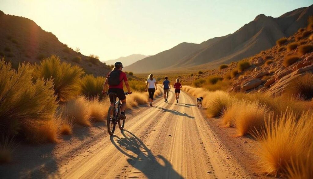
Beyond hiking in Scottsdale Arizona, the region offers bouldering, horseback riding, and guided nature walks. The McDowell Sonoran Preserve hosts interpretive tours led by rangers, while local outfitters offer e-bike rentals for outdoor activities in Scottsdale Arizona that blend exploration with pedal power.
Bike Trails in Scottsdale AZ
Scottsdale’s multi-use paths include the bike trails in Scottsdale AZ like the Scottsdale Greenbelt and the McDowell Mountain Multi-use Trail. These smooth, wide tracks are perfect for road or mountain bikes, offering desert vistas and connectivity to key trailheads. Helmets are mandatory and early starts beat midday heat.
Running Trails Scottsdale AZ
For cardio enthusiasts, running trails in Scottsdale AZ such as the Pima/Dynamite network and Lost Dog Wash provide looped routes ranging from 3 to 10 miles. Well-graded surfaces and gradual elevation gains make them ideal for hill repeats or sunrise jogs, with ample parking and restrooms at the trailheads.
Walking Trails in Scottsdale Arizona
If you prefer a leisurely pace, explore walking trails in Scottsdale Arizona at places like Chaparral Park or the Scottsdale Waterfront Path. These paved, flat promenades offer scenic views of canals, cacti gardens, public art, and city skylines—perfect for a casual stroll or stroller walk.
Photography & Scenic Hikes for Memorable Views
Most Scenic Hikes in Scottsdale
Trails like Tom’s Thumb, Pinnacle Peak, and Sunrise Trail rank among the most scenic hikes in Scottsdale. Each offers unique vantage points—granite monoliths, valley panoramas, and city-to-mountain perspectives. Hike early to avoid haze and crowds, and pause often to frame each memorable moment.
Beautiful Scottsdale AZ Photo Spots
Don’t miss hidden gems like the “Crested Saguaro” on the Pima/Dynamite trails or the Seven Sacred Pools outside Scottsdale city limits. These beautiful Scottsdale AZ photo spots provide dramatic compositions: flowering cacti framing rugged peaks, or desert washes reflecting storm-lit skies. Keep an eye on weather forecasts—monsoon storms can create breathtaking cloud formations far above the desert floor.
Hiking Photography Tips
Capture the best of Scottsdale nature area by shooting during the “golden hour” just after sunrise or before sunset. Use wide-angle lenses to encompass saguaros and mountain backdrops. For desert flower close-ups, switch to macro mode. Remember to protect your gear from dust and heat by keeping it in a sealed bag when not shooting.
Seasonal Hiking in Scottsdale Arizona
Spring Wildflower Hikes in Scottsdale AZ
Every spring, the Sonoran Desert explodes with color—golden brittlebush, purple lupine, and red poppies light up even the driest washes. For the best Spring Wildflower Hikes in Scottsdale AZ, head to Brown’s Ranch Loop or the McDowell Sonoran Preserve Saguaro Loop Trail Scottsdale AZ, where mile-long stretches of desert blooms frame panoramic mountain views.
Mid-March through April is peak season; schedule hikes on weekday mornings to enjoy fewer crowds and softer light for hiking photography. Remember to tread lightly—stop to admire, but don’t pick wildflowers, and pack a field guide or use AllTrails to help identify each vibrant bloom.
Summer Shade & Water-Focused Hikes in Scottsdale
The Jane Rau Interpretive Trail offers sturdy shade-covering mesquite trees just steps from the Brown’s Ranch Trailhead. For a water-focused outing, explore the washes along the Desert Park Trail after monsoon storms—ephemeral pools can form near the Gateway Loop junction. Always check the forecast: summer thunderstorms can bring flash flood risk, so avoid narrow canyons during active storms.
Autumn Desert Color Trails in Scottsdale Arizona
As temperatures cool in autumn, the desert takes on warm hues—rust-colored grasses contrast with still-green saguaros. Trails like Lost Dog Wash and Quartz Trail Scottsdale AZ shine in late October, offering soft, golden light on rocky outcrops. Fall’s scattered showers enhance the hues and attract wildlife: you might spot jackrabbits or quail along these Desert Color Trails in Scottsdale Arizona.
Winter Hiking in Scottsdale & Safety Tips
Winter Hiking in Scottsdale is a favorite for locals and visitors alike—daytime highs hover in the mid-60s, perfect for longer hikes in Phoenix Scottsdale. Pinnacle Peak Park Scottsdale AZ and Tom’s Thumb via the Mescal Trailhead offer clear, crisp air and unobstructed views of snow-tipped peaks to the north.
Monsoon & Rainy Season Hikes in Scottsdale AZ
Monsoon season (July-September) transforms the desert: hummingbird-pollinated flowers burst and washes roar with runoff. Monsoon & Rainy Season Hikes in Scottsdale AZ like the Fraesfield Loop and Gateway Loop Trail reward you with dramatic skies and occasional spray-cooled air near shallow crossings.
Conclusion: Plan Your Best Hiking in Scottsdale Adventure
Exploring the incredible variety of hiking in Scottsdale promises unforgettable adventures for every type of outdoor enthusiast. Whether you’re seeking easy hikes in Scottsdale AZ like the Bajada Nature Trailhead, thrilling climbs such as hiking Camelback in Scottsdale, or peaceful walks along dog-friendly hiking trails in Scottsdale AZ, this desert paradise offers it all.
For those searching for the best hikes in Scottsdale, destinations like the McDowell Sonoran Preserve Saguaro Loop Trail and Pinnacle Peak Park Scottsdale AZ showcase some of the most scenic and rewarding experiences. From short hikes in Scottsdale perfect for quick getaways to hiking trails in Scottsdale with waterfallsideal during the rainy season, you can tailor your adventure to match your fitness level, schedule, and interests.
Thanks to its year-round trail access, stunning desert scenery, and variety of outdoor activities in Scottsdale Arizona, the region has become a top destination for nature lovers, families, and avid hikers alike. Whether you’re aiming to join hiking groups in Scottsdale, photograph breathtaking landscapes, or tackle the hiking mountains in Scottsdale AZ, careful planning and choosing the right trails ensure a safe and memorable trip.
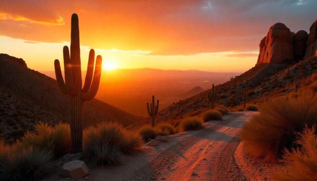
Get ready to lace up your boots, pack your gear, and experience the unmatched beauty of hiking in Scottsdale Arizona—where every trail tells a story, and every step brings you closer to the heart of the Sonoran Desert.
FAQs on Hiking in Scottsdale
Are Hiking Trails in Scottsdale AZ Open Year-Round?
Yes, most hiking trails in Scottsdale AZ are open year-round, thanks to the region’s mild winter climate and well-maintained paths like those in the McDowell Sonoran Preserve. However, during peak summer heat or heavy monsoon rains, certain trailheads may close temporarily for safety.
Where to Hike in Scottsdale for Beginners?
For beginners looking for the best hikes in Scottsdale, easy trails like the Bajada Nature Trailhead Scottsdale AZ or Kovach Family Nature Trail Scottsdale AZ offer gentle elevation gains, scenic desert views, and well-marked paths perfect for first-time hikers.
Where to Stay While Hiking in Scottsdale?
If you’re planning a hiking in Scottsdale Arizona trip, stay near North Scottsdale for quick access to trails like Tom’s Thumb and Pinnacle Peak Park. Resorts and hotels near the McDowell Sonoran Preserve also offer great proximity to top hiking trails in Scottsdale AZ.
Are Dogs Allowed on Hiking Trails in Scottsdale AZ?
Yes, many dog-friendly hiking trails in Scottsdale AZ welcome leashed pets, especially in areas like the Lost Dog Wash Trailhead and parts of the McDowell Sonoran Preserve. Always carry extra water for your dog and follow posted pet rules to protect the desert ecosystem.
How to Join Hiking Groups in Scottsdale?
Joining hiking groups in Scottsdale is easy through local clubs, MeetUp events, and outdoor outfitters that host guided hikes. Groups like the Scottsdale Hiking Club offer organized outings for all skill levels, perfect for making friends and safely exploring new hikes in Scottsdale.
Ethan Marlowe is an experienced hiker and outdoor gear specialist based in Colorado. With over 7 years of hands-on experience trekking through the Rockies, Pacific Northwest, and East Coast trails, he delivers practical advice, expert gear reviews, and survival insights. His goal is to help hikers of all levels make smarter decisions on and off the trail.