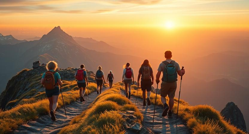
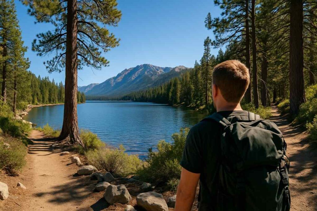
Introduction to Lake Tahoe Hiking
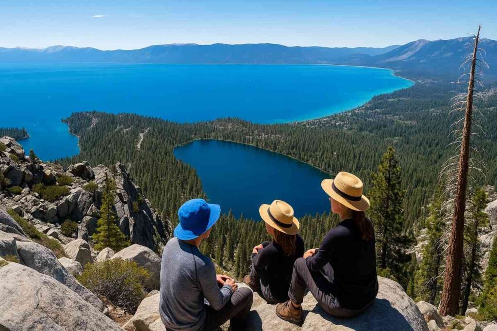
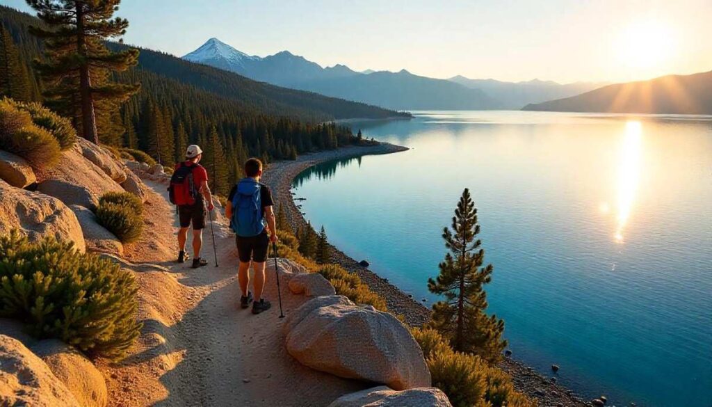
Why Lake Tahoe Hikes Are Legendary
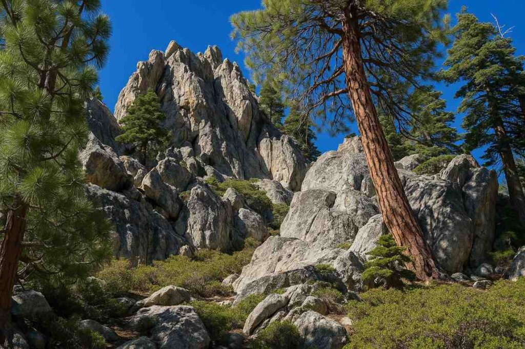
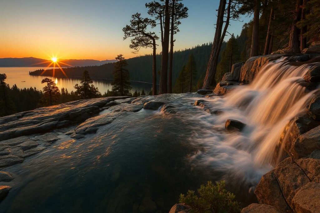
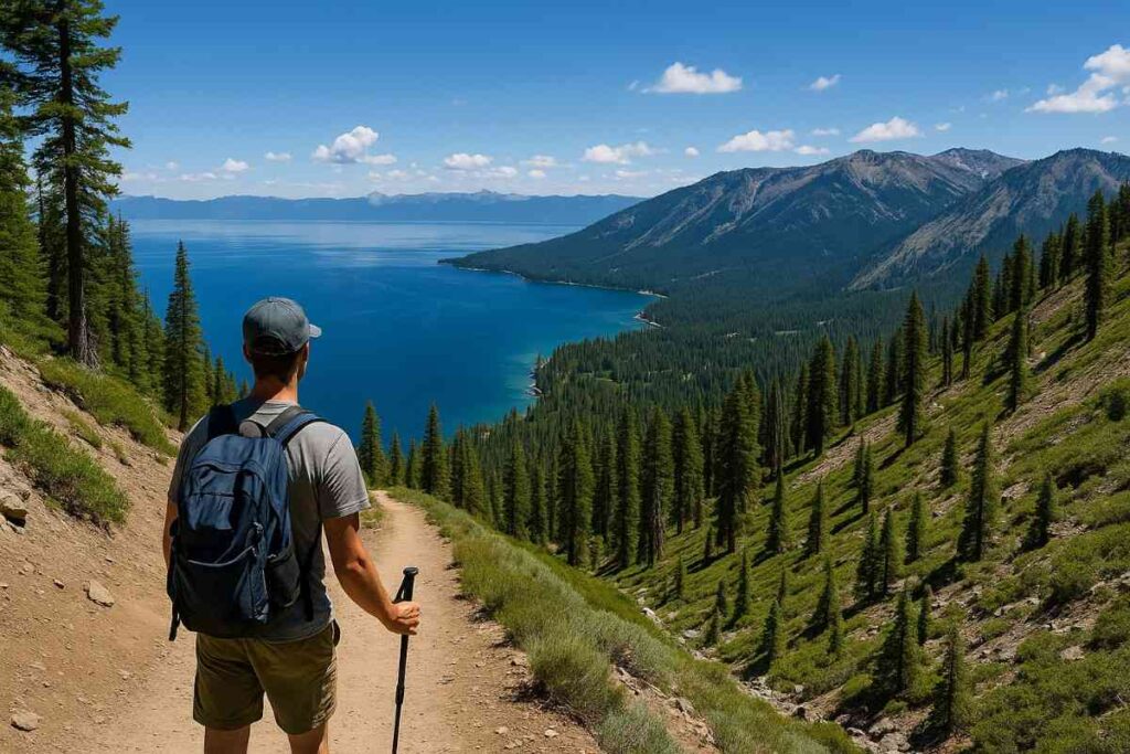
Nestled in the Sierra Nevada, Lake Tahoe offers some of the most breathtaking alpine scenery in North America. From towering granite peaks to crystal-clear waters, every step on these Lake Tahoe hikes reveals dramatic vistas and pristine wilderness. Whether you’re tackling the rugged Tahoe Rim Trail or exploring hidden valleys off beaten paths, the sheer variety of terrain—from dense forests to open ridgelines—keeps both newcomers and seasoned trekkers coming back year after year.
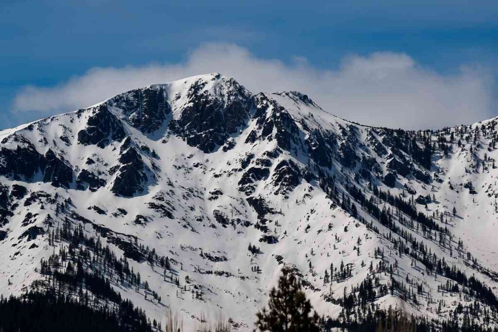
How Deep Is Lake Tahoe & Its Influence on Local Climate
At an astonishing maximum depth of 1,645 feet, Lake Tahoe is the second-deepest lake in the U.S. This immense volume of water moderates the surrounding climate, keeping summer days cooler and winter nights milder. Hikers often notice that snow lingers longer on north-facing slopes and that afternoon breezes off the lake can turn a warm climb into a chilly descent—so plan your layers accordingly.
Lake Tahoe Water Temperature and Seasonal Considerations
Water temperatures in Lake Tahoe fluctuate from the high 30s °F under ice cover to the low 60s °F in late summer. While a refreshing dip after an easy hike in Lake Tahoe can be exhilarating, swimmers should be prepared for chilly conditions—especially in spring and early summer when snowmelt keeps the water near 40–50°F. Always check real-time readings on the Tahoe City Gauge before planning any shoreline activities.
How to Choose the Perfect Trail from Best Hikes in Lake Tahoe
Choose a hike that matches your fitness level and time constraints. Short loops around Fallen Leaf Lake provide gentle introductions, while full-day ascents of Mount Tallac demand serious endurance. Consider:
- Distance: Measure round-trip miles, not point-to-point.
- Elevation Gain: Even a moderate 1,000-foot climb can feel steep at altitude.
- Difficulty Rating: Look beyond mileage—terrain and exposure matter too.
By weighing these factors alongside seasonal trail conditions, you’ll pick the ideal route for an unforgettable Tahoe adventure.
Top 15 Best Hikes in Tahoe That You Should Visit
1. Cave Rock
Introduction
Perched on Tahoe’s East Shore, Cave Rock offers a short but rewarding climb to a windswept granite promontory with sweeping lake vistas and a dramatic tunnel carved by the Southern Pacific Railroad in 1931 . This cultural landmark—sacred to the Washoe Tribe—combines spiritual significance with panoramic viewpoints, making it a must-do Lake Tahoe hike. Tucked along Highway 50 on Lake Tahoe’s eastern shore, Cave Rock feels like stepping into a natural amphitheater carved over millennia. This hike brings you face-to-face with towering volcanic formations and offers intimate views of Tahoe’s deepest blue waters.
The trail winds through mixed pine and aspen groves, where morning light filters through leaves and dapples the rocky path. You’ll often see local climbers scaling nearby faces, reminding you of Tahoe’s adventurous spirit. Wildlife sightings—chipmunks darting among boulders and hawks circling above—add to the sense of wilderness close to civilization. At the top, the plateau reveals a dramatic overlook where the lake’s curvature is laid bare, making every step worth the gentle scramble.
Distance | Elevation Gain | Difficulty | Permit
- Distance: 1.5 miles RT
- Elevation Gain: 360 feet
- Difficulty: Easy/Moderate
- Permit: None required
Best Time to Visit
Late spring through early fall (May–October) when wildflowers bloom along the ridge and rock surfaces are dry.
Personal Tips & Safety Precautions
- Wear traction-friendly shoes; granite can be slippery when wet.
- Start early to avoid crowds and midday heat.
- Bring a light jacket—winds atop Cave Rock can be brisk.
- Respect tribal signage and stay on designated trails.
2. Maggie’s Peak
Introduction
Maggie’s Peak crowns the Spooner Summit area with one of Tahoe’s most accessible summit hikes, featuring geologic outcrops and 360° views of the lake, Sierra Nevada, and Carson Valley . Its ridge-line scramble and open granite slabs showcase Tahoe’s rugged beauty. Rising above the slopes of Heavenly Mountain Resort, Maggie’s Peak offers one of the most iconic panoramic vistas in Tahoe. As you climb over talus fields and through fragrant pine forests, each bend in the trail teases a broader sweep of lake and mountain peaks.
This route feels alpine yet accessible, blending gentle switchbacks with rocky knolls that invite you to pause and soak it all in. Photographers love the golden hour light here, when the lake mirrors the sky’s pastel hues. Beyond the view, Maggie’s Peak connects you to Tahoe’s unique microclimates—snowpack lingers well into summer, and wildflowers explode in meadows by late July. The summit rewards with a full-circle perspective that makes clear why this ridge is a local favorite.
Distance | Elevation Gain | Difficulty | Permit
- Distance: 2.8 miles RT
- Elevation Gain: 1,000 feet
- Difficulty: Moderate
- Permit: None required
Best Time to Visit
June through September for clear summit views and minimal snowpack.
Personal Tips & Safety Precautions
- Hike midweek to avoid peak weekend traffic at the Spooner Summit TH.
- Use sunscreen—exposed granite offers no shade.
- Carry at least 2 liters of water; there’s no reliable spring.
- Wear layers; summit breezes can be chilly even on warm days.
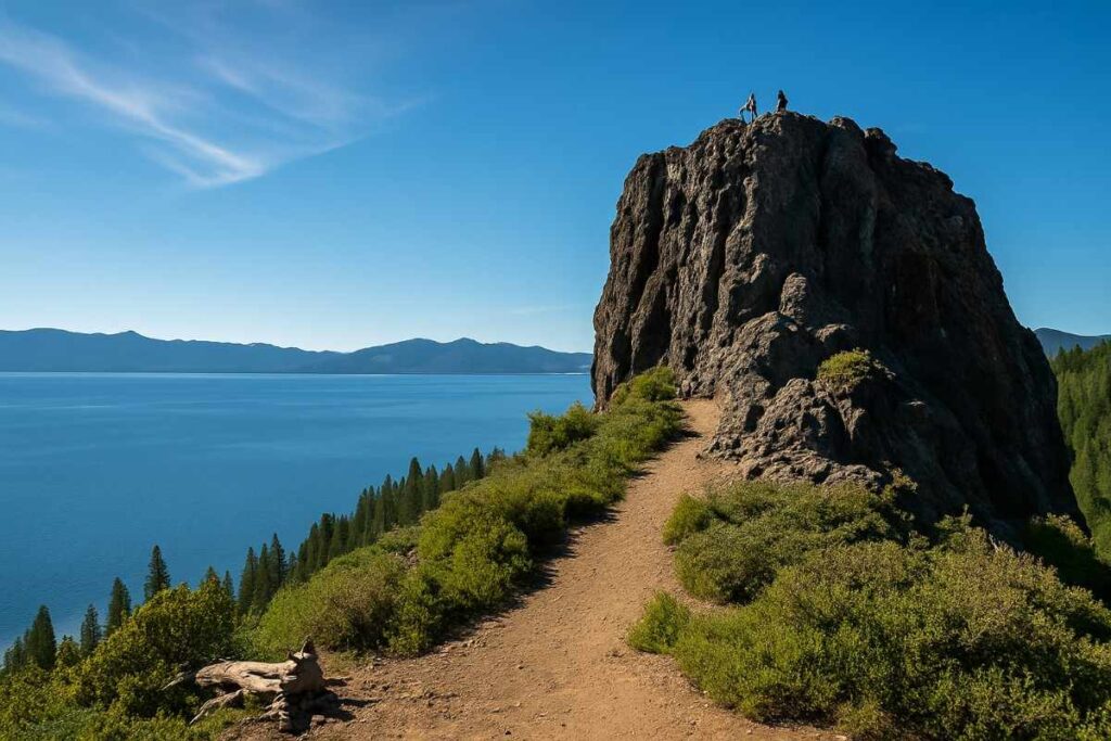
3. Castle Rock Lake Tahoe
Introduction
Nestled in Emerald Bay State Park, Castle Rock Trail climbs through whispering pines to a rocky knoll overlooking Vikingsholm and Lake Tahoe’s sapphire waters . Panoramic platforms let you spy paddleboarders far below, while the route’s gentle switchbacks suit casual adventurers. Castle Rock’s dramatic granite outcrop juts boldly over Stateline, Nevada, embodying the raw geological power that shaped Tahoe’s basin. As you approach, the trail threads beneath soaring pine arches before revealing sudden openings onto steep cliffs.
From these vantage points, the lake shimmers far below, its shoreline etched with hidden coves. The rock itself offers playful boulder-hopping opportunities, inviting hikers to test footwork on natural staircases. Seasonal vistas change the mood here dramatically—from summer’s bright greens to autumn’s fiery reds and golds. Because of its proximity to casinos and resort areas, Castle Rock is the perfect half-day escape: you’re in the heart of Tahoe’s excitement one moment and enveloped by ancient stone the next.
Distance | Elevation Gain | Difficulty | Permit
- Distance: 2.4 miles RT
- Elevation Gain: 450 feet
- Difficulty: Easy/Moderate
- Permit: $10 day-use parking fee
Best Time to Visit
May through October, before winter snows close the switchbacks.
Personal Tips & Safety Precautions
- Arrive before 9 AM to snag limited parking near Eagle Point Campground.
- Combine with Vikingsholm Trailhead exploration for a full Emerald Bay experience.
- Pack a picnic to enjoy at the summit’s rocky benches.
- Watch for rattlesnakes sunning on exposed granite in summer.
4. Eagle Rock Lake Tahoe
Introduction
A quick hop from US 50 near Meyers, Eagle Rock Trail offers a family-friendly loop amid Jeffrey pines, ending at a sandstone outcrop dubbed “Eagle Rock” for its shape and James Peak views . It’s a classic south Lake Tahoe hike with big payoff in under an hour. Perched above Tahoe City, Eagle Rock rewards early-morning hikers with a front-row seat to the sun’s first kiss on the lake. The approach meanders through lush meadows and tall Jeffrey pines, where the scent of resin fills the air.
As you round the bend, Eagle Rock emerges—a broad slab of granite jutting into open sky. From this rare lakeside perch, you feel truly immersed: the only thing between you and the water’s blue depths is a sheer drop. It’s a spot treasured by locals for sunrise yoga sessions and sunset reflections alike. The contrasts here—soft meadow grasses against hard stone, cool breeze off the lake against the warm sun—make Eagle Rock a sensory feast that epitomizes Lake Tahoe hiking at its best.
Distance | Elevation Gain | Difficulty | Permit
- Distance: 1.3 miles RT
- Elevation Gain: 250 feet
- Difficulty: Easy
- Permit: None required
Best Time to Visit
Year-round (though winter snowshoes may be needed Dec–Mar).
Personal Tips & Safety Precautions
- Great for sunrise hikes—parking lot faces east.
- Bring binoculars for birdwatching; eagles and hawks frequent the ridge.
- In winter, use gaiters to keep snow out of boots.
- Trail narrows quickly—yield to uphill hikers.
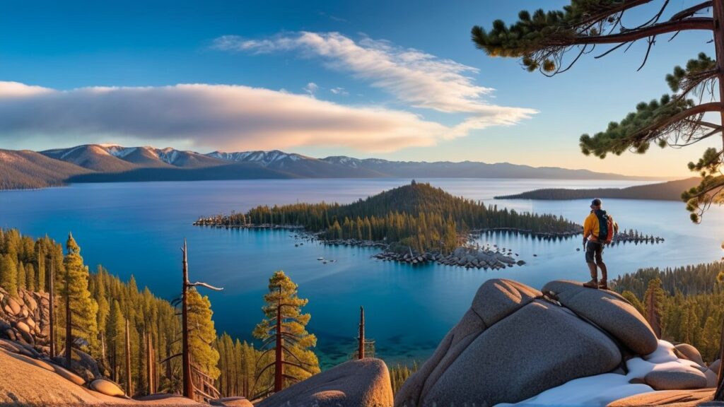
5. Vikingsholm Trail (Emerald Bay)
Introduction
Descending from the Vikingsholm trailhead, this wooded switchback trail leads to the 38-room Scandinavian mansion on Emerald Bay’s shore—Vikingsholm—and offers lakeside views framed by granite cliffs . An ideal blend of natural beauty and architectural history. Entering Emerald Bay via the Vikingsholm Trail feels like stepping into a fairytale fjord. Towering granite walls cradle the water as you descend through an old-growth forest draped in ferns and moss. The trail’s namesake, Vikingsholm, emerges at the bottom: an elegant Scandinavian-style mansion nestled on the shore.
This architectural gem offers a cultural counterpoint to the natural drama, its turrets and stonework blending seamlessly with the surrounding cliffs. Kayakers often paddle nearby, adding a human scale to the sweeping bay. As you loiter at the water’s edge, you recognize why Vikingsholm was built here—a place where artistry and wilderness coexist in perfect harmony. Each twist in the descent reveals a new viewpoint, making every step a discovery.
Distance | Elevation Gain | Difficulty | Permit
- Distance: 1.7 miles RT
- Elevation Gain: 700 feet
- Difficulty: Moderate
- Permit: $10 day-use parking fee
Best Time to Visit
June–September, when the trail is snow-free and lake Tahoe water temperature warms.
Personal Tips & Safety Precautions
- Tour Vikingsholm mansion ($10 per adult) at the trail bottom for cultural context.
- Pack swimwear to cool off at Emerald Bay Beach.
- Carry snacks—trailside benches are scarce.
- Start clockwise to tackle the steeper initial descent.
6. Rubicon Trail (South Lake Tahoe)
Introduction
Carving a high-shore traverse between D.L. Bliss and Emerald Bay State Parks, the Rubicon Trail delivers cathedral-like pine forests, granite beaches, and open cliff-top views of Tahoe’s western shore . It’s a backpacking Tahoe no permit romp (day use only) through the lake’s most dramatic shoreline. Winding along the lake’s western shore, the Rubicon Trail is Tahoe’s classic shoreline adventure. Expect a mix of sun-drenched granite slabs and shaded forest segments, with waterfalls cascading onto beaches just off-trail.
The undulating terrain keeps your muscles engaged, while the ever-present lake views keep spirits high. Popular spots like Pirate’s Cove offer swimming holes and picnic nooks, ideal for mid-hike refreshment. The trail stretches both east and west, letting you tailor your day to a quick out-and-back or a full traverse into D.L. Bliss State Park. Boat traffic and paddleboarders below add lively color, reminding you that this is as much a social trail as it is a wilderness getaway.
Distance | Elevation Gain | Difficulty | Permit
- Distance: 16 miles point-to-point
- Elevation Gain: 1,500 feet total
- Difficulty: Strenuous
- Permit: Day-use parking fee; no overnight camping allowed
Best Time to Visit
July-September for stable trail conditions and minimal snow drifts.
Personal Tips & Safety Precautions
- Shuttle or arrange car drop at opposite trailheads.
- Hike east-to-west to catch morning light on Emerald Bay.
- Bring bear-proof food canisters in forested camps.
- Filter water from granite potholes after snowmelt (May/June).
7. Cascade Falls
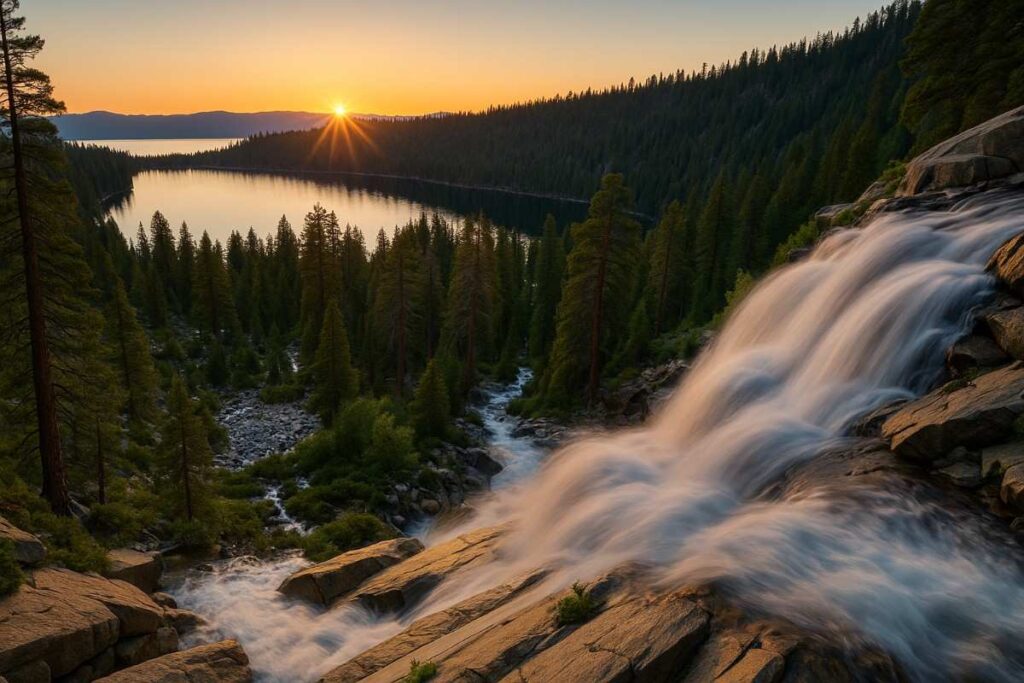
Introduction
A short, forested jaunt near Fallen Leaf Lake, Cascade Falls rewards hikers with a tiered waterfall plunging into a mossy amphitheater—photogenic year-round and roaring after spring runoff. Hidden within Desolation Wilderness, Cascade Falls surprises with a double-tiered waterfall that tumbles into an emerald pool. The hike threads through granite terracing, where lichen-speckled boulders create a striking foreground to the falls. Lush ferns and shady hemlocks hug the creek banks, offering cool respite on summer afternoons.
Approach in spring to witness snowmelt amplify the torrent; by September, the flow softens into a gentle cascade over sculpted rock faces. The sound of rushing water drowns out other hikers, creating an intimate, almost secret oasis. Nearby granite slabs invite you to pause, stretch out, and let the mist cool your face before turning back toward the lake’s bright expanse.
Distance | Elevation Gain | Difficulty | Permit
- Distance: 2.5 miles RT
- Elevation Gain: 600 feet
- Difficulty: Moderate
- Permit: None required
Best Time to Visit
April–June for fullest flows; quieter late fall when leaves cloak the trail.
Personal Tips & Safety Precautions
- Nearby parking fills quickly; carpool if possible.
- Use waterproof boots—stream crossings can be slippery.
- Bring a micro-fleece for misty summit chill.
- Respect fragile riparian zones; stay on rock hop points.
8. Shirley Canyon Trail
Introduction
Carved into steep granite near Palisades Tahoe, Shirley Canyon features rock bridges, a carved “Refugee Bridge,” and a cascading creek that thrills hikers with cliff-draped pools . Its mix of technical sections and serene creekside stretches feels more remote than its proximity suggests. Just off Highway 89, Shirley Canyon Trail delivers a rainforest-like canyon in the high Sierra. Towering walls funnel cool breezes while gurgling streams carve a path through smooth granite. The route unfolds in a series of scenic switchbacks, each revealing plunging waterfalls framed by verdant moss and ferns.
As the trail steepens, you catch glimpses of Eagle Lake through narrow apertures. The canyon’s protected microclimate allows for lush flora—rare wildflowers bloom even late into summer. At peak flow, the falls create rainbows in the mist, turning a simple hike into a sensory spectacle. For those seeking dramatic scenery close to civilization, Shirley Canyon is a Tahoe hiking secret waiting to be explored.
Distance | Elevation Gain | Difficulty | Permit
- Distance: 3.7 miles RT
- Elevation Gain: 1,600 feet
- Difficulty: Strenuous
- Permit: None required
Best Time to Visit
July-September, once high snow has melted and creek flows moderate.
Personal Tips & Safety Precautions
- Start early to beat afternoon thunderstorms common in summer.
- Crampons or traction devices may be needed before July.
- Pack snacks high in electrolytes for the steep climb.
- Keep dogs on leash—trail narrows at cliffside exposures.
9. Mount Tallac
Introduction
Arguably Tahoe’s toughest day-hike, Mount Tallac towers at 9,735 ft and demands endurance, but gifts 360° panoramas—including Fallen Leaf Lake’s sapphire waters—and a summit rock cairn that beckons memorable vistas. The iconic peak of Mount Tallac dominates Tahoe’s southern skyline, and its trail is nothing short of epic. Early stretches wind through dappled aspen groves and clear mountain lakes that reflect alpine cliffs. As you climb, the trail exposes switchbacks carved into talus fields, where each vantage point peels back a new layer of vistas—Tahoe’s sapphire surface glimmers below, ringed by high peaks.
At the summit, a rocky perch commands 360° panoramas from Heavenly Valley to Desolation Wilderness. The sense of accomplishment is profound: you’re standing atop one of Tahoe’s most storied summits. Though strenuous, the journey feels woven into Tahoe’s mountain lore, connecting you with generations of hikers who revered this sacred peak.
Distance | Elevation Gain | Difficulty | Permit
- Distance: 10.2 miles RT
- Elevation Gain: 3,700 feet
- Difficulty: Very Strenuous
- Permit: Wilderness quota (self-issue at trailhead)
Best Time to Visit
July–early September to avoid snow and access Tahoe Meadows trailhead road.
Personal Tips & Safety Precautions
- Acclimatize with shorter north lake tahoe hikes first.
- Start pre-dawn; summit by 10 AM to avoid lightning risk.
- Bring a summit lunch and camera for sunrise photos.
- Carry extra layers—high winds chill quickly above treeline.
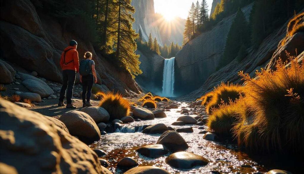
10. Eagle Falls + Desolation Wilderness
Introduction
Linking Eagle Falls Trail to the Desolation Wilderness boundary, this route threads you from a roaring cascade into glacial boulder fields and alpine lakes—crystal-clear Echo and Velma Lakes are premier backpacking Tahoe with no permit day-trip targets. Combining the lower Eagle Falls and Desolation Wilderness access, this route pairs a postcard-perfect waterfall with the vast granite basin beyond. The initial jaunt to the falls is a family-friendly delight—spray-kissed granite steps lead to a 30-foot curtain of water.
From there, you have the option to push onward into the wilderness: gentle creek crossings and open meadows usher you toward Eagle Lake, where granite cliffs rise like fortresses. Birdsong and marmot whistles fill the air, and the sense of entering protected wilderness is immediate. This dual-purpose hike lets you savor both easy-access beauty and real backcountry—no permit needed if you day-hike, making it an irresistible Tahoe classic.
Distance | Elevation Gain | Difficulty | Permit
- Distance: 6 miles RT
- Elevation Gain: 1,000 feet
- Difficulty: Moderate/Strenuous
- Permit: Self-issue wilderness permit for beyond Eagle Lake
Best Time to Visit
June–August, when Thunder Mountain passes clear and lakes warm to 60–65°F.
Personal Tips & Safety Precautions
- Pack a lightweight shelter if camping past Eagle Lake.
- Bring a map/GPS; Desolation trails can be unmarked.
- Filter lake water; snowmelt can carry silty runoff.
- Leave no trace—pack out all human waste.
11. Fallen Leaf Lake Loop
Introduction
Nestled just south of Tahoe City, the Fallen Leaf Lake Loop offers a serene escape around one of Tahoe’s hidden gems. Towering pines and granite outcrops frame crystal-clear waters, and the loop feels delightfully uncrowded compared to the main lake shore trails. Early morning light dances across the surface, making this a photographer’s dream and a peaceful start to any Tahoe hiking day. Winding around the tranquil shores of Fallen Leaf Lake, this loop trail offers a perfect blend of forest solitude and lakeside serenity. Towering pines give way to open meadows where the mountain’s reflection shimmers on the water’s surface.
Occasional sandy beaches invite you to pause for a lakeside picnic or a quick dip in the crystalline water. Birdsong and the gentle lapping of waves create a calming soundtrack, making this one of the best places to reconnect with nature. On clear days, you’ll catch glimpses of distant peaks rising beyond the treeline—proof that you’re still very much in the heart of Tahoe wilderness. Despite its remote feel, the trailhead is easily accessible from South Lake Tahoe, striking the ideal balance between adventure and convenience.
Distance | Elevation Gain | Difficulty | Permit
- Distance: 7.8 miles
- Elevation Gain: 1,000 ft
- Difficulty: Moderate
- Permit: None required
H4. Best Time to Visit
Late spring through early fall (May–October) when wildflowers bloom and fallen-leaf colors peak.
Personal Tips & Safety Precautions
- Start at sunrise to avoid afternoon heat and enjoy calm waters.
- Wear traction-friendly footwear; the exposed granite can get slick when wet.
- Pack electrolytes—there’s no water refill once you leave the trailhead.
- Keep an eye on weather—thunderstorms can roll in quickly over the Sierra.
12. Stateline Fire Lookout
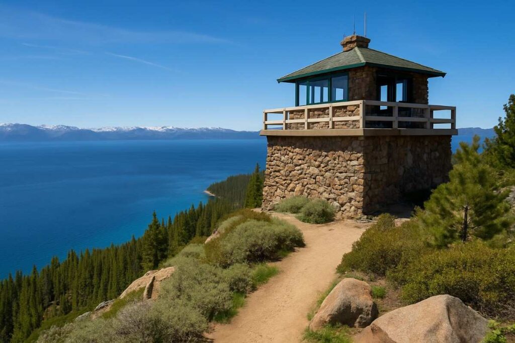
Introduction
Perched just above Crystal Bay on the Nevada–California border, Stateline Fire Lookout rewards hikers with sweeping panoramas of Lake Tahoe’s north shore. Though short, the trail traverses historic talus slopes to reach a staffed stone lookout tower that houses interpretive displays on Tahoe’s fire ecology. It’s a perfect half-day outing for families or anyone craving big views with minimal effort. Perched above the Nevada–California border, the Stateline Fire Lookout trail delivers panoramic lake views that stretch from Sand Harbor to Emerald Bay.
The hike threads through fragrant juniper and manzanita, with occasional wildflower bursts in spring. As you climb, the forest thins and the lookout tower comes into view—an iconic red-roofed sentinel set against the vast blue mirror of Tahoe. From the top, you’re treated to a 360° vista of glittering water, rugged peaks, and the distant Sierra crest. The historic structure itself makes for a striking photograph, casting long shadows in the golden hour.
Distance | Elevation Gain | Difficulty | Permit
- Distance: 1.0 mile
- Elevation Gain: 300 ft
- Difficulty: Easy
- Permit: None required
Best Time to Visit
June through September, when the lookout is staffed and telescopes are available.
Personal Tips & Safety Precautions
- Arrive before 10 AM for the best light and fewer crowds.
- Use the free binoculars at the tower to spot shoreline wildlife.
- Shade is minimal—bring a hat and sunscreen.
- Check staffing hours online; winter access can be limited.
13. Chickadee Ridge
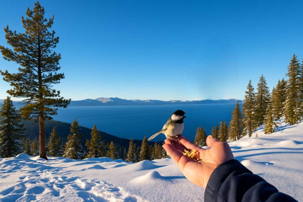
Introduction
Just west of Meyers, Chickadee Ridge offers a forested climb culminating in rocky viewpoints that peer into the Upper Truckee Marsh and beyond to Mount Tallac. Its relative obscurity makes for tranquil bird-watching—hence the name—and vibrant fall color displays along aspen groves. For solitude and seasonal foliage, this ridge delivers. Chickadee Ridge feels like a best-kept secret of Tahoe’s western shore, revealing sweeping lake views through stands of new-growth pine. The trail’s gentle ascent rewards you with open ridgelines where wind-sculpted trees lean dramatically toward the water.
Here, the ridge narrows, offering both solitude and a thrilling sense of exposure without the technical scramble. Hikers often spot black bears foraging below in early summer or wildflowers carpeting the slopes in late July. The ridge terminates above the Stateline channel, where gondola cars drift by on Heavenly Mountain, adding a whimsical touch. This lightly trafficked route feels worlds away from resort crowds, making it a true hidden gem for those seeking quiet panoramas.
Distance | Elevation Gain | Difficulty | Permit
- Distance: 4.2 miles round-trip
- Elevation Gain: 750 ft
- Difficulty: Moderate
- Permit: None required
Best Time to Visit
Mid-September to early October for peak aspen color.
Personal Tips & Safety Precautions
- Bring binoculars for songbird spotting in spring and fall.
- Trail can be overgrown; long pants prevent brush scratches.
- Carry insect repellent—mosquitoes gather near the marsh.
- Park carefully along narrow forest roads to avoid blocking traffic.
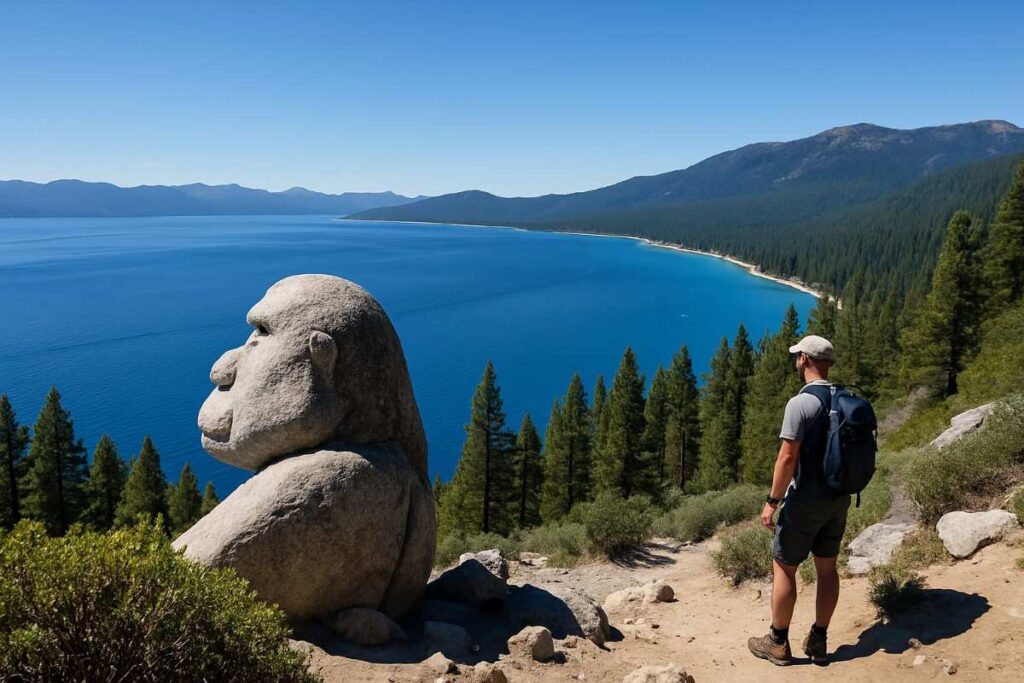
14. Monkey Rock (Incline Village NV)
Introduction
A local favorite, Monkey Rock sits above Incline Village with a short but steep approach that ascends to a sculpted granite outcrop resembling a crouching primate. Once at the top, you’re treated to a dramatic perch above Tahoe’s turquoise waters—ideal for sunrise selfies or a quick picnic. The hike’s brevity makes it perfect for a work-day afternoon escape. Just steps from Incline Village’s lively center, Monkey Rock provides an unexpected urban wilderness escape. The path climbs through dense lodgepole pine until you reach an open granite dome crowned by a lone Jeffrey pine—your “Monkey Rock” perch. Here, Tahoe’s sapphire expanse sprawls before you, and shoreline details—from sandbars to docks—look like miniatures.
Local climbers often pause here before tackling more technical routes, making this spot feel part of Tahoe’s climbing culture. Despite its popularity at sunset, the hike remains intimate thanks to its short length and steep profile. A quick scramble grants one of the best lakeside vantage points, proving that grand views needn’t require a full-day commitment.
Distance | Elevation Gain | Difficulty | Permit
- Distance: 1.8 miles round-trip
- Elevation Gain: 600 ft
- Difficulty: Easy-Moderate
- Permit: None required
Best Time to Visit
April through October; spring wildflowers and summer breezes are highlights.
Personal Tips & Safety Precautions
- Go early on weekends to snag a parking spot at Tunnel Creek Trailhead.
- Wear sturdy shoes—rock scrambling near the top can be slippery.
- Carry layers; the ridge is windy, even on warm days.
- Bring a small trash bag—help keep the viewpoint pristine.
15. Tahoe Rim Trail Segment: Barker Pass
Introduction
As a slice of the iconic Tahoe Rim Trail, the Barker Pass segment links Tahoe Meadows to Spooner Summit with alpine vistas at every turn. Wildflower-studded fields, sweeping lake views, and a sense of remoteness belie its proximity to Carson City. For seasoned hikers, it’s a showcase of Tahoe’s lofty ridgelines in a manageable day-hike package. This segment of the Tahoe Rim Trail crosses Barker Pass, offering a high-country trek above tree line with uninterrupted views of Desolation Wilderness. As you gain elevation, the forest gives way to open ridges dotted with hardy alpine wildflowers that bloom in tidal waves each summer. The trail undulates across polished granite saddles, where the wind carries the crisp scent of snowmelt.
Distance | Elevation Gain | Difficulty | Permit
- Distance: 8.0 miles round-trip
- Elevation Gain: 1,200 ft
- Difficulty: Moderate-Strenuous
- Permit: None required
Best Time to Visit
July through September, when snowmelt opens the high passes and wildflowers peak.
Personal Tips & Safety Precautions
- Start from Tahoe Meadows early to avoid afternoon thunder.
- Pack an extra layer—temperatures can drop 20°F at ridgecrest.
- Carry at least 2 L of water; there are no reliable streams along this segment.
- Use a GPS-loaded map; junctions to side trails can be confusing.
Quick Comparison Table: Top 15 Best Hikes in Tahoe
| Trail Name | Distance | Elevation Gain | Difficulty | Best Time to Visit | Permit Required |
|---|---|---|---|---|---|
| Cave Rock | 1.8 mi | 400 ft | ⭐️⭐️☆☆☆ Easy | Spring to Fall | No |
| Maggie’s Peak | 2.8 mi | 1,200 ft | ⭐️⭐️⭐️⭐️☆ Moderate to Hard | Summer to Early Fall | No |
| Castle Rock Lake Tahoe | 3.0 mi | 800 ft | ⭐️⭐️⭐️☆☆ Moderate | Late Spring to Fall | No |
| Eagle Rock Lake Tahoe | 3.5 mi | 1,000 ft | ⭐️⭐️⭐️☆☆ Moderate | Summer | No |
| Vikingsholm Trail (Emerald Bay) | 1.7 mi | 500 ft | ⭐️⭐️☆☆☆ Easy | Summer to Fall | No |
| Rubicon Trail (South Lake Tahoe) | 6.0 mi | 400 ft | ⭐️⭐️⭐️☆☆ Moderate | Spring to Fall | No |
| Cascade Falls | 1.5 mi | 300 ft | ⭐️⭐️☆☆☆ Easy | Summer to Fall | No |
| Shirley Canyon Trail | 2.5 mi | 1,000 ft | ⭐️⭐️⭐️⭐️☆ Moderate to Hard | Summer | No |
| Mount Tallac | 10.0 mi | 3,400 ft | ⭐️⭐️⭐️⭐️⭐️ Hard | Summer to Early Fall | Yes (Desolation Permit) |
| Eagle Falls + Desolation Wilderness | 4.0 mi | 1,200 ft | ⭐️⭐️⭐️⭐️☆ Moderate to Hard | Summer to Fall | Yes (Desolation Permit) |
| Fallen Leaf Lake Loop | 8.0 mi | 600 ft | ⭐️⭐️⭐️☆☆ Moderate | Summer to Fall | No |
| Stateline Fire Lookout | 5.0 mi | 1,200 ft | ⭐️⭐️⭐️⭐️☆ Moderate to Hard | Summer | No |
| Chickadee Ridge | 3.2 mi | 1,000 ft | ⭐️⭐️⭐️☆☆ Moderate | Spring to Fall | No |
| Monkey Rock (Incline Village NV) | 2.0 mi | 500 ft | ⭐️⭐️☆☆☆ Easy | Summer | No |
| Tahoe Rim Trail Segment: Barker Pass | 5.0 mi | 1,000 ft | ⭐️⭐️⭐️⭐️☆ Moderate to Hard | Summer to Early Fall | No |
Best Trails by Region
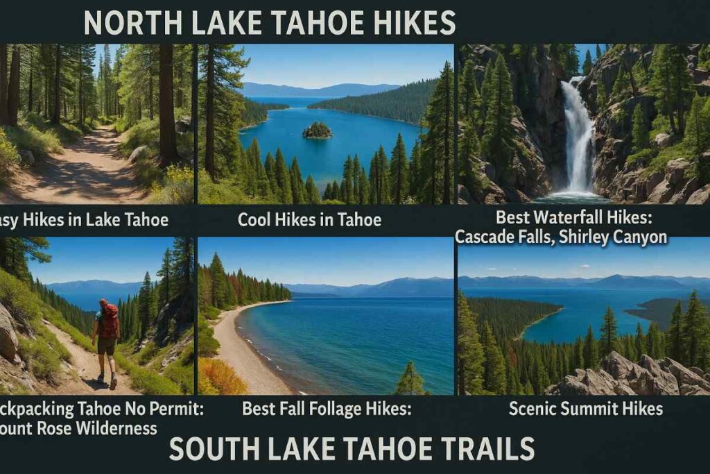
North Lake Tahoe Hikes
Easy Hikes in Lake Tahoe
Both the Tahoe Meadows Loop and Tunnel Creek Trail offer gentle terrain and ample shade, making them perfect for families and beginners seeking a relaxed hiking in Lake Tahoe experience. Tahoe Meadows Loop winds through wildflower-filled meadows with panoramic views of the High Sierra, while Tunnel Creek Trail leads you into a historic mining-era tunnel before opening onto forested slopes overlooking the lake. These trails stay cool even on summer afternoons, making them ideal for a sunrise or sunset stroll along the North Lake Tahoe hikes network. Look for interpretive signs at trailheads explaining the region’s ecology and history—small details that enrich every step.
Cool Hikes in Tahoe
For a taste of alpine adventure without a long approach, take the Heavenly Mountain Gondola to High Camp, then follow the ridgeline path for sweeping lake views and rocky outcrops. At the summit of Bald Mountain, hikers are treated to 360° panoramas of Lake Tahoe and the surrounding Carson Range—an unforgettable vista that rewards minimal effort. Both routes showcase Tahoe’s dramatic topography and are accessible year-round (though snow can linger into early summer), cementing their status as cool hikes in Tahoe for seasoned explorers and photographers alike.
Best Waterfall Hikes: Cascade Falls, Shirley Canyon
Chasing misty cascades is a highlight of Tahoe’s waterfall hikes. Cascade Falls drops over granite ledges into a sapphire pool, surrounded by lush ferns and moss—a serene reward for the short hike from Eagle Falls trailhead. Meanwhile, the Shirley Canyon Trail ascends through dense forest to a multi-tiered waterfall framed by towering granite walls. Both hikes offer invigorating spray and prime photo spots, making them top picks for best hiking trails in South Lake Tahoe that combine scenic payoff with moderate effort.
Backpacking Tahoe No Permit: Mount Rose Wilderness
For backcountry enthusiasts seeking solitude, the Mount Rose Wilderness provides extensive routes with no permit requirements for day trips. Trailheads at Galena Creek and Grey Creek launch you into high alpine terrain dotted with wildflower meadows, glacial cirques, and remote lakes. While campsites do require registration, day-hikers can explore up to 11 miles of rugged trails without bureaucratic hurdles. This makes Mount Rose a go-to option for backpacking Tahoe without permit adventures—perfect for those craving an off-grid challenge just outside Reno’s urban boundaries.
South Lake Tahoe Trails
Best Trails Lake Tahoe: Rubicon Trail, Fallen Leaf Lake Loop
The Rubicon Trail links D.L. Bliss and Emerald Bay State Parks, offering nearly 16 miles of shoreline panoramas, rocky coves, and hidden beaches—ideal for multi-day backpacking or a long day-hike along South Lake Tahoe hikes. Less strenuous but equally picturesque, the Fallen Leaf Lake Loop encircles its namesake lake with forested shorelines, sandy beaches, and peaks reflected in clear water. Both routes showcase the best places to hike in Tahoe, combining dramatic vistas with varied terrain for hikers of all levels.
Lake Hikes & Beach Hikes
For a breezy daytime outing, the El Dorado Beach Trail meanders along shallow shorelines and granite outcrops, perfect for wading and rock-hopping. Nearby, the Baldwin Beach Path offers quick access to sandy coves and turquoise shallows, making it a favorite beach hikes in Lake Tahoe spot. These accessible trails merge shoreline relaxation with light hiking, letting you dip your toes in the lake after a short, scenic walk.
Best Fall Foliage Hikes:
As temperatures cool, the Ellis Peak trail offers one of Tahoe’s richest displays of autumn color, with aspen groves turning gold against the backdrop of deep blue water. The Stanford Rock Loop also traverses mixed hardwood and conifer stands, showcasing seasonal hues that photographers and leaf-peepers chase each October. These cool hikes in Tahoe transform into ephemeral galleries of fall foliage, rewarding hikers with both panoramic and intimate forest scenes.
Scenic Summit Hikes
For summit-bound adventurers, Mount Tallac delivers one of Tahoe’s most demanding but breathtaking ascents—exposed granite ridges and alpine lakes at your feet. Less rigorous but still striking, the Heavenly Mountain Trail climbs from the resort base to unobstructed overlooks of the lake and valley below. Both routes fulfill the promise of best Lake Tahoe hikes, offering summit triumphs paired with sweeping views that stick with you long after you descend.
Planning Your Tahoe Hiking Adventure

Where to Stay
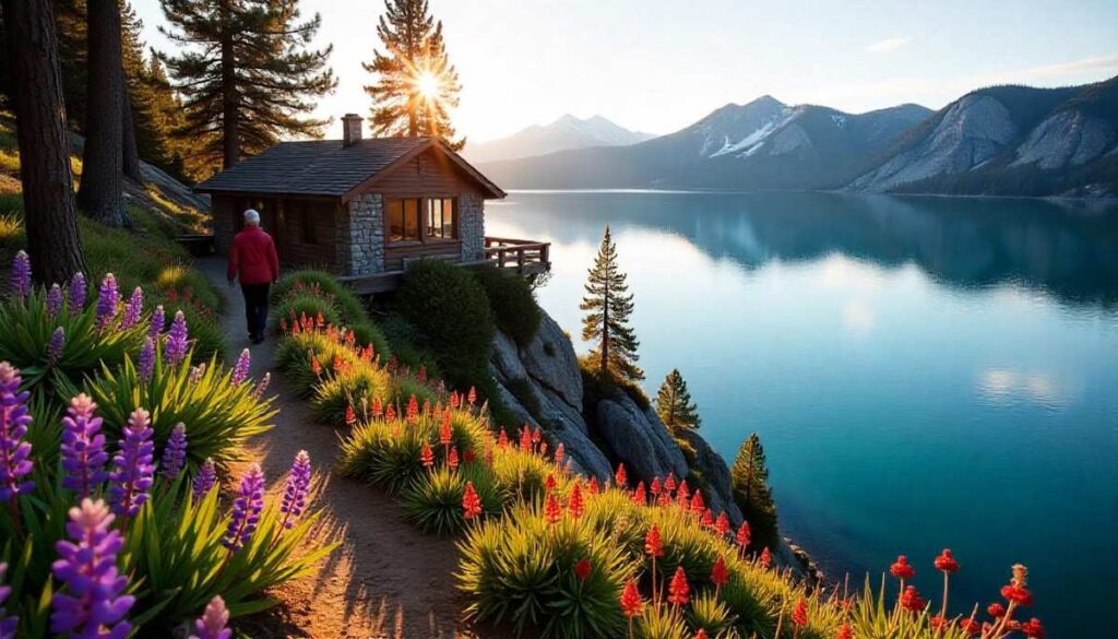
Lake Tahoe Cabins & Cabin Rentals
Renting a Lake Tahoe cabin immerses you in the forested serenity of the Tahoe Basin, with options ranging from rustic log cabins to luxury lakefront estates. Many cabins at Sand Harbor and Homewood offer private docks and direct access to Lake Tahoe trails, allowing early starts and sunset returns without the drive. Book early for summer months, when demand peaks and consider midweek stays to save on rates and avoid crowds.
Airbnb Lake Tahoe vs. Best Lake Tahoe Hotels
Airbnb Lake Tahoe listings often provide kitchens, pet-friendly policies, and unique mountain charm—ideal for families or longer stays. In contrast, top Lake Tahoe hotels like The Ritz-Carlton, Lake Tahoe, and Hyatt Regency Lake Tahoe cater to travelers seeking on-site amenities such as spas, shuttle services, and concierge-guided Tahoe activities. Choose based on your priorities: home-like convenience or full-service comfort.
Cheap Hotels in South Lake Tahoe
Budget-conscious explorers can find deals at motels along Hwy 50 and midrange hotels near Highway 89, many offering complimentary breakfast and shuttle access to trailheads. Properties like the Tahoe Seasons Resort sometimes bundle lodging with lift tickets or shuttle passes to Heavenly—helping you maximize your hiking time without overspending on cheap hotels in South Lake Tahoe.
Pet Friendly Hotels Lake Tahoe & Hard Rock Hotel Tahoe
For furry companions, several lodgings welcome leashed dogs, including pet friendly hotels lake Tahoe like Forest Suites Resort and the Hard Rock Hotel & Casino Lake Tahoe. These locations often provide amenities such as dog beds, treats, and nearby walking paths—perfect for post-hike relaxation with your four-legged hiking buddy.
Aston Resort Lake Tahoe & Thunderbird Lodge Lake Tahoe
Luxury seekers may opt for properties like the Aston Resort Lake Tahoe or the historic Thunderbird Lodge Lake Tahoe, both offering lakeside elegance and curated experiences. From lakeshore yoga sessions to guided nature walks, these resorts integrate other things to do in Lake Tahoe in summer with upscale lodging—ideal for combining adventure with indulgence.
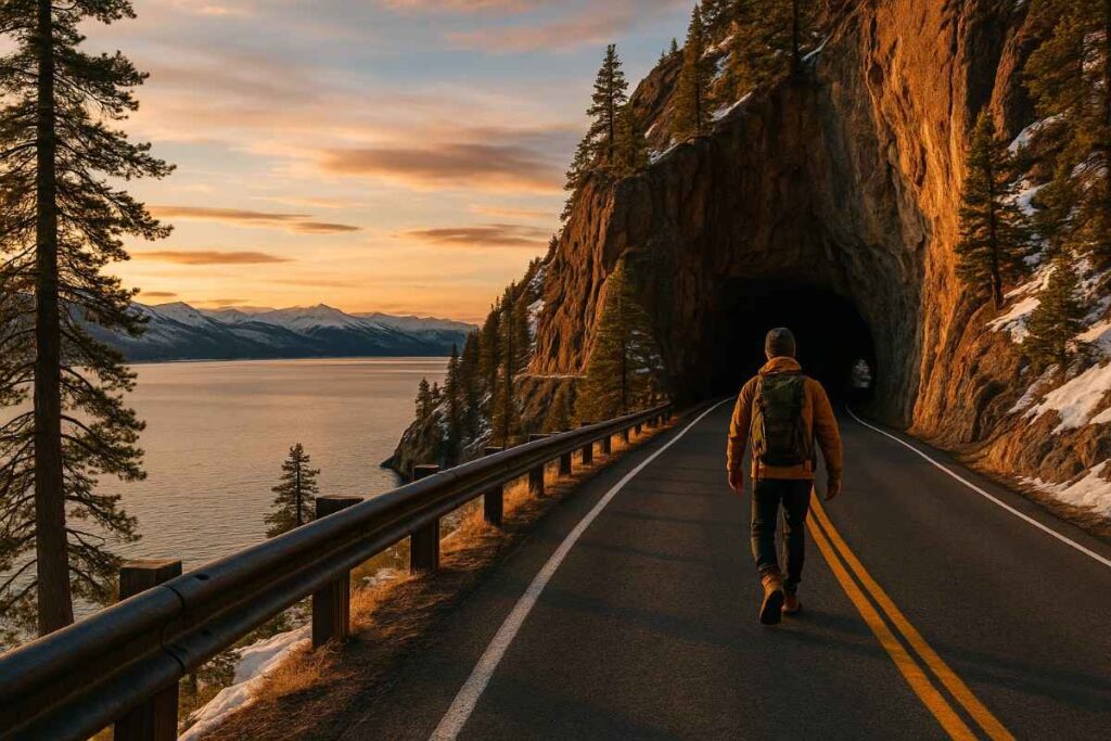
Getting There & Around
Closest Airport to Lake Tahoe & Shuttle Options
The closest airport to Lake Tahoe is Reno-Tahoe International Airport, about 45 miles northeast. From there, shuttle services like Tahoe Airporter and South Tahoe Airporter provide direct transfers to major towns. Private car rentals and ride-share options are also available—just remember mountain roads may require chains or AWD in early spring and late fall.
Tahoe Daily Tribune: South Lake Tahoe Events & Updates
Stay informed on South Lake Tahoe events by subscribing to the Tahoe Daily Tribune. Their outdoor coverage highlights trail conditions, local festivals, and weather advisories—critical intel for planning hikes around Tahoe’s dynamic climate and forest-fire season.
Post Hike Essentials
Best Beaches in Lake Tahoe: Sand Harbor, El Dorado Beach
After a day on Lake Tahoe hiking trails, unwind at Sand Harbor, with its emerald shallows and granite boulders perfect for sunbathing, or head to El Dorado Beach for a quieter lakeside picnic. Both beaches feature nearby picnic facilities and restrooms—essential for multi-hour trailheads to beach transitions.
Breakfast Spots in South Lake Tahoe
Refuel after dawn hikes at local cafés like The Red Hut Café or The Deer Point Café, known for hearty omelets and fresh-baked biscuits. These family-run spots open early, making them top choices for breakfast in South Lake Tahoe after an overnight beach or summit trek.
Capturing the Moment
Don’t forget your camera: Tahoe’s clarity and contrast create postcard-perfect compositions. Scout lookout points like Inspiration Point in D.L. Bliss State Park or the vista at Tunnel Creek Trail—both offering sweeping panoramas that make nature photography a compelling part of your Lake Tahoe photos collection.
Experience Based Hikes in Lake Tahoe

Best Family Hikes in Lake Tahoe
For a South Lake Tahoe hike that everyone can enjoy, the Meeks Bay Trail offers gentle terrain, wildflower meadows, and creekside picnic spots perfect for families with young kids or strollers. The wide, well-marked path parallels Meeks Creek, allowing little ones to explore the water’s edge safely while parents soak in views of Desolation Wilderness peaks. Interpretive signs along the way share insights into local ecology, making it a low-stress way to teach children about Tahoe’s unique alpine environment.
Best Dog Friendly Hikes in Tahoe
Lake Tahoe–Nevada State Park’s Cave Rock day-use area is one of the top dog friendly hikes around Tahoe, featuring a shaded loop trail that hugs the shoreline and passes through historic volcanic formations. Well-managed sandy beaches allow leashed pups to splash in shallow coves while owners enjoy panoramic views of Vale Peak and the Glenbrook Basin. The relatively flat, 1-mile loop means dogs of all fitness levels can join in, and shaded pines provide respite during midday heat. Remember to bring waste bags and plenty of fresh water—Tahoe’s high elevation and sunshine can dehydrate four-legged friends quickly. For detailed dog hiking guide click here.
Best Sunrise & Sunset Hikes
Witnessing sunrise over Emerald Bay is an unforgettable cool hike in Tahoe; the Vikingsholm Trail delivers early-bird hikers to a vista point where Tahoe’s mirror-like surface catches dawn’s first light. Conversely, Cave Rock’s overlook loop is ideal for sunset, with unobstructed views over the Carson Range as the sky shifts from gold to amethyst. Both trails reward minimal crowds at twilight hours, offering the solitude many seek when capturing Tahoe’s fiery alpenglow. Lightweight headlamps, warm layers, and knowledge of trailhead exits are essential when hiking these routes outside typical daylight hours.
Essential Gear & Preparation for Tahoe Hiking
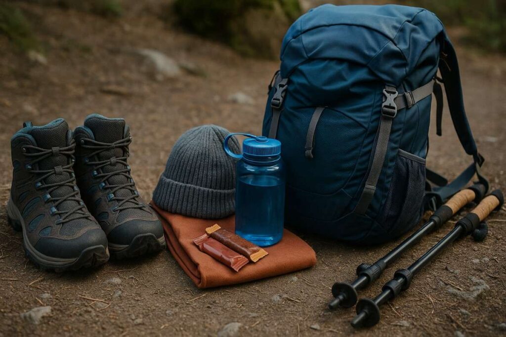
Footwear & Apparel for Tahoe’s Rocky, Sandy & Snowy Trails
Choosing the right footwear is critical for Lake Tahoe hikes—opt for waterproof midsoles with aggressive tread to handle both sandy beaches and rocky alpine paths. Quick-dry, moisture-wicking socks prevent blisters, while convertible hiking pants offer ventilation during summer heat and warmth when layered under rain shells in the shoulder seasons. A sun-protected wide-brim hat and polarized sunglasses guard against intense mountain glare reflected off water and snow. Consider crampons or microspikes for winter hikes on icy sections of the Tahoe Rim Trail, ensuring uphill traction and downhill control.
Hydration, Nutrition & Altitude Acclimatization Tips
Tahoe’s high elevation (over 6,200 ft at lake level) accelerates dehydration and fatigue; plan on carrying at least 2 liters of water per person, augmented by a hydration bladder for easy sipping. Electrolyte tablets in water bottles can prevent cramps on North Lake Tahoe hikes, especially during strenuous ascents. Pack high-energy, low-bulk snacks such as nuts, jerky, and dried fruit to sustain blood sugar without weighing you down. Spend an extra day in Tahoe for mild acclimatization—easy loops around Sand Harbor before tackling higher backpacking Tahoe no permit zones will ease symptoms of altitude sickness .
Seasonal Hiking in Lake Tahoe

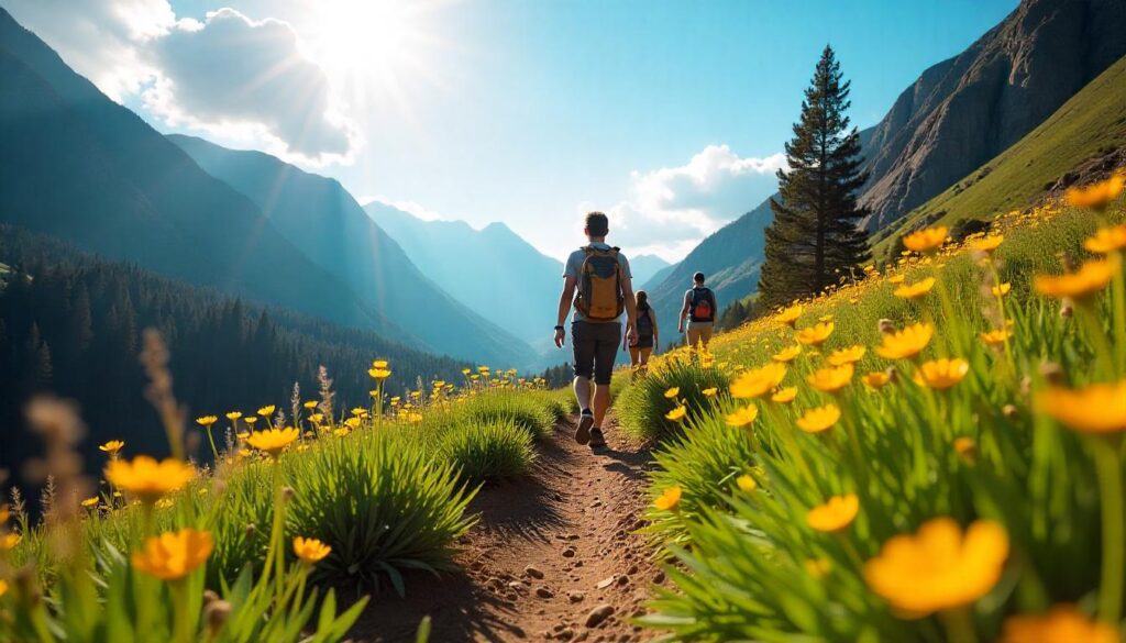
Spring Hiking in Tahoe: Wildflowers & Snowmelt Falls
Late April through early June is prime time for spring hiking around Lake Tahoe. Melted snow feeds gurgling creeks and waterfalls, creating roaring cascades at sights like Cascade Falls and Shirley Canyon. Wildflowers burst into color across granite slabs—look for lupine, columbine, and Indian paintbrush carpeting meadows near Spooner Lake and along the Tahoe Meadows Loop. Trails can be muddy or still snow-packed at higher elevations, so microspikes and gaiters are wise. Aim for lower‐elevation routes (under 7,000 ft) until mid‐May, then gradually venture higher as snow recedes.
Summer Hiking: Beach-Side Loops & High Alpine Summers
From late June through August, most Lake Tahoe hikes are snow-free and offer long daylight hours. Beach hikes, such as the easy El Dorado Beach Trail, combine cooling lake breezes with sandy shores. For epic panoramas, head up to Mount Tallac or the Tahoe Rim Trail—the high country blooms with subalpine wildflowers and open meadows. Remember that afternoon thunderstorms often build by 2 PM; start early and plan to be off exposed ridges by midday. Pack plenty of water—Lake Tahoe water temperature remains under 70°F, so lakeside dips are refreshing but chilly.
Fall Hiking: Turning Aspens & Foliage-Filled Valleys
September and October showcase Tahoe’s golden views. Aspens along Ellis Peak and Stanford Rock Loop glow in oranges and yellows, while cooler nights keep bugs at bay. Trails closer to the lake—like Fallen Leaf Lake Loop—offer mild temperatures and crisp mornings. Fall conditions can shift quickly; keep layers handy for temperature swings, and expect early snow at elevations above 8,000 ft later in October. Fall is also quietest season, so you’ll enjoy solitude on even the most popular Lake Tahoe trails.
Winter Hiking & Snowshoe Routes: Tahoe Rim Trail in Snow
Winter transforms Tahoe into a snow-shoeing wonderland. From December through March, roads to higher trailheads often close—stick to easily accessed routes like Tahoe Meadows Loop or lower‐elevation snowshoe routes in Emerald Bay State Park. Rent snowshoes or traction devices, and carry avalanche safety gear if venturing off groomed paths. Gamow Cal photography on snow-covered aspen groves is spectacular at sunrise. Check current conditions with the Forest Service before heading out, as storms can strand unprepared hikers.
Final Thoughts on Hiking in Lake Tahoe
In exploring the best hikes in Lake Tahoe, we’ve covered everything from iconic summits like Mount Tallac and Eagle Rock to serene beach-side loops along El Dorado Beach and the Baldwin Beach Path. You now know how to choose the perfect trail—balancing distance, elevation, and difficulty—and you’ve seen our in-depth breakdown of the top 15 Lake Tahoe hiking experiences, complete with precise trail metrics, seasonal timing, and real-world safety tips. Whether you’re seeking easy family adventures on the Tahoe Meadows Loop or craving the challenge of a full Rubicon Trail traverse, this guide equips you with everything you need to tackle Lake Tahoe hikes confidently.
Beyond the trails themselves, we’ve mapped out North Lake Tahoe hikes and South Lake Tahoe trails, highlighted the must-see waterfall hikes like Cascade Falls and Shirley Canyon, and even outlined backpacking Tahoe without permit options for multi-day wilderness quests. Planning your trip is simpler now: from selecting the ideal lodging—be it a cozy Lake Tahoe cabin, an Airbnb Lake Tahoe, or one of the area’s top-rated hotels like the Hard Rock Hotel Lake Tahoe—to figuring out logistics like the closest airport, shuttle services, and where to grab breakfast in South Lake Tahoe. Post-hike, you’ll know the best beaches for a refreshing dip, where to catch sunrise and sunset vistas, and how to capture those breathtaking Lake Tahoe photos.
Our Experience Based Hikes section ensures you’ll find the right fit—whether it’s dog-friendly hiking, easy trails for beginners, wildflower-lined paths in spring, or full-moon stargazing routes. And with the Essential Gear & Preparation advice—covering footwear for rocky terrain, hydration strategies at high altitude, and weather-proof layering—you’ll hit the trails well-equipped and safe. Finally, our Seasonal Hiking tips guide you through spring’s snowmelt waterfalls, summer’s alpine meadows, fall’s golden aspens, and winter’s snowshoe routes, so you can tailor every outing to the very best conditions.
Lake Tahoe’s hiking landscape is as diverse as it is stunning. Armed with this comprehensive guide, you’re ready to immerse yourself in the region’s natural beauty, conquer its famous peaks, and discover hidden gems along its shores. Whether you’re here for a day hike or an extended adventure, these best Lake Tahoe hikes promise unforgettable experiences and endless reasons to return.
Ethan Marlowe is an experienced hiker and outdoor gear specialist based in Colorado. With over 7 years of hands-on experience trekking through the Rockies, Pacific Northwest, and East Coast trails, he delivers practical advice, expert gear reviews, and survival insights. His goal is to help hikers of all levels make smarter decisions on and off the trail.