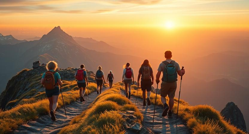
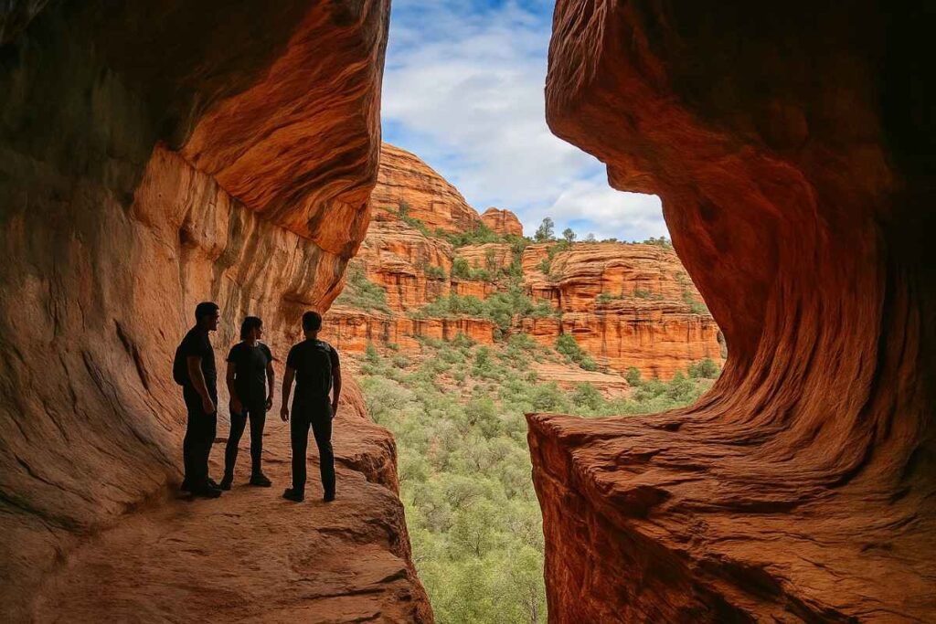
Why Hiking in Sedona Is Unforgettable
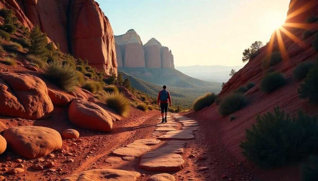
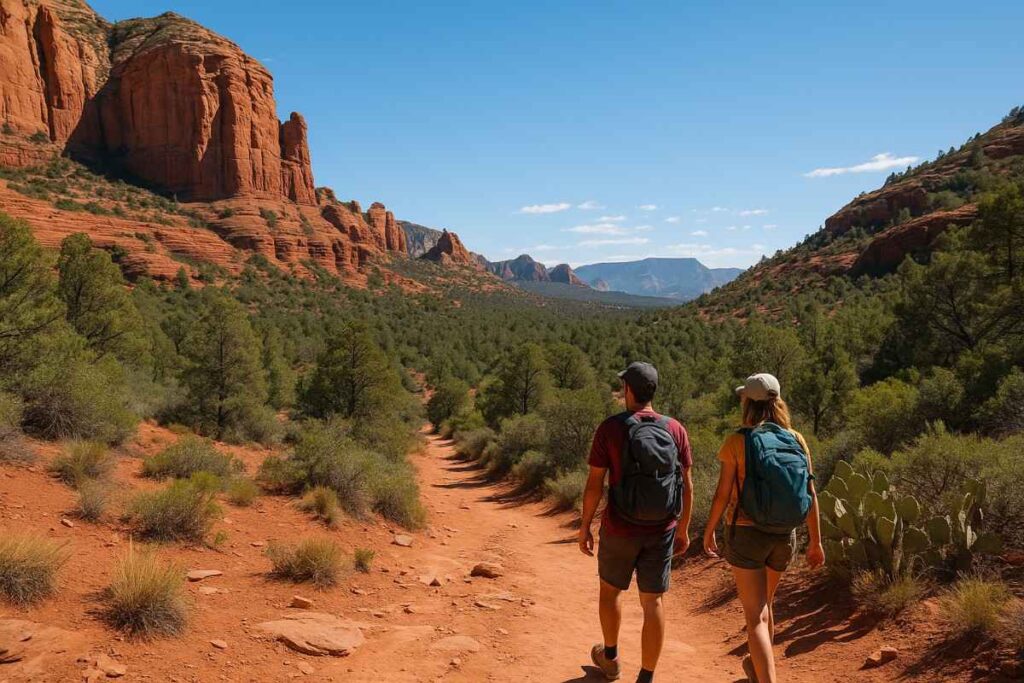
Sedona’s landscape is unlike anywhere else in the world. With bold red sandstone formations, sweeping canyons, and hidden arches, every step on the best hiking trails in Sedona feels like stepping into a masterpiece. Beyond the scenery, you’ll discover the energy of famous vortex sites, the rich history of Native American ruins, and the pure joy of hiking in Sedona Arizona under endless blue skies. Whether you’re seeking easy hikes in Sedona or challenging rock climbs, this is a place where adventure meets serenity.
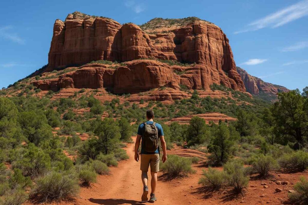
Red Rock Country: Iconic Sedona Scenery
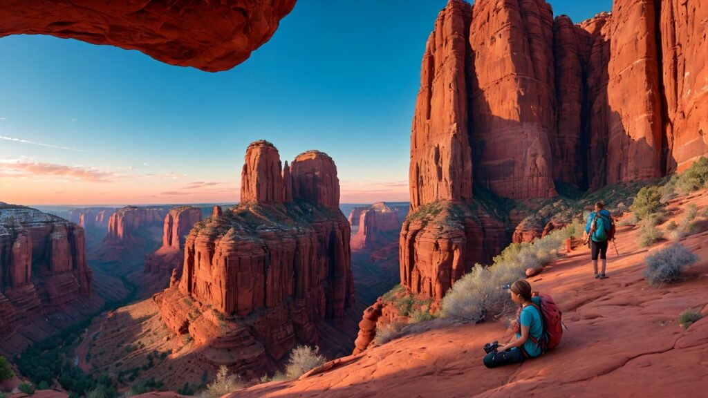
Sedona sits at the heart of Red Rock Country, a geological wonder shaped over millions of years. The glowing cliffs of Cathedral Rock, Bell Rock, and Courthouse Butte create a backdrop so dramatic it’s Instagram-famous for a reason. These Sedona hiking spots aren’t just beautiful—they’re windows into Earth’s history. Walking among these formations, you’ll spot layers of sandstone in shades of crimson and gold, giving every photo a postcard-perfect quality.
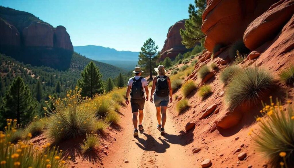
Sedona Area Hikes & Sedona Walking Trails
From the bustling art galleries of Uptown Sedona to quiet pockets along Oak Creek Canyon, the town is dotted with Sedona nature trails that suit every pace. Short loops like the Airport Mesa overlook offer panoramic views within minutes of town, while longer routes like West Fork Trail wind through shady riparian corridors. Use a Sedona hiking trails map—available free at the Visitor Center—to plan loops that combine creekside strolls, vortex visits, and open desert vistas.
Sedona Altitude & Hiking Safety in Sedona
At roughly 4,500–5,200 ft above sea level, Sedona’s elevation can catch newcomers off guard. It’s common to feel a bit more breathless than at sea level, especially on moderate hikes in Sedona with sudden elevation gain. Always acclimate by starting with shorter, easy hikes and drinking extra water. Carry a basic first-aid kit, let someone know your route, and check trail conditions before heading out. For official trail closures or permits, visit the U.S. Forest Service Red Rock District site.
Top 10 Best Hikes in Sedona You Must Visit
Sedona’s red-rock playground offers a trail for every adventurer, from sweeping overlooks to hidden canyons. In this curated list of the top hikes in Sedona, you’ll find iconic Sedona trails and off-the-beaten-path gems that showcase why hiking here is a bucket-list experience. Whether you crave a sunrise scramble up Cathedral Rock or a shaded walk through West Fork’s creek, these routes represent the must-do hikes in Sedona for 2025. Lace up your boots and get ready to explore Sedona hiking spots that blend geology, culture, and pure outdoor joy.
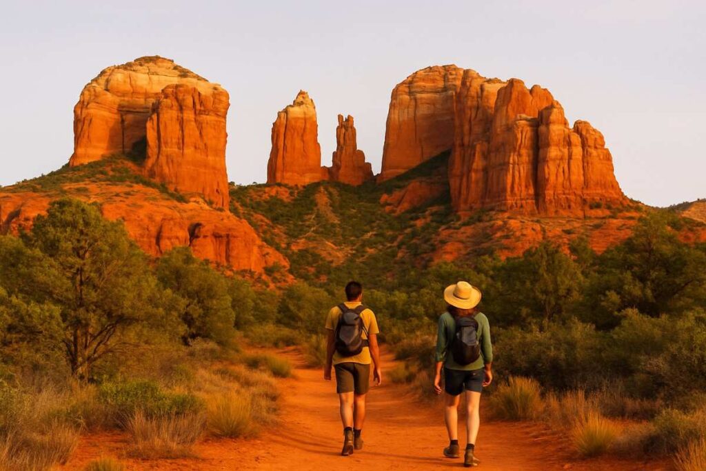
1. Cathedral Rock Hike Sedona
Introduction
Rising like a crimson cathedral against the desert sky, Cathedral Rock is arguably the most photographed of all Sedona hiking trails. Its steep, almost sculptural fins make for thrilling climbing moves and unforgettable panoramas. As you navigate the slick sandstone slabs and tight saddle, you’ll feel the energy of a famous vortex site beneath your feet. This trail delivers both a heart-pounding challenge and one of the best views of Oak Creek Canyon’s layered buttes and mesas.
Perched over the Confluence of Oak Creek, Cathedral Rock stands as a natural fortress of red sandstone, drawing hikers into a vertical playground. The trail’s exposed sandstone fins demand careful footwork and occasional hands-on scrambling, rewarding each move with new angles of the canyon below. Midway up, the wind whispers through narrow crevices, carrying distant calls of hawks circling overhead. From the saddle, you’ll gaze across layered mesas, feeling the hush of a famous vortex beneath your boots. As you descend, the setting sun often ignites the rocks in fiery hues, creating one of the most memorable panoramas in all of Sedona.
Trail Distance, Elevation, Difficulty, and Permit
- Distance: 1.2 miles round-trip
- Elevation Gain: 550 ft
- Difficulty: Moderate to challenging
- Permit: Red Rock Pass required for parking
Best Time to Visit
For sunrise hiking Sedona, Cathedral Rock is hard to beat: the early light paints the sandstone in soft pastels before crowds arrive. In spring and fall, aim for mid-week mornings to avoid shuttle lines. Summer dawn starts are cooler, while winter afternoons offer dramatic shadows and potentially icy patches—bring traction devices if you go late in the season.
Personal Tips & Safety Precautions
- Mind your footing: The sandstone can be slippery when wet—wear shoes with aggressive tread for red rock hiking Sedona.
- Pack headlamps: If you stay atop for sunset, you’ll need a light source for the descent once dusk falls.
- Hydrate early: The steep initial scramble can spike your heart rate—drink at least 16 oz. before you start.
- Avoid crowds: The saddle narrows to a ledge—go solo (or in pairs) outside peak hours for a more serene experience.
2. Devil’s Bridge Trail Sedona AZ
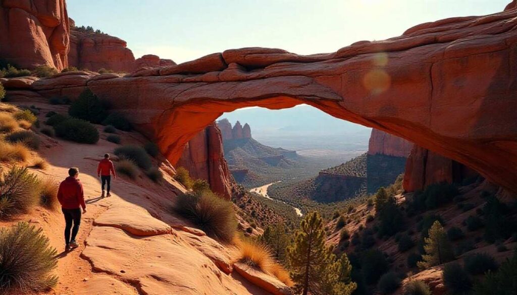
Introduction
Home to the largest natural sandstone arch in the region, Devil’s Bridge epitomizes the drama of Sedona desert hikes. The final approach feels almost cinematic as you ascend a narrow rock spine toward the sunlit span. Along the way, you’ll glimpse panoramic views of Mescal Mountain and Courthouse Butte, making this one of the best scenic hikes in Sedona. Once you step onto the bridge, you’ll understand why it’s a pilgrimage for photographers and adventure seekers alike.
Winding past scrub oak and desert wildflowers, the approach to Devil’s Bridge is a gradual tease of what’s to come—a shadow of the arch appears before the final rocky spine ascent. The last quarter-mile feels cinematic: a narrow sandstone path leading to an immense natural bridge that seems carved by giants. Stand atop its span to peer into an endless red-rock amphitheater, where light and shadow play across distant buttes. Photographers line up for that iconic shot, but the true magic comes in the quiet moments—when you catch the arch glowing in dawn’s first light or bathed in lunar silver on clear nights.
Trail Distance, Elevation, Difficulty, and Permit
- Distance: 4.2 miles out-and-back
- Elevation Gain: 400 ft
- Difficulty: Moderate
- Permit: Red Rock Pass required or shuttle only access
Best Time to Visit
Aim for a sunrise hiking Sedona slot to capture golden light on the arch and avoid the midday heat (and crowds). In summer, start by 6:00 AM; in winter, 8:00 AM still feels crisp. Weekdays see lighter foot traffic, while weekends can feel like a theme-park queue.
Personal Tips & Safety Precautions
- 4WD option: If you have high-clearance, you can drive directly to a closer trailhead—check weather and road conditions first.
- Line management: The arch gets crowded—queue patiently and be ready with your camera for a quick turnaround.
- Mind the drop: Stay centered on the bridge; edges can crumble underfoot, especially after rain.
- Pack snacks: The fairly flat approach invites leisurely stops—energy bars and fresh fruit hit the spot.
3. Boynton Canyon Hike
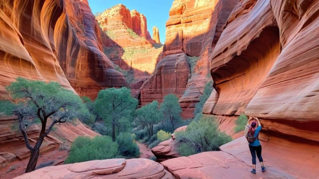
Introduction
Boynton Canyon’s wide amphitheater of vermilion walls is a highlight among Sedona hiking spots, blending sweeping vistas with spiritual energy. The trail meanders through juniper and oak, then opens into a red-rock gorge where a subway-style cave pops into view. Along this Sedona trail guide route, you’ll pass a famous vortex site and uncover hidden side trails that reward you with secret viewpoints.
Boynton Canyon unfolds like a secret gallery of crimson cliffs, where pine-fringed switchbacks open onto vast plateaus of golden grass. As you wind through twisted juniper groves, the hush of the canyon floor gives way to the hum of wind through towering walls. Hidden offshoots promise the thrill of discovery, from moss-lined fissures to petroglyph-scarred alcoves. At the Subway Cave junction, the trail plunges into a cool, cathedral-like chamber that echoes your footsteps. With each turn, Boynton delivers both the expansive grandeur of Sedona’s red rocks and the intimacy of a desert oasis.
Trail Distance, Elevation, Difficulty, and Permit
- Distance: 7.2 miles (full loop)
- Elevation Gain: 600 ft
- Difficulty: Moderate
- Permit: Red Rock Pass required for parking
Best Time to Visit
Spring and fall bring wildflowers and mild temperatures, perfect for this Sedona day hike. Summer mornings before 8 AM dodge the worst heat; winter afternoons offer clear skies but watch for icy patches in shaded canyon sections.
Personal Tips & Safety Precautions
- Cave detour: Bring a headlamp or smartphone flashlight—Subway Cave is dark and uneven.
- Vortex etiquette: If you visit the Boynton Canyon vortex, speak softly and respect the space.
- Trail forks: Several side trails can be confusing—use your Sedona hiking trails map and follow cairns.
- Animal encounters: Be bear-aware and keep snacks sealed; small mammals frequent oak drifts.
4. Bell Rock Loop Trailhead
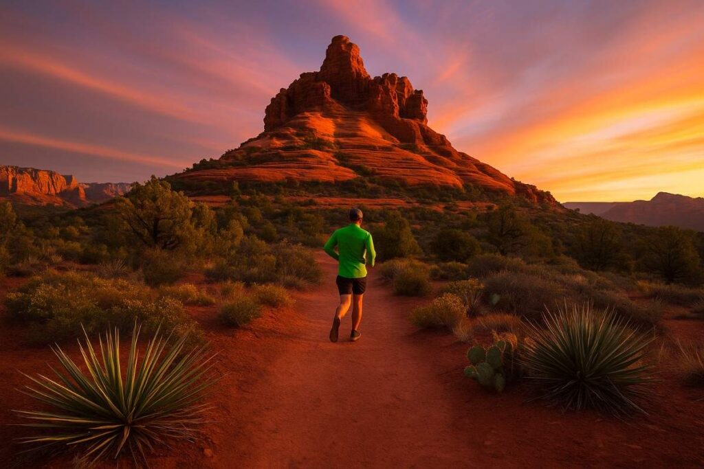
Introduction
One of the iconic Sedona trails, Bell Rock offers a graceful climb up a bell-shaped butte that glows at sunrise and sunset. The Bell Rock Loop provides both a base-level stroll and, for the adventurous, a summit scramble with 360° views of Cathedral Rock, Courthouse Butte, and the valley floor. Its mix of easy hill walks and short rock climbs makes it a perfect best Sedona trails choice for families and solo trekkers alike.
Bell Rock beckons with its smooth, bell-shaped dome—a sentinel watching over the valley. The loop’s gentle rollers and slickrock ledges offer a taste of climbing without vertigo, perfect for capturing sweeping views in every direction. As you circle the base, the ridge to the north reveals a hidden “vortex bench,” where many pause to meditate or simply drink in the panorama. Morning light washes the dome in rosy pastels, while dusk transforms it into a molten sculpture against a purple sky. This trail strikes a rare balance: approachable enough for families, yet rich with geological intrigue.
Trail Distance, Elevation, Difficulty, and Permit
- Distance: 3.5 miles loop
- Elevation Gain: 370 ft
- Difficulty: Easy to moderate
- Permit: Red Rock Pass required
Best Time to Visit
Aim for late afternoon lighting to see Bell Rock’s contours pop in gold tones. Spring evenings are particularly magical, while summer evenings offer cooler air and fewer bugs. Winter midday climbs can be icy—microspikes recommended.
Personal Tips & Safety Precautions
- Sunset perch: The “vortex bench” on Bell Rock’s north side is ideal for quiet stargazing after dark.
- Foot placement: Loose gravel can shift on the incline—place feet deliberately on solid sandstone.
- Dog-friendly: Well-behaved pets on leash are welcome—carry extra water and poop bags.
- Photography tip: Use a wide-angle lens to capture both the rise and surrounding valley in one frame.
5. Fay Canyon Trail Sedona
Introduction
Fay Canyon combines the intimacy of a box canyon with the thrill of a hidden arch scramble. As you walk beneath towering red walls, filtered light creates shifting patterns that change by the hour—perfect for Sedona hikes with views. Midway, a narrow side path leads to Fay Canyon Arch, a delicate sandstone span reachable with a short, airy scramble that rewards you with secluded photo.
Nestled within towering crimson walls, Fay Canyon is a canyon-in-miniature—its narrow floor shaded by fragrant juniper and choking wisteria vines in spring. The main path is a gentle wander, but the real allure lies in the unmarked scramble to a hidden archway, where filtered sunlight creates dramatic beams across the sandstone. Occasionally, you’ll glimpse quiet wildlife—lizards sunning on rocks or kestrels circling overhead. After rain, trickles along the canyon floor sparkle like jewels, inviting hikers to slow down and savor every echo and shadow in this tranquil desert refuge.
Trail Distance, Elevation, Difficulty, and Permit
- Distance: 2.2 miles out-and-back
- Elevation Gain: 150 ft
- Difficulty: Easy to moderate
- Permit: Red Rock Pass required
Best Time to Visit
Spring mornings reveal wildflower blooms, and summer afternoons provide welcome shade under the canyon walls. Fall afternoons showcase fiery red foliage, and winter light casts dramatic shadows—visit between 10 AM–2 PM for optimal brightness.
Personal Tips & Safety Precautions
- Arch approach: The scramble up to the arch is unmarked—watch for cairns and move slowly on steep slabs.
- Water crossings: Seasonal runoff can leave trickles at the canyon floor—waterproof shoes help.
- Desert flora: Stay on the trail to avoid damaging cacti and native grasses.
- Quiet spot: Few hikers venture to the arch—take time to absorb the peaceful canyon ambiance.
6. Little Horse Trail Sedona AZ
Introduction
Tucked between Courthouse Butte and Bell Rock, Little Horse Trail offers varied terrain: pine-scattered benches, slickrock ledges, and whispering desert flats. This popular hike in Sedona feels remote yet is minutes from town. The descent to a saddle provides sweeping views of Red Rock State Park, while the return route hugs the hillside, unveiling unexpected arches and skylines.
Little Horse Trail threads through open desert flats before depositing you atop a rocky saddle with unobstructed views of Courthouse Butte and Bell Rock. The path alternates between smooth dirt switchbacks and broken sandstone slabs, guiding you through sagebrush meadows speckled with spring blooms. Small side nooks reveal petroglyphs, testaments to ancient travelers who once roamed these lands. As the trail arcs back, the sunset often ignites distant formations in a wash of gold, making the entire loop feel like a painter’s homage to the desert.
Trail Distance, Elevation, Difficulty, and Permit
- Distance: 5.0 miles loop
- Elevation Gain: 620 ft
- Difficulty: Moderate
- Permit: Red Rock Pass required
Best Time to Visit
Fall afternoons showcase golden grasses against red cliffs, while spring mornings offer cool air and blooming desert wildflowers. Summer dawn starts help beat the heat, and winter midday hikes give crisp, clear visibility.
Personal Tips & Safety Precautions
- Trail markers: Use GPS or a printed Sedona hiking trails map—junctions can be confusing.
- Rattlesnake alert: Early spring is rattlesnake season—stay on clear dirt paths and avoid tall grass.
- Pack layers: Pine-covered sections stay cooler than exposed slickrock—carry a light fleece.
- Wildlife watch: Keep binoculars handy for spotting hawks and javelinas at dawn.
7. Airport Loop Trail Sedona
Introduction
The Airport Loop Trail circles the Sedona airport mesa, delivering panoramic vantage points of Sedona hiking spots like Cathedral Rock, Bell Rock, and Snoopy Rock. The route combines well-graded dirt paths with brief slickrock traverses, making it one of the best trail loops in Sedona for sunrise or sunset treks. City lights sparkle in the valley below, offering a unique perspective on Sedona’s night sky.
Encircling the plateau that hosts Sedona’s small airport, this trail delivers tabletop views of the surrounding red-rock kingdom. Wide, well-graded paths ease you into morning hikes, while slickrock sections invite playful balancing acts. Panoramas stretch from Cathedral Rock on the east to Snoopy Rock and beyond, a sprawling map of Sedona hiking spots laid at your feet. At sunset, the mesa’s lip becomes a front-row seat to a color show—first pink, then orange, and finally deep violet as the valley lights twinkle below.
Trail Distance, Elevation, Difficulty, and Permit
- Distance: 3.2 miles loop
- Elevation Gain: 350 ft
- Difficulty: Easy to moderate
- Permit: No permit required—pay parking fee at overlook lot
Best Time to Visit
Sunrise and sunset here are spectacular: strike an early start for top Sedona hikes for sunrise, or linger after dusk for stargazing with minimal light pollution. Winter evenings showcase crisp constellations, while summer dawns bring cool breezes.
Personal Tips & Safety Precautions
- Parking strategy: If the small lot is full, use the airport’s paid lot and walk 5 minutes to the trailhead.
- Wind layer: Exposed mesa top can be windy—carry a windbreaker even on warm days.
- Trail combo: Link up with the Sedona View Trail for extra mileage and variety.
- Insect repellent: Evening hikes can stir up mosquitoes—spray on base layers.
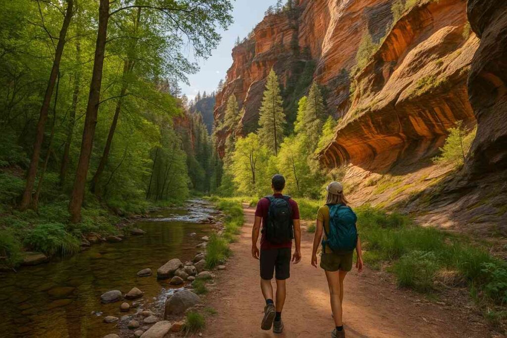
8. West Fork Trail Sedona
Introduction
Winding through a shady riparian gorge, West Fork Trail is a refreshing contrast to Sedona’s sun-baked mesas. You’ll hop across stepping-stone creek crossings, skirt towering sycamore and oak, and pass vibrant fern cascades—rare finds in the desert. This Oak Creek Canyon hike is especially popular during autumn foliage, when gold and crimson leaves mirror the red rocks above.
West Fork feels worlds away from Sedona’s sun-baked ridges: here, a cool creek carves a verdant corridor beneath towering sycamore canopies. Crossing the water dozens of times, you’ll feel the refreshing splash on hot afternoons, while moss-covered boulders create miniature cascades ideal for a quick dip. Autumn brings a riot of gold and amber leaves drifting in the current, transforming the canyon into a seasonal cathedral. With each bend, the scent of damp earth and pine needles greets you, offering a sensory feast rare in desert landscapes.
Trail Distance, Elevation, Difficulty, and Permit
- Distance: 6.9 miles out-and-back
- Elevation Gain: 400 ft
- Difficulty: Easy to moderate
- Permit: Red Rock Pass required for day use
Best Time to Visit
Fall mid-October to early November offers peak color along the creekbanks. Spring brings wildflower bursts, while summer early mornings provide cooler crossings. Winter days can be chilly—pack waterproof boots and microspikes for icy spots.
Personal Tips & Safety Precautions
- Creek crossings: Use trekking poles for balance—stones can be slippery with algae.
- Leave No Trace: The canyon is ecologically sensitive—carry out all trash and avoid trampling ferns.
- Wildlife caution: Keep an eye out for water snakes and small mammals around water pools.
- Photo gear: A waterproof bag or protective sleeve is wise for cameras near waterfalls.
9. Courthouse Loop South Trailhead
Introduction
Encircling the majestic Courthouse Butte, this loop trail delivers varied vistas, from desert scrub flats to elevated overlooks. The Courthouse Loop is an easy hike in Sedona that still offers rewarding viewpoints of the butte’s striated walls, plus glimpses of Bell Rock and Cathedral Rock in the distance. Its gentle grade makes it a favorite for families and dog friendly hiking trails in Sedona.
The Courthouse Loop unfolds around a massive, striated butte that glows like a desert lighthouse at dawn. Its broad, smooth trail is ideal for families, yet it still rewards with unexpected alcoves and bench overlooks. Look back to see Bell Rock and Cathedral Rock framing the horizon, their silhouettes etched against the sky. Creosote bushes and juniper clusters scent the air, and on quiet mornings you may even spot mule deer grazing nearby.
Trail Distance, Elevation, Difficulty, and Permit
- Distance: 3.8 miles loop
- Elevation Gain: 200 ft
- Difficulty: Easy
- Permit: Red Rock Pass required
Best Time to Visit
Spring mornings reveal desert blooms, while fall evenings highlight golden light on the butte’s layers. Summer late-afternoons offer shade along the western flank. Winter midday hikes provide crisp visibility—just dress warmly for the open stretches.
Personal Tips & Safety Precautions
- Trail etiquette: Keep dogs leashed—this area is popular with equestrians and wildlife.
- Sun protection: Large sections have no shade—wear a wide-brim hat and reapply sunscreen.
- Combine loops: Link with Bell Rock Pathway for a longer, varied outing.
- Water stations: No potable water onsite—carry all you need for the full loop.
10. Subway Cave (Long Canyon Trail) Sedona AZ
Introduction
Hidden amid trees and scrub, the Subway Cave is a geological marvel resembling a red-rock aqueduct. Found off the Long Canyon Trail, this alcove features smooth, arching walls that glow when sunlight filters through the entrance. Though the approach involves a sandy wash and a short scramble, discovering this Sedona waterfall hike-style formation feels like unearthing a secret slot canyon.
Hidden along a lesser-known wash, Subway Cave feels like stumbling onto a prehistoric amphitheater carved by water and wind. The walls arch overhead in a gentle vault, their layered hues shifting from deep ochre to glowing amber as sunlight enters the mouth. The approach trail weaves through scrubby desert flats, offering glimpses of distant buttes before diving into the cool tunnel. Inside, the echo of dripping water and the soft glow of filtered light evoke a sense of timeless mystery—one that rewards those willing to stray off the beaten path.
Trail Distance, Elevation, Difficulty, and Permit
- Distance: 1.9 miles round-trip
- Elevation Gain: 250 ft
- Difficulty: Moderate (due to scramble)
- Permit: Red Rock Pass required
Best Time to Visit
Late morning brings direct sunlight into the cave, illuminating its red walls and creating vibrant photo conditions. Spring and fall avoid extreme heat; summer mornings work if you start before 8 AM—shady wash sections stay cool.
Personal Tips & Safety Precautions
- Scramble safety: Wear gloves for rock grips—edges can be sharp and slick.
- Navigation: The turn-off is unmarked—use GPS coordinates or follow cairns documented on AllTrails.
- Leave No Trace: Cave interiors can house nesting swallows—avoid disturbing any wildlife.
- Flash photography: A headlamp or small flashlight helps fill shadows for interior shots.
Comparison Table: Top 10 Best Hikes in Sedona
| Trail Name | Distance | Elevation Gain | Difficulty | Season | Permit Required |
|---|---|---|---|---|---|
| Cathedral Rock Hike | 1.2 miles round trip | 740 ft | ⭐️⭐️⭐️⭐️ Moderate to Hard | Spring & Fall | Red Rock Pass |
| Devil’s Bridge Trail | 4.2 miles round trip | 400 ft | ⭐️⭐️⭐️ Moderate | Spring & Fall | Red Rock Pass |
| Boynton Canyon Trail | 6.1 miles round trip | 826 ft | ⭐️⭐️⭐️ Moderate | Spring & Fall | Red Rock Pass |
| Bell Rock Loop Trail | 1.8 miles loop | 400 ft | ⭐️⭐️ Easy | Year-round | Red Rock Pass |
| Fay Canyon Trail | 2.4 miles round trip | 190 ft | ⭐️⭐️ Easy | Year-round | Red Rock Pass |
| Little Horse Trail | 3.4 miles round trip | 400 ft | ⭐️⭐️⭐️ Moderate | Spring & Fall | Red Rock Pass |
| Airport Loop Trail | 3.3 miles loop | 416 ft | ⭐️⭐️⭐️ Moderate | Spring & Fall | Red Rock Pass |
| West Fork Trail | 6.5 miles round trip | 600 ft | ⭐️⭐️⭐️ Moderate | Spring to Fall | $12 Day Fee |
| Courthouse Loop Trail | 4.2 miles loop | 350 ft | ⭐️⭐️ Easy to Moderate | Spring & Fall | Red Rock Pass |
| Subway Cave (via Long Canyon) | 6.0 miles round trip | 600 ft | ⭐️⭐️⭐️ Moderate | Spring & Fall | Red Rock Pass |
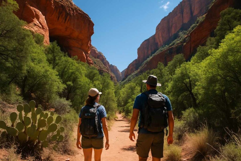
Easy & Short Hikes in Sedona
Sedona’s dramatic red rocks beckon, even when you’re short on time or hiking with little ones. These easy hikes in Sedona AZ give you maximum payoff—stunning views and unique geology—without committing to a full-day trek. Perfect for families, dog-friendly outings, or a quick Sedona day hike before dinner, these routes showcase why Sedona remains one of the top Arizona hiking destinations.
Easy & Short Hikes in Sedona AZ
- Airport Loop Trail
- Courthouse Loop South
- Fay Canyon Trail
- Birthing Cave (1.9 miles round-trip)
This unique alcove hike combines a sandy wash approach with a final steep, rocky climb. The cave’s high walls glow in late morning sun, creating an otherworldly atmosphere. No permit is needed beyond your Red Rock Pass, and the compact distance makes it a top easy hike in Sedona AZ.
Best Sunrise, Sunset & Night Hikes in Sedona
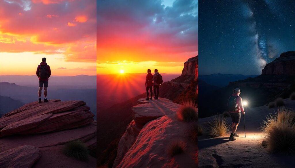
From dawn’s first glow on sandstone to starlit mesa adventures, Sedona’s light shows are legendary. Below, find our top picks for top Sedona hikes for sunrise, best sunset hikes in Sedona, and immersive night hikes in Sedona.
Best Sunrise & Sunset Hikes in Sedona
- Cathedral Rock
- Airport Loop Trail
- Bell Rock
Best Night Hikes in Sedona
After my first moonlit trek on Airport Loop, I felt a quiet wonder I’d never known—just me, the cool night air, and swirling constellations above Cathedral Rock’s silhouette. The desert took on a haunting beauty, and every footstep echoed in the stillness. That night reminded me how Sedona’s outdoor things to do extend beyond daylight, forging connections between earth and cosmos.
Top Night Hikes in Sedona
- Airport Loop Trail (3.2 miles loop)
Easy grading and clear skies make it a favorite for stargazing—pack a red-lens headlamp to preserve night vision and bring a blanket for quick constellations spotting at the overlook. - Bell Rock Pathway (0.8 miles out-and-back)
A short evening stroll takes you close to the base of Bell Rock, where the dome’s shadowed curves frame a dark sky festival. Wear reflective gear for safety near the road. - Cathedral Rock (1.2 miles round-trip)
A challenging scramble in moonlight transforms sandstone fins into dramatic silhouettes. Start late enough to reach the saddle under starlight, but carry extra batteries and warm layers. - Courthouse Loop South (3.8 miles loop)
Gentle terrain and wide trails create a secure path for night hikes—ideal for families new to hiking in Sedona Arizona after dark. Use a GPS watch and tell someone your route.
Night Hiking Safety Tips
- Carry dual light sources (headlamp + flashlight) and spare batteries to avoid being stranded in darkness.
- Check weather and moon phases—avoid nights with heavy cloud cover or unexpected storms.
- Stay on marked trails—nighttime navigation increases Sedona trail difficulty, so keep to well-known routes.
- Pack extra layers—desert temperatures can plummet by 30°F after sunset.
Enjoy Sedona’s heavens as much as its horizons—these nocturnal treks will forever change how you see the desert night sky.
Planning Your Best Hiking in Sedona Adventure

Are Hiking Trails in Sedona AZ Open?
Most popular hikes in Sedona are open year-round, though some trailheads require a Red Rock Pass or America the Beautiful Interagency Pass. Unlike national parks, Sedona’s Forest Service lands remain accessible even in winter snows, but be sure to check seasonal closures for service roads—especially if you plan to drive up to Devil’s Bridge’s off-road trailhead.
Where to Stay in Sedona for Hiking
Choosing the right basecamp can shave hours off your day. Uptown Sedona trails and West Sedona lodging put you within a short drive of Cathedral Rock and Bell Rock, while accommodations near Oak Creek—like L’Auberge de Sedona—offer creekside tranquility after a day on the Sedona trails for hiking. For budget travelers, consider vacation rentals near the Enchantment Resort or campgrounds in Red Rock State Park.
What to Pack for Hiking in Sedona
Before you hit the trails, make sure you’re fully prepared—check out our packing guide for everything you need to bring.
- 2–3 liters of water: Dehydration is the biggest risk in the desert—carry one liter per two hours of hiking.
- High-energy snacks: Trail mix, energy bars, and fruit keep you going on Sedona day hikes.
- Navigation: A printed Sedona hiking trails map and a compass or GPS watch (AllTrails app works well).
- Sun protection: Sunglasses, broad-brim hat, and SPF 30+ sunscreen—even in winter, UV is strong at altitude.
- First-aid kit: Include blister pads, bandages, antiseptic wipes, and any personal medications.
- Headlamp or flashlight: For early starts on sunrise hiking Sedona or unexpected delays at dusk.
What to Wear Hiking in Sedona
Dressing right can make or break your hike—browse our hiking apparel tips to see what to wear on Sedona’s red rocks.
- Moisture-wicking base layers: Breathable shirts and shorts or lightweight hiking pants.
- Sturdy hiking shoes or boots: Look for good traction for red rock hiking Sedona, especially on slick sandstone.
- Lightweight jacket or fleece: Temperatures can drop 20°F after sunset, even in summer.
- Hiking socks: Synthetic or wool blends prevent blisters better than cotton.
- Gloves and beanie: If you’re planning winter hiking in Sedona, these keep you comfortable on exposed ridges.
- Optional gaiters: Helpful if you’ll cross scrubby terrain or shallow creek beds on Oak Creek Canyon hikes.
Seasonal Hiking Sedona: Spring, Summer, Autumn & Winter
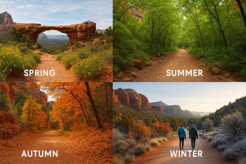
Sedona transforms with each season—wildflower carpets in spring, shaded canyons in summer, fiery foliage in autumn, and frost-tipped rocks in winter. Understanding hiking season in Sedona helps you time your trip for the best conditions, whether you crave blooms, respite from heat, or the serenity of a snowy desert.
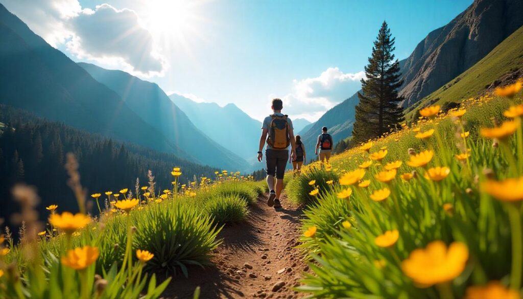
Hiking Sedona in Spring & Wildflowers
Spring ushers in a riot of color as desert primrose, claret cup cacti, and Indian paintbrush bloom along Sedona desert hikes. Trails like the Little Horse Loop and Mescal Trail offer prime wildflower viewing. Expert insight: start hikes mid-morning to catch flowers fully open in sunlight, and carry a loupe or lens to appreciate tiny desert blossoms.
Hiking Sedona in Summer & Shade Spots
Summer’s heat demands early starts on Oak Creek Canyon hikes where riparian corridors provide natural air conditioning. West Fork Trail and Slide Rock State Park trails stay cool under dense sycamore and cottonwood canopies. Pro tip: pack frozen water bottles as instant ice packs and reserve shaded rest stops every mile to avoid heat exhaustion.
Hiking Sedona in Autumn & Fall Colors
Autumn paints Sedona’s canyons in golds and oranges as sycamore, ash, and cottonwood leaves change. West Fork Trail and Fay Canyon become prime destinations for Sedona hiking spots ablaze with color. For the best light, hike late afternoon when low sun filters through foliage, creating a warm glow on red-rock walls.
Hiking Sedona in Winter & Desert Frost
Winter brings crisp mornings, dramatic frost, and fewer crowds on iconic Sedona trails like Cathedral Rock and Devil’s Bridge. Early risers can catch frost-etched cacti and hoarfrost on juniper needles. Safety tip: carry microspikes for icy slickrock and layer up—the desert can lose 20–30°F after sunset.
Hiking Sedona in the Rain
Rainy days turn washes into rushing streams and fill hidden pools on Sedona waterfall hikes like Soldiers Pass and Seven Sacred Pools. Trails can become slippery, so wear waterproof boots and gaiters. After storms, air quality and visibility improve, revealing crystal-clear views of the red-rock formations.
Final Thoughts: Your Sedona Hiking Adventure Awaits
Sedona’s red-rock playground offers something for every outdoor enthusiast—from the adrenaline of scrambling up Cathedral Rock to the tranquil shade of West Fork Trail. This guide to the best hiking trails in Sedona has walked you through planning essentials, top 10 routes, quick family-friendly jaunts, spectacular sunrise and sunset viewpoints, and seasonal highlights. Whether you’re a beginner seeking easy hikes in Sedona or an experienced trekker craving moderate hikes in Sedona, this roadmap ensures you’ll uncover both iconic vistas and hidden gems.
By now, you’ve seen how to prepare with the right layers, pack water and snacks smartly, and respect trail etiquette. You’ve learned where to stay for quick morning starts on top hikes in Sedona and how to navigate permit requirements via the Sedona trail guide. Expert insights—like carrying a headlamp for night hikes or using microspikes on winter slickrock.
From the popular Devil’s Bridge arch to the lesser-known Subway Cave off Long Canyon, each Sedona hiking spot delivers unique geology, framed by shimmering canyons and vortex sites. Short loops such as the Airport Mesa Loop prove that unforgettable views don’t demand all-day commitments, while longer treks like Boynton Canyon reveal hidden caves and sweeping panoramas. For pet owners and families, trails like the Bell Rock Loop and Courthouse Butte Loop demonstrate how accessible adventures in hiking in Sedona Arizona can be.
Seasonal considerations—from spring wildflowers along Sedona desert hikes to autumn foliage in Oak Creek Canyon—ensure that timing your visit makes every mile more memorable. Rainy-day seekers can chase waterfalls in Soldiers Pass, while winter hikers embrace crisp air and frosty vistas atop iconic buttes. No matter the season, knowing the best time to hike in Sedona and planning accordingly helps you avoid crowds and maximize comfort.
As you lace up your boots and consult your Sedona hiking trails map, remember: these are more than just paths through red rocks—they’re gateways to awe, reflection, and genuine connection with nature. Use this guide as your launchpad: bookmark our packing checklist, explore our detailed trail guides, and share your experiences to help other hikers discover why Sedona stands apart among Arizona hiking destinations. Happy trails!
Ethan Marlowe is an experienced hiker and outdoor gear specialist based in Colorado. With over 7 years of hands-on experience trekking through the Rockies, Pacific Northwest, and East Coast trails, he delivers practical advice, expert gear reviews, and survival insights. His goal is to help hikers of all levels make smarter decisions on and off the trail.