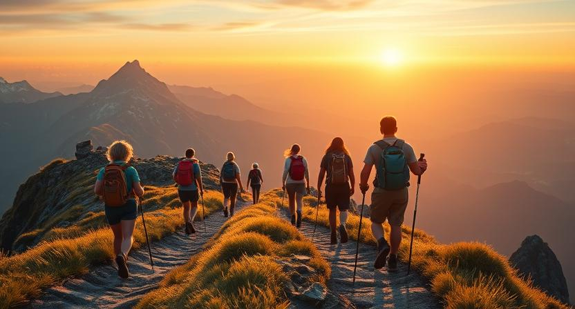
Introduction to Hiking Near Denver
Why Hikes Near Denver Are Legendary
Denver sits at the eastern edge of the Rocky Mountains, making these hikes truly unparalleled in accessibility and diversity. Within a 30-minute drive, you can trade the city skyline for sweeping mountain vistas, red sandstone formations at Red Rocks Park, or alpine forests above tree line. This proximity turns Denver into a launchpad for adventures—street-smart urbanites and seasoned backpackers alike can find trails matching every skill level. The region’s unique geology, from the Fountain Formation at Red Rocks to glacial cirques near St. Mary’s Glacier, adds depth and drama to every step. Moreover, Colorado’s 300+ sunny days per year ensure that your hiking plans rarely fall victim to foul weather .
Denver, Colorado Hiking: Nature, Scenery & Elevation
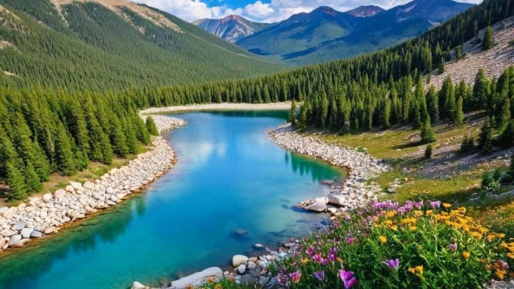
At roughly 5,280 ft altitude, Denver is famously nicknamed the “Mile-High City,” but its trails quickly ascend above 8,000 ft and beyond. This rapid elevation gain yields a variety of ecosystems in short order—grasslands give way to Ponderosa pines, and those to subalpine firs and wildflower-strewn meadows. Hikers often report startling temperature swings, so layering is key. Scenic highlights include glacial lakes like those on the Snowmass Creek Trail, as well as high-desert vistas at Roxborough State Park. Wildlife sightings—mule deer, mountain goats, and even the occasional black bear—give each outing a sense of discovery.
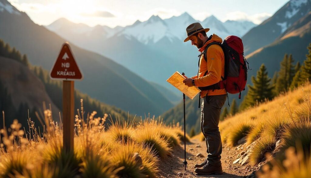
How to Choose the Perfect Denver Hike: Distance, Difficulty & Terrain
Selecting the right Denver, Colorado hiking route hinges on three factors: the trail’s length, its overall climb, and the underfoot terrain. If you’re pressed for time but craving mountain air, day hikes near Denver Colorado such as the 1.4-mile Red Rocks Trading Post Loop offer dramatic views in under an hour. For a moderate workout, the 3-mile round-trip up Mount Sanitas challenges your lungs and legs with a 1,300 ft ascent. Terrain plays a pivotal role—gentler gravel paths in Golden Gate Canyon State Park differ markedly from the sandstone slickrock at North Table Mountain Rim Trail. Always match your footwear—sturdy boots for rocky scrambles, trail runners for flowy singletrack—to the trail surface. Finally, check trailhead access and parking regulations; popular spots like Staunton State Park fill early, while less-known routes such as Waterton Canyon provide plentiful space and easy creek access.
Top 15 Best Hikes Near Denver You Must Experience
1. Red Rocks Trading Post Loop
Introduction
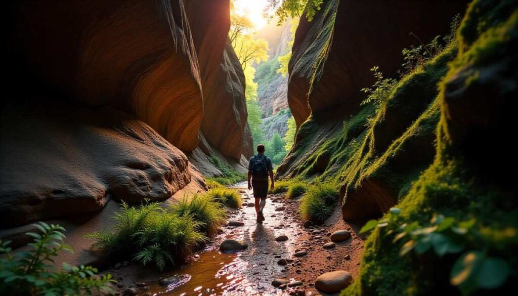
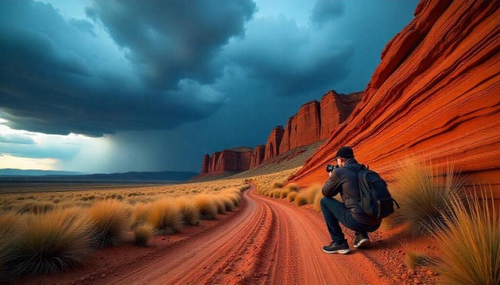
The Red Rocks Trading Post Loop weaves you through the world-famous Red Rocks Amphitheatre’s towering sandstone fins, offering dramatic vistas of the Denver skyline against blood-red stone. You begin on a well-graded dirt path, flanked by pinyon pines and mountain mahogany, before dropping into Trading Post Canyon where hoodoos and natural arches invite close-up exploration. The loop’s exposed ridges catch golden light at sunrise and sunset, making it a magnet for photographers and trail runners. Interpretive signs recount the area’s Native American heritage and geological history, deepening your connection to this urban-proximate gem. Despite being just 15 miles from downtown, the trail feels astonishingly remote, giving you a taste of mountain hikes near Denver without a long drive.
Distance | Elevation Gain | Difficulty | Permit
- Distance: 6 miles loop
- Elevation Gain: 800 ft
- Difficulty: Moderate
- Permit: Free; Red Rocks Park parking fee applies
Best Time to Visit
April–June & September–October: Spring wildflowers and fall foliage accentuate the red sandstone; avoid midsummer heat.
Personal Tips & Safety Precautions
- Trail Shoes: Use grippy soles for slickstone sections, especially after rain.
- Hydration: No water on trail—carry at least 2 L and sip frequently in the high desert.
- Early Arrival: Parking fills by 8 AM on weekends—arrive at dawn or ride the park shuttle.
- Sun Protection: Wide-brimmed hat and SPF 50+ sunscreen are must-haves on exposed ridges.
2. Mount Sanitas Trail
Introduction
Mount Sanitas Trail climbs steeply from the foothills of Boulder Mountain Park, rewarding hikers with uninterrupted panoramas of Denver’s urban sprawl framed by the Rockies. The ascent transitions quickly from shady Douglas-fir forest to sun-baked meadows dotted with alpine sunflowers and penstemon. Near the summit, rocky outcrops require light scrambling, adding an element of adventure to this popular day hike near Denver Colorado route. Summit views stretch from Pikes Peak to Longs Peak on clear days—an ideal benchmark for gauging Colorado’s vast mountain range. Locals flock here after work for quick sunset treks, making the trail a true staple of hiking in Denver culture.
Distance | Elevation Gain | Difficulty | Permit
- Distance: 3.3 miles round-trip
- Elevation Gain: 1,300 ft
- Difficulty: Moderate–Challenging
- Permit: None; Boulder Open Space parking fee
Best Time to Visit
May–September: Snow-free and dry; early mornings beat the afternoon thunderstorm window.
Personal Tips & Safety Precautions
- Pace Yourself: Steep grades demand short rest breaks—turns on the switchbacks give easy photo spots.
- Headlamp: If chasing sunset, a headlamp is essential for the rocky descent.
- Layer Up: Summit winds can gust unexpectedly—carry a windbreaker even on warm days.
- Trail Courtesy: Yield uphill hikers; narrow sections can bottleneck during peak hours.
3. St. Mary’s Glacier & Lower Lake Loop
Introduction
Just 60 minutes from Denver, the St. Mary’s Glacier & Lower Lake Loop takes you to one of Colorado’s few permanent snowfields, even in summer. The trail ascends past wildflower meadows and a chain-link avalanche barrier before emerging onto the glacier’s moraine. Below, the glacier’s melt feeds a serene subalpine lake, whose emerald waters reflect surrounding peaks. Ice shards often drift in the lake well into July, creating an otherworldly alpine ambiance. Interpretive displays explain glacial formation while picnic tables invite lingering by the water’s edge. This waterfall hikes close to Denver alternative pairs rare snowfields with easy access, making it a go-to for families and photographers alike.
Distance | Elevation Gain | Difficulty | Permit
- Distance: 2.5 miles loop
- Elevation Gain: 700 ft
- Difficulty: Easy–Moderate
- Permit: None; minimal parking fee
Best Time to Visit
June–August: Snowfield persists through summer; fall foliage along the creek adds seasonal color.
Personal Tips & Safety Precautions
- Microspikes: May be needed on the glacier’s icy approach even in midsummer.
- Waterproof Footwear: Creek crossings can drench socks—gaiters help keep gravel out of boots.
- Sun & Glare: Sunglasses and sunscreen are vital—snow and water reflect intense UV at 10,000 ft.
- Child Supervision: Glacier edges are slippery; keep young hikers close on ice and rock.
4. Staunton State Park – Elk Meadow to Pine Loop
Introduction
At Staunton State Park, the Elk Meadow to Pine Loop meanders through aspen-lined valleys and over granite outcrops, showcasing the best hikes of Denver within 40 miles. You begin on soft, forested singletrack winding through elk habitat; in summer, wild roses and claret cup cacti bloom beside the trail. Cresting at Pine Junction, the path opens onto sweeping meadows where distant Mount Evans dominates the horizon. Interpretive kiosks highlight park restoration efforts and local wildlife conservation. The loop’s varied terrain—from shaded woodland to open sagebrush flats—delivers a true taste of the Front Range’s ecological diversity, making it a must-do hiking trails.
Distance | Elevation Gain | Difficulty | Permit
- Distance: 5.4 miles loop
- Elevation Gain: 900 ft
- Difficulty: Moderate
- Permit: $10 day-use fee per vehicle
Best Time to Visit
May–October: Wildflower season peaks in June; fall aspens glow gold in late September.
Personal Tips & Safety Precautions
- Trail Mix Variety: Pack seeds and nuts to keep energy steady through rolling terrain.
- Wildlife Awareness: Elk rut season (Sept–Oct) calls for extra distance and respectful viewing.
- Map Navigation: Multiple intersecting trails—download the Staunton State Park map app before hiking.
- Hydration: No water sources past the trailhead—carry 1.5 L per person, plus electrolytes.
5. Chautauqua Trail to Royal Arch
Introduction
The Chautauqua Trail to Royal Arch is perhaps Boulder’s most iconic hike near Denver, combining easy access from city limits with breathtaking views of the Flatirons. From the Chautauqua Park trailhead, the path ascends through shady ponderosa pines and wildflower-strewn meadows, gradually revealing the jagged sandstone slabs of the Second Flatiron. Halfway up, you branch onto a narrow, rocky shelf that leads you beneath Royal Arch—a dramatic, naturally carved sandstone bridge set against a backdrop of green foothills. Hikers linger here to snap photos and listen to wind whisper through the archway. The trail culminates at a panorama of Denver’s skyline framed by the Front Range, reminding you why hiking in Denver is so rewarding.
Distance | Elevation Gain | Difficulty | Permit
- Distance: 3.5 miles round-trip
- Elevation Gain: 1,200 ft
- Difficulty: Moderate
- Permit: None; metered parking or shuttle advised
Best Time to Visit
April–October: Spring’s wildflowers and fall’s golden light enhance the sandstone hues; avoid winter ice on the shelf.
Personal Tips & Safety Precautions
- Footing: Wear approach shoes with sticky rubber for the rocky ledges near the arch.
- Sunrise Trek: Arrive before dawn for empty trails and soft morning light through the arch.
- Trail Crowds: Weekday mornings are quieter—weekend parking fills by 8 AM.
- Hydration Pack: No water on route; a 1.5 L bladder keeps hands free for scrambling.
6. North Table Mountain Rim Trail
Introduction
Rising above Golden’s historic downtown, the North Table Mountain Rim Trail offers a unique mesa-top mountain hikes of Denver experience with 360° views of the foothills and Denver skyline. The rim trail follows an ancient lava cap rim, providing easy-to-follow sandy singletrack interspersed with basalt outcroppings. Wildflowers, including yucca and penstemon, bloom along the grassland benches in June. Watch for bighorn sheep grazing on cliff edges and golden eagles riding thermals overhead. The relatively gentle grade makes this one of the easy hikes in Denver Colorado with big-mountain scenery.
Distance | Elevation Gain | Difficulty | Permit
- Distance: 6.1 miles loop
- Elevation Gain: 700 ft
- Difficulty: Easy–Moderate
- Permit: None; Golden Gate Canyon State Park day-use fee
Best Time to Visit
May–September: Spring blooms and dry summer conditions make for stable footing on the rim.
Personal Tips & Safety Precautions
- Sun Protection: No shade—wear a sun hoodie and wide-brim hat on the exposed rim.
- Binoculars: Great for spotting wildlife on far canyon walls.
- Trail Etiquette: Stay on the rim to protect the fragile grassland ecosystem below.
- Post-Hike Brewery: Golden’s downtown breweries offer craft brews to celebrate your mesa trek.
7. South Table Mountain Loop
Introduction
Just south of town, the South Table Mountain Loop delivers trails around Denver flavor with its panoramic overlooks and interpretive geology signs. This loop traverses grassland slopes dotted with rabbitbrush and prickly pear cactus, then climbs to the mesa rim where vaulted views stretch from Pikes Peak to Longs Peak. Historical markers reveal cattle grazing and oil drilling history, adding cultural depth to your wander. The descent back through rolling foothills offers chances to spot mule deer darting among rock outcrops. Its varied terrain and proximity to I-70 make South Table a popular day hike choice with minimal drive time.
Distance | Elevation Gain | Difficulty | Permit
- Distance: 5 miles loop
- Elevation Gain: 800 ft
- Difficulty: Moderate
- Permit: None; BLM-managed, free parking
Best Time to Visit
March–November: Spring green-up, summer wildflowers, and fall’s crisp air all shine on this loop.
Personal Tips & Safety Precautions
- Map Download: Cell signal can drop on rim—save offline routes on your phone.
- Dog Friendly: Well-behaved, leashed dogs welcome—carry extra water for pets.
- Watch for Rattlers: Warm rock areas are prime basking spots; stay on trail surfaces.
- Evening Glow: Sunset casts warm tones on the basalt rim—plan for extra downtime.
8. Mount Falcon West Ridge via Castle Trail
Introduction
Climbing out of Bear Creek Lake Park, the Mount Falcon West Ridge via Castle Trail offers a blend of forested switchbacks and rocky ridges culminating at ruins of John Brisben Walker’s envisioned summer castle. Early sections wind through Ponderosa pines, while the ridge trail rewards with views of downtown Denver, Red Rocks Amphitheatre, and the Continental Divide. The ghostly stone tower remnants atop Castle Rock evoke early 20th-century ambition amid wild country. Numerous spur trails off the West Ridge invite exploration of hidden basins and beaver ponds. This route exemplifies hiking near Denver Co by blending history, ecology, and sweeping vistas within a single trek.
Distance | Elevation Gain | Difficulty | Permit
- Distance: 6.7 miles loop
- Elevation Gain: 1,400 ft
- Difficulty: Moderate–Strenuous
- Permit: None; Castle Trail parking fee
Best Time to Visit
April–October: Spring and fall offer colorful forest floors, while summer’s early mornings avoid afternoon storms.
Personal Tips & Safety Precautions
- Castle Ruins: Exercise caution near unstable walls; do not climb on the ruins.
- Wildlife Watch: Early morning yields fox and elk sightings near lower ponds.
- Trail Junctions: Multiple intersecting paths—use the park’s trail map posted at each junction.
- Layering: Unexpected ridge winds require a light windproof jacket even in summer.
9. Apex Park – Rocky Mountain Arsenal Loop
Introduction
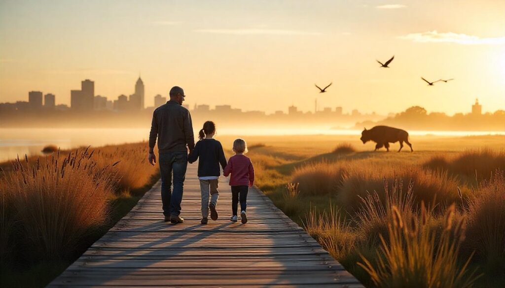
The Apex Park – Rocky Mountain Arsenal Loop combines suburban charm with wildlife-rich grasslands and wetlands just 10 miles from downtown Denver. Beginning at Apex Park’s red-rock cliffs, the trail descends into the Arsenal’s refuge habitat, where thousands of migratory birds, bison, and prairie dogs inhabit restored wetlands. Boardwalks cross marshes alive with herons and sandhill cranes, while prairie grasses sway under the Front Range breeze. Interpretive kiosks detail the area’s transformation from 1940s munitions plant to national wildlife refuge. This hiking route offers both accessible terrain and memorable wildlife encounters.
Distance | Elevation Gain | Difficulty | Permit
- Distance: 8 miles loop
- Elevation Gain: 300 ft
- Difficulty: Easy
- Permit: Free; timed entry reservation required at Arsenal
Best Time to Visit
March–May & September–November: Bird migrations peak; fall grasses turn amber and prairies glow.
Personal Tips & Safety Precautions
- Entry Reservation: Book timed slots online to access the refuge area.
- Binoculars: Essential for spotting bison and raptors without disturbing them.
- Sun & Heat: Minimal shade—carry 3 L water and sunblock on summer hikes.
- Respect Wildlife: Stay on designated trails—wild animals have right of way; do not feed.
10. Eldorado Canyon – Matthews/Winters Loop
Introduction
The Eldorado Canyon – Matthews/Winters Loop threads through one of Colorado’s premier rock-climbing meccas, offering hikers a thrilling backdrop of sheer sandstone cliffs towering 1,000 ft overhead. Beginning at the Eldorado Canyon State Park main trailhead, you follow the Fowler Trail along South Boulder Creek, shaded by waterfall-draped walls and cottonwood groves. At Matthews/Winters Saddle, expansive views open onto the foothills and Denver skyline in the distance, reminding you how hiking in Denver blends urban convenience with wild beauty. On the descent via the Winters Trail, you pass historic stone cabins and vibrant aspens in fall, before looping back through the canyon’s riparian corridor alive with songbirds. This route’s mix of geology, history, and creekside serenity makes it one of the best hike near Denver for a full-day adventure.
Distance | Elevation Gain | Difficulty | Permit
- Distance: 8 miles loop
- Elevation Gain: 1,600 ft
- Difficulty: Moderate–Strenuous
- Permit: $7 day-use fee
Best Time to Visit
April–October: Spring runoff enhances creek cascades; winter ice can make trails slippery.
Personal Tips & Safety Precautions
- Cliff Awareness: Stay clear of climbing anchors and belay zones to avoid falling gear.
- Stream Crossings: Use trekking poles for balance—boulder hopping can be slick after rain.
- Wildflowers & Insects: Summer brings thistle blooms and bees—carry bite relief just in case.
- Historic Sites: Respect restored cabins and do not enter locked structures.
11. Waterton Canyon to High Line Canal
Introduction
Starting at the northern edge of Littleton, the Waterton Canyon to High Line Canal trail follows the South Platte River’s historic railroad grade before transitioning onto Denver’s canal system. Early miles traverse dramatic red sandstone canyons and reclaimed mine sites, now home to mule deer and golden eagles. As you reach the High Line Canal, the landscape softens into tree-lined towpaths and suburban greenbelts, illustrating the region’s evolution from wild canyon to urban oasis. Cyclists, joggers, and equestrians share the wide crushed-gravel path, making this a true hiking trails near Denver multi-use corridor. Birdwatchers flock here for quail and heron sightings, and anglers appreciate easy river access. The trail’s seamless link between wilderness and city life earns it a spot among the best hikes of Denver for varied scenery and minimal traffic.
Distance | Elevation Gain | Difficulty | Permit
- Distance: 12 miles one-way (shuttle recommended)
- Elevation Gain: ~200 ft
- Difficulty: Easy
- Permit: None; parking fees apply at Waterton Canyon
Best Time to Visit
March–November: Low winter water levels ease crossings; spring brings riparian wildflowers.
Personal Tips & Safety Precautions
- Shuttle Plan: Arrange pick-up at High Line Canal trailhead to avoid a 12-mile return.
- Wildlife Respect: Moose occasionally browse along riverbanks—keep distance and quiet.
- Path Etiquette: Yield to horses and cyclists; announce yourself when passing.
- Water Safety: The South Platte current can be strong—avoid water entry near drop-offs.
12. Lair o’ the Bear – Bear Creek Loop
Introduction
Deep in Morrison’s foothills, the Lair o’ the Bear – Bear Creek Loop indulges hikers in a riparian retreat where towering cottonwoods shade the creek and mossy rock overhangs conceal small waterfalls. The trailhead at Bear Creek Lake Park connects to the historic Lair o’ the Bear picnic area—once famed for its eucalyptus grove and dance pavilion. Hikers follow the creek upstream, encountering fern-covered chutes and vivid creek pools before looping back through grassy meadows and Ponderosa stands. Seasonal wildflower displays, including columbine and monkeyflower, brighten spring visits. The moderate grade and creekside rest spots make this one of the easy hikes in Denver Colorado that feels remote despite its proximity to town.
Distance | Elevation Gain | Difficulty | Permit
- Distance: 5 miles loop
- Elevation Gain: 500 ft
- Difficulty: Easy–Moderate
- Permit: $10 day-use fee for park entry
Best Time to Visit
May–September: Spring sees peak creek flow and bloom; summer provides cooling shade.
Personal Tips & Safety Precautions
- Bug Protection: Mosquitoes thrive near water—carry repellent and wear long sleeves in early season.
- Slip Hazards: Rock slabs near waterfalls can be slick—wear shoes with good traction.
- Picnic Prep: Bring a blanket—several creekside meadows make perfect lunch spots.
- Leave No Trace: Pack out all trash—picnic areas attract raccoons and bears at dawn and dusk.
13. Evergreen Lake Trail
Introduction
Nestled in the mountain town of Evergreen, the Evergreen Lake Trail circles a serene reservoir framed by lodgepole pine and Douglas-fir, all under the watch of Echo Mountain’s slopes. This 4.4-mile paved loop offers a seamless blend of lakeshore strolling and forest immersion, making it a top place to hike for families and casual walkers. Rental kayaks and paddleboards dot the lake in summer, while in winter the frozen surface becomes a skating rink. Seasonal interpretive panels along the path explain the area’s logging and reservoir history, adding context to the scenic outing. Sweeping mountain views and abundant birdlife—ospreys, herons, and bald eagles—elevate this simple circuit into one of the best day hikes in Denver, Colorado.
Distance | Elevation Gain | Difficulty | Permit
- Distance: 4.4 miles loop
- Elevation Gain: Minimal (<200 ft)
- Difficulty: Easy
- Permit: Free; metered parking at Evergreen Lake Park
Best Time to Visit
Year-Round: Summer water activities; fall foliage; winter skating if frozen; spring wildflowers.
Personal Tips & Safety Precautions
- Dog-Friendly: Leashed pets welcome—carry water bowl and waste bags to keep path clean.
- Paved Path: Great for strollers and wheelchairs, but adjust pace on busier weekends.
- Fishing License: Anglers need a Colorado fishing license; catch-and-release only.
- Sunset Views: West side benches give perfect reflections of pink sunset on the lake.
14. Mount Bierstadt (Colorado 14er)
Introduction
A mere 60 miles from Denver, the Mount Bierstadt summit is the most accessible of Colorado’s fourteeners, offering novice climbers a taste of summiting the Grand Teton–style achievement. The trail winds through forested switchbacks before opening onto high-alpine tundra and scree fields. Wildflower meadows—featuring glacier lilies and sky pilot—bloom profusely along the middle slopes in July. Above treeline, the trail narrows to loose rock and coal-black boot paths etched into the mountain’s spine. Summit day greets adventurers with 360° views of the Continental Divide, including neighboring peaks like Grays and Torreys. While popular, proper acclimatization and early starts mitigate altitude sickness and afternoon storms, making Bierstadt a bucket-list mountain hike near Denver.
Distance | Elevation Gain | Difficulty | Permit
- Distance: 7 miles round-trip
- Elevation Gain: 2,850 ft
- Difficulty: Strenuous
- Permit: None; self-issue trailhead permit
Best Time to Visit
July–August: Snow-free ridges and peak wildflower bloom; thunderstorms after noon are common.
High Altitude Tips & Safety Precautions
- Acclimatize: Spend a night at 10,000 ft (e.g., Guanella Pass) before summiting.
- Early Start: Begin before 4 AM to finish descent before afternoon lightning warnings.
- Gear: Carry crampons if early-season snow lingers; trekking poles aid scree navigation.
- Buddy System: Summit parties of two or more ensure safety on exposed ridges.
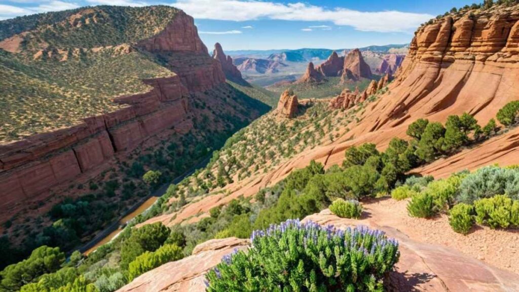
15. Roxborough State Park – Fountain Valley Trail
Introduction
The Fountain Valley Trail in Roxborough State Park unveils a dramatic corridor of red sandstone fins and rolling prairie grasslands just 25 miles south of Denver. Hikers traverse a 6.7-mile loop through riparian groves, across sundrenched meadows, and along the base of towering Dakota Sandstone formations carved over 300 million years. Interpretive signs explain ancient ecosystems, while panoramic overlooks furnish prime viewing for bighorn sheep and hawks. Seasonal wildflowers—penstemon, sunflowers, and Indian paintbrush—create vibrant swaths against the red rock. This best view of Rocky Mountains in Denver–adjacent trail offers both educational exhibits and pure scenic immersion, making it a cornerstone Denver Colorado hiking spot.
Distance | Elevation Gain | Difficulty | Permit
- Distance: 6.7 miles loop
- Elevation Gain: 600 ft
- Difficulty: Moderate
- Permit: $10 day-use fee
Best Time to Visit
April–May & September–October: Spring blooms and fall gold highlight sandstone contrasts; summer heat can be intense.
Personal Tips & Safety Precautions
- Stay Hydrated: Park has no water refill stations—carry 2–3 L per person.
- Trail Etiquette: Stay on trails to protect fragile desert soils and cryptobiotic crust.
- Sun & Wind: Wide-brim hat and windproof layer recommended on exposed fins.
- Wildlife Watch: Dawn and dusk are best for observing bighorn sheep along canyon edges.
Quick Comparison of Best Hikes Near Denver
| Trail Name | Distance | Elevation Gain | Difficulty Level | Best Season | Dog-Friendly |
|---|---|---|---|---|---|
| Red Rocks Trading Post Loop | 1.4 mi | 300 ft | ⭐ Easy | March–November | Yes |
| Mount Sanitas Trail | 3.2 mi | 1,323 ft | ⭐⭐⭐ Hard | March–November | Yes |
| St. Mary’s Glacier & Lower Lake Loop | 2.4 mi | 400 ft | ⭐⭐ Moderate | April–October | Yes |
| Staunton State Park – Elk Meadow to Pine Loop | 8.3 mi | 1,500 ft | ⭐⭐ Moderate | May–October | Yes |
| Chautauqua Trail to Royal Arch | 3.2 mi | 1,417 ft | ⭐⭐ Moderate | March–October | Yes |
| North Table Mountain Rim Trail | 7.7 mi | 1,000 ft | ⭐⭐ Moderate | January–November | Yes |
| South Table Mountain Loop | 4.0 mi | 600 ft | ⭐ Easy | All Year | Yes |
| Mount Falcon West Ridge via Castle Trail | 2.3 mi | 400 ft | ⭐ Easy | March–October | Yes |
| Apex Park – Rocky Mountain Arsenal Loop | 15.9 mi | 200 ft | ⭐ Easy | All Year | No |
| Eldorado Canyon – Matthews/Winters Loop | 3.5 mi | 800 ft | ⭐⭐ Moderate | All Year | Yes |
| Waterton Canyon to High Line Canal | 6.2 mi | 700 ft | ⭐ Easy | All Year | No |
| Lair o’ the Bear – Bear Creek Loop | 1.6 mi | 200 ft | ⭐ Easy | All Year | Yes |
| Evergreen Lake Trail | 1.4 mi | 100 ft | ⭐ Easy | All Year | Yes |
| Mount Bierstadt (Colorado 14er) | 7.2 mi | 2,736 ft | ⭐⭐⭐ Hard | June–October | Yes |
| Roxborough State Park – Fountain Valley Trail | 2.3 mi | 336 ft | ⭐ Easy | All Year | No |
Best Denver Trails by Category

Best Waterfall Hikes Close to Denver
For waterfall hikes close to Denver, Franklin Falls and Staunton State Park’s Elk Falls offer dramatic cascades within easy reach. Franklin Falls (2 miles round-trip) delivers thunderous flow in spring and a family-friendly boardwalk, while Elk Falls (5 miles loop) winds through aspen groves to a moss-clad drop framed by towering cliffs. Both routes reward with mist-cooled air and photogenic pools, making them ideal day hikes near Denver Colorado for waterfall chasers. Pack grippy shoes and a waterproof layer—spray zones get surprisingly wet even on sunny days.
Best Mountain Hikes Near Denver
If you crave mountain hikes , the twin Flatirons via Chautauqua Trail and Mount Sanitas deliver steeper ascents and urban panoramas. The Chautauqua to Royal Arch route (3.5 miles) snakes beneath dramatic sandstone slabs, while Mount Sanitas (3.3 miles) challenges you with a 1,300-ft climb and rocky scrambling near the summit. Both trails offer unbeatable views of the Denver skyline backed by the Rockies. Start early to beat weekend crowds and afternoon thunderstorms common above 6,000 ft.
Best Day Hikes in Denver, Colorado
For best day hikes in Denver, Colorado, the Red Rocks Trading Post Loop and Evergreen Lake Trail provide distinct experiences. Red Rocks (6 miles) immerses you in the amphitheater’s blood-red fins and city views, while Evergreen Lake (4.4 miles) circles a tranquil reservoir with picnic spots and year-round recreation. These loops suit hikers of all levels—bring plenty of water, sunscreen, and a camera to capture Denver’s geological diversity within an hour’s drive of downtown.
Best Easy Hikes in Denver, Colorado
When you need a gentle escape, easy hikes in Denver like the Apex Park–Rocky Mountain Arsenal Loop and String Lake Loop shine. Apex Park (8 miles loop) blends red-rock overlooks with restored wetlands teeming with birds, while String Lake Loop (3.7 miles) skirts a high-alpine lake beneath the Tetons—both under 10 miles and with minimal gain. These trails prove that you don’t have to climb mountains for fresh air and natural beauty; pack a snack and enjoy a relaxed pace.
Best Backpacking Near Denver
For multi-day backpacking near Denver, the Mt. Bierstadt summit and Death Canyon–Alaska Basin Loop deliver true wilderness. Bierstadt (7 miles, 2,850-ft gain) can be done as a car-camp overnighter near Guanella Pass, while the Death Canyon loop (30+ miles) traverses alpine lakes, wildflower meadows, and high-ridgeline passes above 10,000 ft. Both require permits, bear canisters, and careful weather monitoring—but reward with solitude, starry nights, and an unmatched sense of adventure just a short drive from the Mile-High City.
Essential Gear & Preparation for Denver Hiking
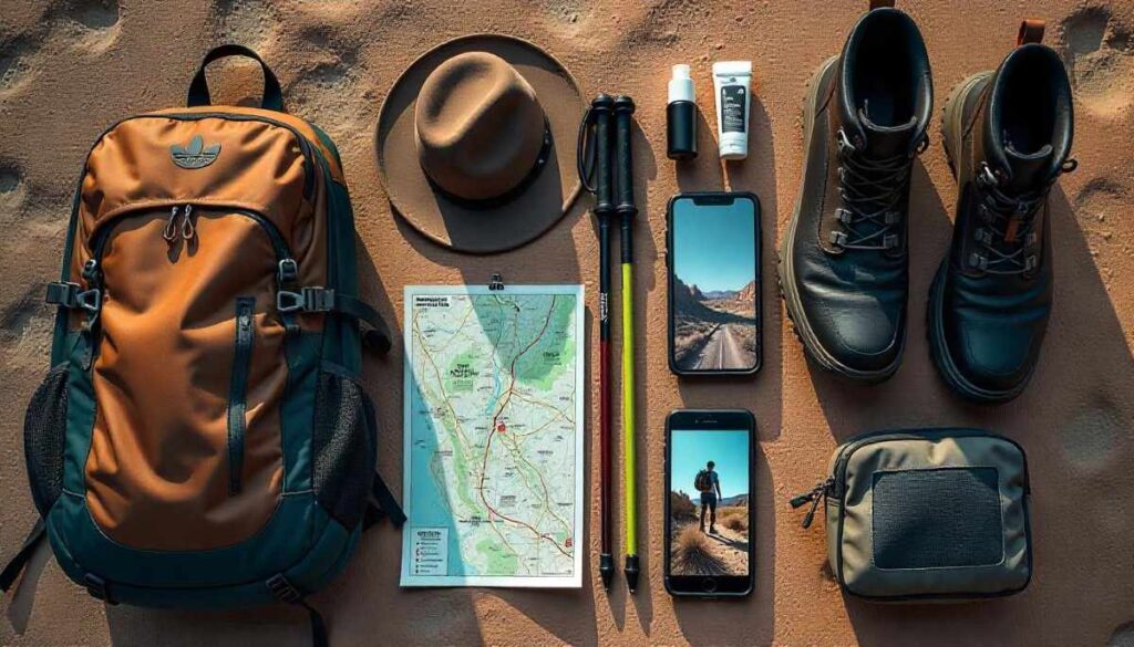
Footwear & Apparel for Rocky Mountain Hikes
- Sturdy, Ankle-Support Boots: Choose waterproof boots with aggressive tread for rocky scrambles on trails like Mount Sanitas and Red Rocks Trading Post Loop—they protect against roll-overs and keep feet dry during creek crossings.
- Moisture-Wicking Layers: Denver’s swift elevation changes demand a base layer that pulls sweat away, a mid-layer for warmth on ridges, and a breathable shell to block afternoon thunderstorms common above 8,000 ft.
- Convertible Hiking Pants: Zip-off legs let you adapt from shaded pine forests to sun-baked grasslands on North Table Mountain Rim Trail without carrying extra garments.
- Wide-Brim Hat & Sunglasses: UV intensity increases with elevation—protect your face and eyes when gazing at distant peaks on Eldorado Canyon or the Flatirons.
Hydration, Nutrition & Altitude Acclimatization
- Dual-Reservoir Hydration Pack: Carry 2 L up front for easy sipping on steep ascents, plus a back bladder for backup. On day hikes, you’ll burn through water faster above tree line.
- Electrolyte-Rich Snacks: Pack nuts, jerky, and salted trail mix to replace sodium lost during high-altitude climbs—especially on backpacking routes.
- Altitude Acclimatization Plan: Spend your first day on lower-elevation loops like Apex Park before tackling 14ers like Mount Bierstadt to reduce head-ache risk.
- Portable Water Filter: Enable refill from mountain streams on longer treks—filters cut pack weight and keep you hydrated on multi-day backpacking in Denver trips.
Where to Stay While Hiking in Denver
- Downtown Denver Hotels: Ideal for quick access to hiking trails near Denver and a vibrant evening scene—look for those offering early breakfast and shuttle services to trailheads.
- Boulder or Golden Lodges: Base yourself near key trailheads like Chautauqua and North Table Mountain, cutting drive time for sunrise starts.
- Trailhead Campgrounds: Spots at Staunton State Park and Bear Creek Lake Park let you roll out of your tent directly onto the trail, minimizing transit and maximizing morning light.
- Vacation Rentals in Foothills: Mountain cabins in Morrison or Evergreen provide cozy retreats after hiking in Denver, with easy access to Red Rocks and Evergreen Lake Trail.
Seasonal Hiking in Denver

Spring Hikes in Denver
Spring unleashes waterfalls on Staunton State Park and Winter Conejos Canyon; meadows along South Table Mountain fill with lupine and columbine. Temperatures range from 40–60 °F, so layer for chilly mornings and wet trail patches. Early-season storms can linger—check forecasts and pack a waterproof shell.
Summer Hikes in Denver
Summer hiking delivers long, sunny days perfect for ascending Mount Sanitas or exploring the Roxborough Fountain Valley Trail. Start before 7 AM to beat the heat and afternoon thunderstorms that sweep over the Rockies around 2–4 PM. Carry 3 L of water and lean into shaded riparian trails like Lair o’ the Bear for midday respite.
Fall Hikes in Denver
Fall’s crisp air and golden aspens transform Chautauqua to Royal Arch and Eldorado Canyon into postcard scenes. Daytime highs of 50–70 °F make for comfortable climbs, while clear skies offer unbeatable views of the Continental Divide. Pack an extra mid-layer—the temperature can drop 20 °F from noon to sunset.
Winter Hikes in Denver
Winter hiking—on trails like Apex Park and Bear Creek Loop—calls for microspikes or snowshoes, as 5,000–7,000 ft elevations often see 3–10 in of snow. Trails are quieter, offering serene snowscapes. Dress in moisture-wicking layers, carry extra warm gloves, and be mindful of early trail closures due to snowpack and ice.
Final Thoughts on Best Hikes Near Denver
Denver’s backyard truly offers something for everyone—from urban oases to rugged alpine summits, these best hikes near Denver showcase the Mile-High City’s stunning proximity to wild places. If you’re craving dramatic redstone scenery, the Red Rocks Trading Post Loop delivers world-class amphitheaters without a long drive. For steep, lung-burning climbs, Mount Sanitas and the Chautauqua to Royal Arch route reward you with skyline-to-spires panoramas that remind you why hiking in Denver has become a lifestyle.
Families and casual walkers will find solace in gentle loops like Evergreen Lake Trail and the Apex Park–Rocky Mountain Arsenal Loop, where wildlife—including bison and bald eagles—shares the path. These easy hikes in Denver Colorado prove that you don’t need heavy packs or alpine experience to enjoy fresh air and scenic diversity. Waterfall chasers can plan spring outings to Franklin Falls or creekside adventures in Staunton State Park, while best spring hikes in Denver reward with wildflower blooms and rushing cascades.
For multi-day adventures, the nearby Mount Bierstadt fourteener and backcountry circuits in the South Table Mountain Loop or Death Canyon–style excursions invite seasoned hikers to test their mettle at altitude, offering starry nights and sunrise alpenglow. Proper preparation—layered apparel, hydration systems, altitude acclimatization, and bear spray—is essential when you venture into higher elevations or shoulder seasons.
Seasonality transforms each trail:
- Summer extends daylight for high-alpine loops like Roxborough Fountain Valley Trail and North Table Mountain Rim Trail,
- Fall cloaks aspen groves in gold on Chautauqua and Eldorado Canyon,
- Winter offers serene snowshoe routes on Bear Creek Lake Park and Apex Park, and
- Spring welcomes thawed streams and wildflowers on String Lake Loop and South Table Mountain.
Ultimately, Denver’s hiking scene is about balance—urban convenience meets mountain escape. Whether you lace up for a sunrise scramble or a leisurely lakeside stroll, these trails connect you to the region’s geological wonders, native plants, and abundant wildlife. Bookmark this guide, tailor your day-trip or overnight pack list, and explore responsibly using Leave No Trace principles. Denver hiking is waiting just beyond the skyline—ready to challenge your body, clear your mind, and deepen your appreciation for Colorado’s unparalleled outdoor heritage.
Ethan Marlowe is an experienced hiker and outdoor gear specialist based in Colorado. With over 7 years of hands-on experience trekking through the Rockies, Pacific Northwest, and East Coast trails, he delivers practical advice, expert gear reviews, and survival insights. His goal is to help hikers of all levels make smarter decisions on and off the trail.