Introduction to Seattle Hiking
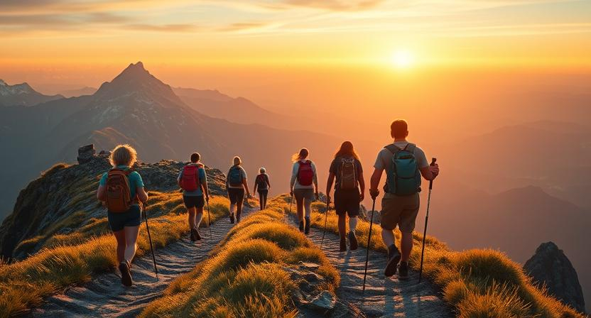
Why Best Hikes Near Seattle Are Legendary
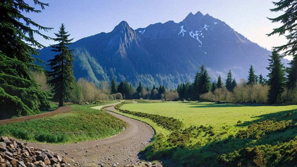
Seattle’s backyard is legendary because dramatic peaks and lush forests rise within an hour of downtown. From the jagged ridges of the Cascades to moss-draped lowland trails, the region delivers a diversity you’d expect half a continent away. Local hikers praise routes like Rattlesnake Ledge for its panoramic lake view, while others swear by hidden waterfall descents on Franklin Falls. This variety keeps both newcomers and seasoned trekkers coming back—every outing feels like a new adventure amid the city’s trademark evergreen canopy.
Seattle Mountains & Elevation in Seattle, Washington
Seattle sits at sea level, backed by mountain giants that top out around 5,000–7,000 ft within easy driving distance. The nearby Cascades include peaks such as Mount Si (3,150 ft) and Tiger Mountain (3,004 ft), offering steep gains and alpine vistas. These elevation changes create quick microclimate swings: one trailhead can feel temperate and misty, while three miles up you’re above the clouds with snapping winds. Familiarizing yourself with trailhead elevation and total gain is key to choosing a hike that matches your fitness and goals.
Seattle Weather & Seasonal Considerations for Hikers
Seattle’s reputation for rain belies a true four-season climate. Winters bring cool, wet days—pack waterproof layers and microspikes for icy patches on exposed ridgelines. Spring showers give way to lush wildflower displays by May, making mid-week outings ideal for solitude. Summer boasts long, sunny days with minimal mosquito activity; it’s prime time for alpine lake dips on Lake 22 Trail or sunrise summits at Mount Si. Fall delivers crisp air and stunning larch color on north-facing slopes. Always check the National Weather Service forecast and trail reports on Washington Trails Association before heading out.
How to Choose the Perfect Seattle Hike: Distance, Difficulty & Terrain
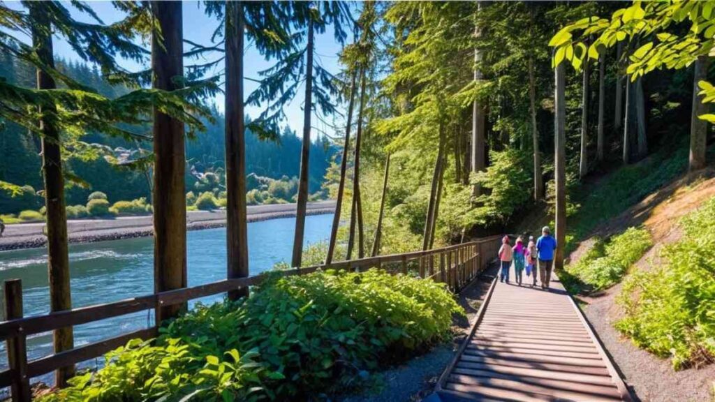
Selecting the right trail near Seattle means balancing distance, elevation gain, and underfoot conditions. If you’re seeking a quick urban escape, Discovery Park’s 2.8-mile loop offers sea-level walking trails and saltwater views. Craving a workout? Rattlesnake Ledge’s 4 mile round-trip and 1,160 ft gain delivers both burn and reward. For waterfall chasers, Franklin Falls (2 mi, 450 ft gain) combines ease with scenic payoff. Consider trail surface—slickrock, gravel, or muddy forest floor—to match your footwear and skill. And factor in trailhead access: popular routes like Snoqualmie Falls fill fast, so aim for early starts or use shuttle services.
Top 15 Best Hikes Near Seattle You Must Try
1. Rattlesnake Ledge
Introduction
Perched above Rattlesnake Lake, Rattlesnake Ledge rewards every step with a jaw-dropping panorama of the reservoir and Cascade foothills. The trail begins in dense second-growth forest, where ferns and cedars cloak a gentle ascent until rocky outcrops appear. As you climb, the canopy breaks to reveal glimpses of Mount Si framed between tree trunks. At the ledge, benches carved by generations of hikers invite you to rest and soak in views of deep blue water below. This hike’s popularity stems from its balance of challenge and reward—ideal for both day hikes near Seattle veterans and first-timers seeking a taste of alpine scenery.
Despite crowds on weekends, early mornings bring solitude and soft light perfect for photography. Local shuttle options from North Bend help avoid parking battles, making it one of the best hikes near Seattle for accessibility and scenery.
Distance | Elevation Gain | Difficulty | Permit
- Distance: 4 miles round-trip
- Elevation Gain: 1,160 ft
- Difficulty: Moderate
- Permit: None (NW Forest Pass for parking)
Best Time to Visit
Spring–Fall (April–October): Wildflowers in spring and clear skies in fall make the ledge views even more spectacular.
Personal Tips & Safety Precautions
- Early Start: Arrive before 8 AM on weekends to secure a parking spot and enjoy cooler temperatures.
- Footwear: Sturdy trail runners with ankle support help on slick granite slabs near the ledge.
- Hydration: Carry at least 2 L of water; the exposed viewpoint offers no shade.
- Shuttle Info: Use the King County Metro shuttle from North Bend for guaranteed parking.
2. Snoqualmie Falls Trail
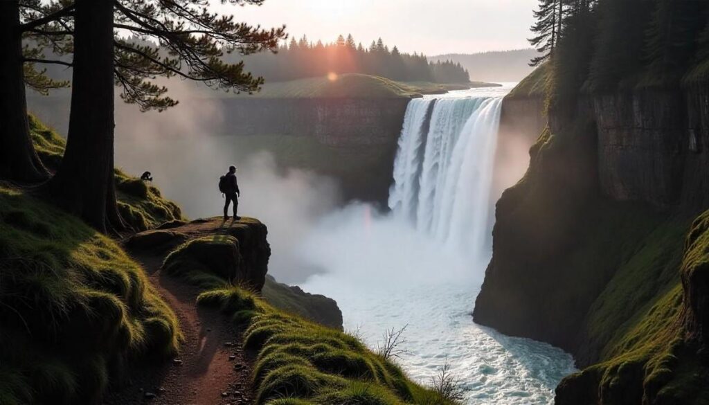
Introduction
The Snoqualmie Falls Trail is less a hidden gem and more a Pacific Northwest icon—its thunderous 268-ft waterfall draws photographers, families, and pilgrims of mist alike. The paved outlook gives sweeping views, while a steeper, rugged spur trail descends to the river’s edge, offering a front-row seat to the churning waters below. Interpretive panels along the way narrate hydroelectric history and local Salish legend, adding cultural depth to the natural spectacle.
Despite its urban proximity, the trail’s lower section feels remote, with towering firs and hidden alcoves. A handful of picnic spots overlook the falls, making it a perfect family friendly hike near Seattle that doubles as an educational outing. Well-marked signs guide you between viewpoints, and limited fee-based parking ensures regular turnover.
Distance | Elevation Gain | Difficulty | Permit
- Distance: 1.7 miles round-trip (down-and-back)
- Elevation Gain: 300 ft
- Difficulty: Easy–Moderate
- Permit: $5 day parking fee
Best Time to Visit
Winter–Spring (November–May): Peak flow from rain and snowmelt makes the falls thunderous; summer flow less dramatic.
Personal Tips & Safety Precautions
- Secure Parking: Arrive midweek or use the Wildwood Park lot for overflow parking.
- Trail Shoes: Wear shoes with good tread for slippery rock near the lower plunge pool.
- Layer Up: Mist from the falls can soak you—bring a light waterproof layer.
- Stay Behind Barriers: Strong currents and undercut banks make river access dangerous.
3. Twin Falls Loop
Introduction
Hidden in Snoqualmie River’s green canyon, Twin Falls Loop offers a lush, moderate trek punctuated by two powerful cascades visible from well-placed viewpoints. Moss-draped cedars arch over the trail, creating a fern-lined corridor that feels a world away from city life. A sturdy boardwalk spans the first drop, while a short scramble reveals the second, more secluded fall. Spring’s high water brings thunderous roars, while late summer’s gentle flow invites wading at the first overlook. Interpretive signs detail the river’s salmon runs and logging history, adding context to this best waterfall hike in Seattle Washington. Despite its ease, the loop challenges hikers with short, steep sections that keep the heart pumping.
Distance | Elevation Gain | Difficulty | Permit
- Distance: 3.6 miles loop
- Elevation Gain: 500 ft
- Difficulty: Moderate
- Permit: Northwest Forest Pass for parking
Best Time to Visit
April–June: Peak waterfall flow and lush spring foliage make this loop exceptionally scenic.
Personal Tips & Safety Precautions
- Boardwalk Caution: Wear grippy shoes; boards can become slick with moss in damp weather.
- River Safety: Do not cross river currents—stick to designated viewing platforms.
- Bug Repellent: Spring and summer bring mosquitoes in shady river sections.
- Parking Tip: Park early or carpool; the lot fills quickly on sunny weekends.
4. Discovery Park Loop
Introduction
Nestled in Magnolia, Discovery Park Loop is Seattle’s largest green space, blending forest, meadow, and bluff to create a microcosm of Pacific Northwest ecosystems. Towering Douglas firs and western redcedars shade the first leg, while open meadows burst with wildflowers in May and June. The trail then curves toward the bluff, offering panoramic views of Puget Sound, the Olympic Mountains, and downtown skyscrapers on clear days. Abandoned military bunkers and interpretive signs hint at the park’s Cold War past, adding historical intrigue.
Beach access allows tide pooling and birdwatching, making this loop a top urban hike Seattle option for families and solo explorers. Benches overlook the sound, perfect for a picnic with a view of passing ferries.
Distance | Elevation Gain | Difficulty | Permit
- Distance: 2.8 miles loop
- Elevation Gain: 200 ft
- Difficulty: Easy
- Permit: Free; paid parking at lot
Best Time to Visit
April–October: Wildflowers, bird migrations, and long daylight hours maximize this loop’s appeal.
Personal Tips & Safety Precautions
- Dog Friendly: Leashed dogs welcome; bring waste bags to keep trails clean.
- Tide Awareness: Check tide tables before exploring the beach—some sections close at high tide.
- Sunset Spot: The west bluff is ideal for sunset views of the Olympic silhouette.
- Restrooms & Water: Facilities are only near the lot—carry extra water for the full loop.
5. Lake 22 Trail
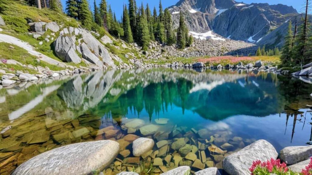
Introduction
Carved by glacial ice, Lake 22 shimmers emerald beneath a dramatic cirque of granite ridges. The trail ascends through verdant old-growth forest, crossing bubbling creeks and mossy log bridges. Midway, a moss-covered rock slide challenges your footing before the final switchbacks reveal the lake’s jewel-like waters. In summer, the amphitheater walls echo with the calls of mountain chickadees, and trace snowfields cling to shaded ledges. Wildflowers carpet the meadow below the outlet in July, painting lupine, paintbrush, and avalanche lilies in vibrant contrast. This is one of the best hiking trails in Seattle for its blend of old-growth grandeur and alpine payoff without requiring technical gear.
Distance | Elevation Gain | Difficulty | Permit
- Distance: 5.4 miles round-trip
- Elevation Gain: 1,150 ft
- Difficulty: Moderate
- Permit: Northwest Forest Pass
Best Time to Visit
July–September: Snow-free approaches and peak wildflower displays make the hike most rewarding.
Personal Tips & Safety Precautions
- Footbridge Use: Hike poles help maintain balance on narrow log crossings during spring runoff.
- Layering: Mornings near the lake can be chilly—bring a lightweight jacket.
- Shade & Bugs: Carry bug spray for creek crossings where mosquitoes gather.
- Parking Pass: Display your forest pass prominently to avoid fines.
6. Tiger Mountain
Introduction
Tiger Mountain’s network of trails sits just 30 minutes from downtown Seattle, offering a true Canyonlands best hikes–style challenge in the Cascades’ foothills. From the West Tiger #3 trailhead, you ascend through dense fir and cedar groves, crossing seasonal streams and mossy rock outcrops. Midway, the forest opens to stunted alpine meadows where views of Mount Rainier and the Seattle skyline emerge on clear days. Wildlife—black-tailed deer and varied songbirds—abounds, rewarding diligent hikers. Rock outcroppings near the summit create natural benches perfect for a snack break while you scan the horizon. Well-built ladders and log steps ease the steep sections, making Tiger Mountain a top best hikes near Seattle for both fitness-seekers and nature lovers.
Distance | Elevation Gain | Difficulty | Permit
- Distance: 4.5 miles round-trip
- Elevation Gain: 2,000 ft
- Difficulty: Strenuous (steep grade)
- Permit: Northwest Forest Pass ($5/day or $30 annual)
Best Time to Visit
June–October: Snow-free trails, wildflowers in meadows, and stable weather make for ideal summit attempts.
Personal Tips & Safety Precautions
- Trail Choice: West Tiger #3 is the steepest; opt for East Tiger #3 for a more gradual climb.
- Footing: Wear boots with firm ankle support—roots and rocks abound.
- Hydration: Carry at least 2.5 L water; no reliable water sources on the ridge.
- Navigation: Trail junctions are well-marked—follow signs to avoid wrong turns.
7. Franklin Falls

Introduction
Tucked off I-90, Franklin Falls is famous for its thunderous cascade and family-friendly accessibility. The trail threads through a verdant canyon, where cedar and alder shade the path and wildflowers line the streambanks in spring. At the falls’ base, mist-cooled air invites lingering by the plunge pool. Interpretive signs highlight the falls’ hydrology and salmon spawning habitat downstream. In winter and early spring, ice formations sculpt the rocks into surreal shapes. Despite its proximity to the freeway, the route feels remote—only a short scramble at the end separates you from the roar of falling water. It’s a quintessential easy hikes near Seattle and one of the best waterfall hikes near Seattle Washington.
Distance | Elevation Gain | Difficulty | Permit
- Distance: 2 miles round-trip
- Elevation Gain: 400 ft
- Difficulty: Easy–Moderate
- Permit: Northwest Forest Pass ($5/day or $30 annual)
Best Time to Visit
March–May: Snowmelt swells the falls, making for dramatic cascades and lush canyon greenery.
Personal Tips & Safety Precautions
- Ice Caution: In winter, carry microspikes for the final approach to avoid slipping.
- Stream Crossing: Use provided logs or stones; currents can be deceptively strong.
- Crowd Timing: Weekday mornings are quietest—weekends can be busy.
- Leave No Trace: Pack out tissues and garbage to protect salmon habitat.
8. Mount Si
Introduction
Mount Si is Seattle’s classic summit challenge, revered by hikers and runners alike for its relentless switchbacks and iconic vista. Rising over 3,100 ft in just 4 miles, the trail surges through second-growth forest before emerging onto exposed granite slabs near the summit. From the pegmatite crest, you look down on the Snoqualmie Valley and across to the Cascades’ jagged peaks. The route’s popularity stems from its accessibility—just 45 minutes from downtown—and the reliable reward at the top. Early mornings often offer a sea-of-clouds inversion beneath you, while sunset trips return through the quiet, shadowed forest. This is undeniably one of the top hikes near Seattle for training and epic photo ops.
Distance | Elevation Gain | Difficulty | Permit
- Distance: 8 miles round-trip
- Elevation Gain: 3,150 ft
- Difficulty: Hard (steep and sustained)
- Permit: Northwest Forest Pass ($5/day or $30 annual)
Best Time to Visit
May–September: Snow melts by late spring; fall offers clear skies and cool trail conditions.
Personal Tips & Safety Precautions
- Altitude Prep: Hike in two halves—tackle Devil’s Staircase section first, then pace to the summit.
- Sunrise Summit: Begin before 4 AM for panoramic dawn views; headlamp essential.
- Foot Care: Climbs are repetitive—wear moisture-wicking socks to prevent blisters.
- Parking Alert: Limited lot—carpool or arrive before 6 AM on weekends.
9. Little Si
Introduction
Just a stone’s throw from its big sibling, Little Si offers a compact but rewarding climb that delivers valley and ridge views in under two hours. The forested path winds through towering hemlock groves before a final rocky scramble reveals vistas of Mount Si and the Cascade crest. Bouldering enthusiasts frequent the summit base, turning the trail’s end into a mini outdoor gym.
The scramble is manageable for most, making it a popular 3 mile hikes near Seattle choice for families and day-trippers. Wild raspberry bushes and spring trilliums dot the lower sections, offering seasonal color. Its proximity to North Bend means you can finish your hike with a quick espresso at a local café—a true fun hikes near Seattle experience.
Distance | Elevation Gain | Difficulty | Permit
- Distance: 4 miles round-trip
- Elevation Gain: 1,000 ft
- Difficulty: Moderate (rock scramble)
- Permit: Northwest Forest Pass ($5/day or $30 annual)
Best Time to Visit
April–October: Spring blossoms and summer larch patches make for colorful hikes; fall clears the crowds.
Personal Tips & Safety Precautions
- Scramble Care: Wear shoes with sticky rubber soles for the final rock scramble.
- Wildlife Watch: Watch for rattlesnakes basking on boulders in warmer months.
- Trail Mix: Pack extra snacks—the summit bench is perfect for a picnic.
- Post-Hike Treat: Stop at North Bend’s Snoqualmie Brewery for a craft brew.
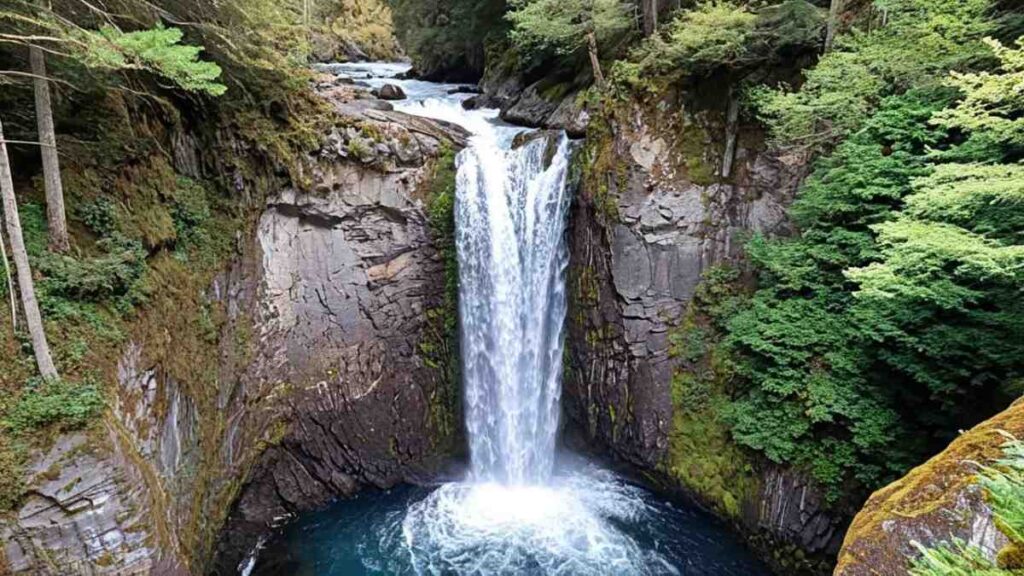
10. Wallace Falls Trail
Introduction
Wallace Falls cascades in tiers over 650 ft, making it one of the Northwest’s most dramatic best waterfall hikes near Seattle Washington. The trail climbs steadily through old-growth forest, passing a meandering creek before revealing the Lower Falls in a mossy amphitheater. Further up, a series of viewpoints track the waterfall’s multiple drops, culminating at Upper Wallace Falls, where you stand on a suspended bridge high above the roar. Seasonal wildflowers punctuate each stage, and the canyon walls funnel cool breeze toward hikers. The well-maintained path combines boardwalks and staircases, ensuring safe access year-round. Wallace Falls is a cornerstone Seattle day hikes destination for its immersive waterfall sequence and reliable trail quality.
Distance | Elevation Gain | Difficulty | Permit
- Distance: 5.6 miles round-trip
- Elevation Gain: 1,500 ft
- Difficulty: Moderate–Strenuous
- Permit: Northwest Forest Pass ($5/day or $30 annual)
Best Time to Visit
April–June & September–October: Peak flow in spring; crisp fall air and foliage at canyon rim.
Personal Tips & Safety Precautions
- Boardwalk Etiquette: Step aside for uphill hikers; boards can get slick in rain.
- Layering: Microclimate at Upper Falls can be chillier—carry a midlayer.
- Photo Timing: Mid-morning light illuminates the falls’ tiers best.
- Backcountry Access: Extend to Tolmie Peak for an overnight backpacking option.
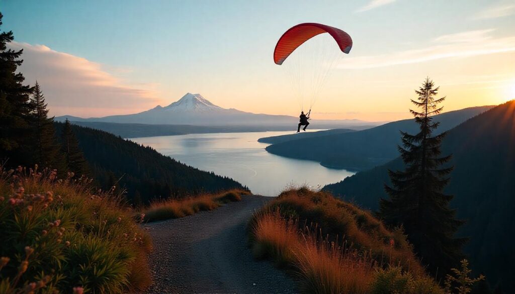
11. Poo Poo Point via Chirico Trail
Introduction
Poo Poo Point, perched on Tiger Mountain’s southeast slope, is famed for its paragliding launch site—and for good reason. The Chirico Trail winds through lush bamboo and cedar groves, its gentle grade opening onto rocky clearings where soaring eagles and paragliders dot the sky. As you climb, filtered sunlight highlights ferns and wild salal, evoking a primeval forest feeling despite the trail’s popularity. Near the summit, outcrops of exposed granite reward you with sweeping views of the Sammamish Valley, Lake Sammamish’s aqua sheen, and the distant Seattle skyline.
Seasonal rhododendron blooms flare along the path in spring, while fall foliage adds warm hues to the lofty perch. The launch pad’s wind sock—ever twitching—signals ideal conditions for flight, and hikers often pause here to watch winged adventurers drift into the valley below. This blend of forest tranquility and adrenaline-charged spectacle cements Poo Poo Point as one of the best hikes near Seattle for both nature lovers and thrill seekers.
Distance | Elevation Gain | Difficulty | Permit
- Distance: 7 miles round-trip
- Elevation Gain: 1,600 ft
- Difficulty: Moderate–Strenuous
- Permit: Northwest Forest Pass ($5/day or $30 annual)
Best Time to Visit
April–October: Stable spring and fall weather offers consistent thermals for paragliding and clear summit vistas.
Personal Tips & Safety Precautions
- Paraglider Zone: Stay clear of the launch area when wind socks are up—launchers have right of way.
- Trail Junctions: Watch for signs—several spurs intersect; missing a turn adds miles.
- Hydration & Snacks: No water sources; pack high-energy foods for sustained climbs.
- Footwear: Trail runners with rock-gripping soles handle the slick granite at the summit.
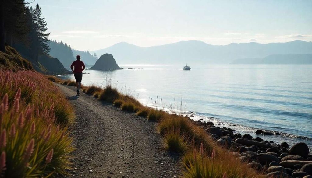
12. Carkeek Park Loop
Introduction
Carkeek Park offers a refreshing urban hike Seattle dwellers prize for its blend of rainforest, salmon stream, and Puget Sound beach. The ADA-accessible Forest Trail begins in old-growth Douglas fir, weaving past Big Finn Creek’s seasonal salmon runs and interpretive signage on local ecology. As you descend, the trail opens onto meadows dotted with camas lilies in May and swaths of wild strawberries in summer. A boardwalk guides you through tidal wetlands, where migratory shorebirds forage at low tide. Bluff-top viewpoints grant expansive Sound vistas with the Olympic Mountains beyond. Picnic shelters and play areas add family-friendly amenities, while fire rings permit small beachside bonfires at sunset.
Distance | Elevation Gain | Difficulty | Permit
- Distance: 1.8 miles loop
- Elevation Gain: 200 ft
- Difficulty: Easy
- Permit: Free (City of Seattle park)
Best Time to Visit
March–September: Wildflowers and summer low tides reveal rich tidal flats; winter months offer storm-watching.
Personal Tips & Safety Precautions
- Tide Tables: Check tide charts to avoid being cut off on the beach during rising tides.
- Salmon Spawning: Best viewed in fall—wear waterproof boots to navigate streamside boardwalks.
- Dog Friendly: Dogs on leash welcome; bring bags to protect salmon habitat.
- Restroom Locations: Facilities are at the main lot and beach parking area—plan breaks accordingly.
13. Seward Park Loop (Forest Hikes Near Seattle)
Introduction
Encircling the 300-acre forest peninsula in Lake Washington, Seward Park Loop immerses hikers in an ancient grove of Douglas fir, western redcedar, and bigleaf maple—some trees exceed 400 years old. The paved, multi-use trail hugs the shoreline, unveiling sweeping water views and spawning grounds for coho and chinook salmon in seasonal creeks. Interpretive panels explain Indigenous Duwamish connections to the land, enriching the hiking in Seattle experience with cultural history. Benches under canopy gaps offer resting points where sun filters through moss-draped branches.
In spring, trillium carpets the forest floor; summer brings hummingbird activity at flowering shrubs. On clear days, Mount Rainier’s snow-capped summit presides over the distant skyline. Accessible from several points, this loop is a kid friendly hikes near Seattle staple that delivers ancient forest vibes within city limits.
Distance | Elevation Gain | Difficulty | Permit
- Distance: 2.4 miles loop
- Elevation Gain: Minimal (<100 ft)
- Difficulty: Very Easy
- Permit: Free (City of Seattle park)
Best Time to Visit & Urban Nature
Year-Round: Spring for wildflowers, summer for salmon runs, fall for leaf color, winter for storm watching on Lake Washington.
Personal Tips & Safety Precautions
- Wildlife Spotting: Early morning yields sightings of herons and otters near creek mouths.
- Trail Bikes: Multi-use path—watch for cyclists and joggers.
- Accessibility: Paved path is stroller and wheelchair friendly; some sections narrow near shore.
- Water Stations: Water fountains near the main parking lot; none mid-loop.
14. Poo Poo Point via Mt. Si Highway
Introduction
An alternative route to the Chirico Trail, this approach to Poo Poo Point follows the former Mt. Si Highway, ascending more gradually through open meadows and rhododendron thickets. The trailhead sits at an abandoned highway tunnel, where interpretive signs chronicle early logging operations. Pine and alder forest transitions into fern-carpeted gullies before bursting onto basalt outcrops with commanding views of the Snoqualmie Valley. The final stretch parallels the paragliding launch pads, offering a bird’s-eye perspective on takeoffs and landings.
This variation is less crowded than Chirico, making it a great hikes near Seattle choice for those seeking solitude. Seasonal wildflower blooms paint the meadows in June, and fall’s golden grasses sway under crisp skies.
Distance | Elevation Gain | Difficulty | Permit
- Distance: 6 miles round-trip
- Elevation Gain: 1,200 ft
- Difficulty: Moderate
- Permit: Northwest Forest Pass ($5/day or $30 annual)
Best Time to Visit
May–September: Wildflowers in meadows and consistent thermals for paragliding make summer ideal.
Personal Tips & Safety Precautions
- Trailhead Access: Parking at John Wayne Pioneer Trail lot; avoid blocking private driveways.
- Sun Protection: Exposed meadows offer no shade—wear a sun hat and apply SPF.
- Watch for Cyclists: Mountain bikers use parts of the old highway—yield when necessary.
- Emergency Exit: The old tunnel provides shelter in sudden storms; carry a headlamp if using it.
15. Lake Serene & Bridal Veil Falls (Alpine Lake & Wildflower Hikes Near Seattle)
Introduction
The Lake Serene & Bridal Veil Falls combo is a crown jewel among alpine lake hikes near Seattle, weaving together a thundering 594-ft waterfall and a serene glacial tarn. The trail begins at a wooded trailhead, following the South Fork of the Sultan River through old-growth forest. A midway side trip leads to the base of Bridal Veil Falls, where misty spray cools the air and creates rainbows in sunlight. Continuing upward, you pass talus slopes and cascading streams before arriving at Lake Serene’s turquoise waters, framed by towering granite cliffs.
Late July brings avalanche lilies along the shoreline, while fall’s crisp air and early snow dusting transform the basin into a shimmering amphitheater. Backpackers can camp on designated sites near the lake, turning this in the best solo hike near Seattle into a memorable overnight under the stars.
Distance | Elevation Gain | Difficulty | Permit
- Distance: 8.2 miles round-trip
- Elevation Gain: 2,000 ft
- Difficulty: Strenuous
- Permit: Northwest Forest Pass ($5/day or $30 annual)
Best Time to Visit
July–September: Peak wildflower season and typically snow-free trail conditions make summer ideal.
Personal Tips & Safety Precautions
- Campsite Etiquette: Use designated sites only; lake shoreline is fragile.
- Water Treatment: Filter or boil from streams—no potable water at lake.
- Early Start: Begin hike before dawn to enjoy falls in soft morning light and avoid afternoon storms.
- Bear Awareness: Carry bear spray and store food properly when camping overnight.
Quick Comparison Table: 15 Best Hikes Near Seattle
| Trail Name | Elevation Gain | Difficulty | Best Season | Dog-Friendly |
|---|---|---|---|---|
| Rattlesnake Ledge | 1,160 ft | ⭐️⭐️☆☆☆ Moderate | Year-round | Yes |
| Snoqualmie Falls Trail | 250 ft | ⭐️☆☆☆☆ Easy | Year-round | Yes |
| Twin Falls Loop | 500 ft | ⭐️☆☆☆☆ Easy | March–October | Yes |
| Discovery Park Loop | 140 ft | ⭐️☆☆☆☆ Easy | Year-round | Yes |
| Lake 22 Trail | 1,350 ft | ⭐️⭐️☆☆☆ Moderate | May–November | Yes |
| Tiger Mountain (West Tiger 3) | 2,000 ft | ⭐️⭐️⭐️☆☆ Moderate | Year-round | Yes |
| Franklin Falls | 400 ft | ⭐️☆☆☆☆ Easy | April–September | Yes |
| Mount Si | 3,150 ft | ⭐️⭐️⭐️⭐️☆ Hard | January–October | Yes |
| Little Si | 1,240 ft | ⭐️⭐️☆☆☆ Moderate | Year-round | Yes |
| Wallace Falls Trail | 1,200 ft | ⭐️⭐️☆☆☆ Moderate | Spring–Fall | Yes |
| Poo Poo Point via Chirico Trail | 1,664 ft | ⭐️⭐️⭐️☆☆ Moderate | January–September | Yes |
| Carkeek Park Loop | 200 ft | ⭐️☆☆☆☆ Easy | Year-round | Yes |
| Seward Park Loop | 150 ft | ⭐️☆☆☆☆ Easy | Year-round | Yes |
| Poo Poo Point via Mt. Si Highway | 1,200 ft | ⭐️⭐️⭐️☆☆ Moderate | Year-round | Yes |
| Lake Serene & Bridal Veil Falls | 2,000 ft | ⭐️⭐️⭐️☆☆ Moderate | May–October | Yes |
Best Seattle Trails by Category

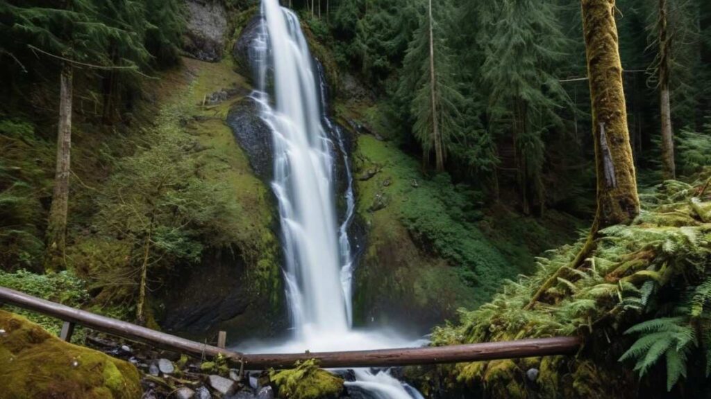
Best Waterfall Hikes Near Seattle Washington
The best waterfall hikes near Seattle Washington deliver the delight of misty canyons and thunderous cascades within easy driving distance. Trails like Franklin Falls and Snoqualmie Falls showcase multi-tiered drops framed by ancient cedar groves, while Wallace Falls Trail boasts a 650-ft series of plunges amid old-growth forest. Each route offers interpretive signs detailing salmon runs or logging history, adding context to the scenic reward. Pack grippy shoes and waterproof layers to safely navigate slick rock and spray zones, and plan visits in spring or early summer for peak flow after winter snowmelt.
Best Lake Hikes Near Seattle
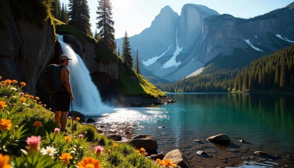
Seattle’s proximity to alpine basins means you don’t have to travel far for lake hikes near Seattle with mirror-like waters and granite backdrops. Lake 22 Trail and Lake Serene both wind through moss-draped forests before opening onto emerald and turquoise lakes ideal for a cooling dip. For a gentler day-hike, Rattlesnake Ledge overlooks a serene reservoir that feels alpine despite its low-elevation start. These hikes reward persistence with clear water reflections of surrounding peaks—bring a picnic to savor the view and a waterproof map for reliable navigation.
Best Urban Hikes Seattle & Hikes Near Downtown Seattle
For those craving a quick nature fix without leaving city limits, urban hikes Seattle offers leafy loops and shoreline strolls mere minutes from downtown. Discovery Park Loop blends bluff-top panoramas of Puget Sound with WWII relics in eucalypt groves, while Carkeek Park Loop weaves beach, forest, and salmon-stream habitat in a compact 1.8-mile circuit. These hikes near downtown Seattle require minimal effort but deliver maximal payoff: fresh sea breeze, migratory birdwatching, and easy parking. They’re perfect for lunchtime escapes or sunset outings after work.
Best Easy Hikes Near Seattle & Free Hikes Near Seattle
If you’re seeking easy hikes near Seattle that won’t break the bank, the region offers countless free hikes near Seattle with minimal elevation gain and family-friendly terrain. Seward Park Loop circles an ancient old-growth peninsula on paved paths, while Franklin Falls and Twin Falls Loop provide scenic waterfall views on well-maintained trails. These low-impact routes make outdoor recreation accessible to everyone—no permit required and only modest Northwest Forest Pass fees for some Snoqualmie-area trails.
Best Family Friendly & Kid Friendly Hikes Near Seattle
For outings with little ones, look to family friendly hikes near Seattle that balance safety and discovery. Gentle loops like Discovery Park, with its interpretive panels and beach sections, and Little Si, with its manageable scramble, encourage curiosity without exhaustion. Playground facilities at Carkeek Park and picnic shelters at Snoqualmie Falls add comfort for parents, while short spur trails to viewpoints keep children motivated. Pack snacks, bring a small first-aid kit, and plan for restroom stops at trailheads.
Best Dog Friendly Hikes Seattle
Seattle hikers with canine companions rejoice: many dog friendly hikes Seattle welcome four-legged friends on leash, from the mossy woods of Tiger Mountain trails to the bluff-top wind at Discovery Park Loop. Carkeek Park allows dogs on leash along forest and beach trails, complete with off-leash areas near parking. Be sure to carry extra water for your pup, pick up all waste to protect wildlife, and check seasonal trail closures—some Snoqualmie Pass hiking trails restrict dogs during fire season.
Essential Gear & Safety for Seattle Hiking
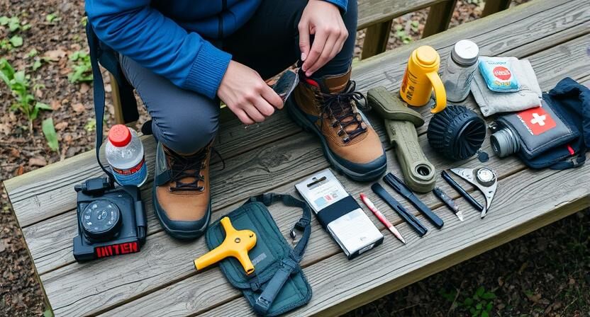
Footwear, Rain Gear & Apparel for Forest Trails Near Seattle
- Sturdy, Waterproof Trail Shoes: Opt for trail runners or hiking boots with aggressive treads and sealed seams to handle muddy forest hikes near Seattle. Good ankle support prevents twists on uneven roots and rocks common on Seattle hiking trails, while waterproof membranes keep your feet dry in rain-soaked moss beds.
- Breathable Rain Shell & Pants: Invest in a lightweight, packable rain jacket and trousers with sealed seams and pit zips. Pacific Northwest weather can switch from drizzle to downpour in minutes—even on easy hikes near Seattle—so having breathable protection ensures you stay comfortable without overheating.
- Moisture-Wicking Base Layers: Merino wool or synthetic tops and bottoms pull sweat away from skin, preventing chill when temperatures drop under dense canopy or at higher trailheads like Rattlesnake Ledge. Quick-dry fabrics also minimize the risk of hypothermia if you cross iced-over creek streams.
- Insulating Mid-Layer: Pack a thin fleece or light synthetic jacket for cool mornings and evenings. The temperature on day hikes near Seattle can swing 20 °F from start to finish—an easily stowed mid-layer provides warmth without bulk during summit breaks or sunset views.
Hydration, Nutrition & Layering for Variable Weather
- Hydration Pack or Bladder: Carry at least 1–2 L of water in a hands-free reservoir. Even short hikes near Seattle on routes like Discovery Park Loop can dehydrate you under dense foliage and unexpected sun breaks. Add an emergency water filter or purification tablets for multi-day backpacking on Lake Serene & Bridal Veil Falls.
- Electrolyte-Rich Snacks: Pack bars fortified with sodium and potassium, as well as dried fruit for quick energy. Sweating on steep climbs—Mount Si or Tiger Mountain—depletes salts faster than plain water can replace, so periodic electrolyte boosts prevent cramps and dizziness.
- Layered Clothing System: Embrace the three-layer principle: base layer (moisture-wicking), mid-layer (insulation), and shell (weather protection). This approach lets you adapt to frequent temperature swings on winter hikes near Seattle or muggy summer mornings before the clouds burn off.
- Emergency Blanket & Packable Poncho: A compact Mylar blanket and disposable poncho add lightweight safety margins on remote fall larch hikes near Seattle. Should weather turn or if you hike off-trail, these items can prevent hypothermia and signal rescuers.
Wildlife Encounters, Leave No Trace & Trail Etiquette
- Wildlife Respect: Keep 50 ft distance from deer, elk, and foraging bears; never feed animals on Seattle hikes. Use binoculars for close-up views, and store food in sealed bags to avoid attracting wildlife to campsites on overnight routes like Lake Serene.
- Pack Out All Waste: Follow Leave No Trace principles by carrying out every scrap of trash, including biodegradable items like orange peels, which can disrupt local ecosystems on trails such as Franklin Falls. Human waste should be buried 6 inches deep, 200 ft from water sources.
- Stay on Durable Surfaces: Avoid shortcutting switchbacks or trampling fragile undergrowth in old-growth sections of Seward Park Loop and Rattlesnake Ledge approaches. Wandering off-trail compacts soil, kills moss mats, and accelerates erosion.
- Courteous Sharing: Yield uphill on narrow singletrack, announce your presence when passing, and leash dogs on multi-use paths like Carkeek Park Loop. Respecting fellow hikers, bikers, and equestrians keeps urban hikes Seattle friendly and inclusive.
Seasonal Hiking Near Seattle
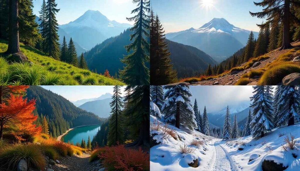
Spring Wildflower Hikes Near Seattle
Spring breathes life into wildflower hikes near Seattle, with trilliums carpeting Seward Park Loop and camas lilies brightening Discovery Park Loop. Trails beneath alder and maple burst into bloom, and damp conditions magnify floral scents. Hike mid-week in April–May to avoid crowds and witness salmon returning to headwater streams on free hikes near Seattle. Remember to tread lightly around blooms—many native flowers are fragile and slow to recover from trampling.
Summer Waterfall & Lake Hikes Near Seattle WA
Summer’s long days and warm temperatures make waterfall hikes near Seattle Washington and lake hikes near Seattle irresistible. Early mornings on Snoqualmie Falls Trail beat the crowds, while Lake 22 and Lake Serene offer refreshing swims under sunscreen-safe skies. Pack a dry bag for electronics and a swimsuit, and start at dawn to avoid afternoon thunderstorms common in the Cascades.
Fall Larch Hikes Near Seattle & Aspens
October’s larch gold transforms slopes on Alpine Lake & Wildflower Hikes Near Seattle, drawing photographers to Lake Serene meadows draped in yellow needles. Aspen groves along Wallace Falls Trail mirror the effect in riverside canyons. Daytime highs remain in the 60s °F, perfect for moderate 3 mile hikes near Seattle, while crisp evenings remind you to pack a warm mid-layer.
Winter Hikes & Snowshoe Options Near Seattle
Winter’s snowpack invites snowshoe outings on Mount Si shoulders and Tiger Mountain subalpine meadows, turning familiar best hikes near Seattle into silent, snow-clad wonderlands. Use microspikes on Rattlesnake Ledge and carry gaiters on Franklin Falls to keep feet dry crossing icy streams. Always check avalanche forecasts and carry emergency gear when venturing above 2,000 ft in the Cascades.
Final Thoughts on Best Hikes Near Seattle
Seattle offers one of the most diverse, scenic, and accessible hiking landscapes in the U.S., making it a paradise for outdoor lovers at every experience level. Whether you’re looking for a casual afternoon stroll through lush forests, a waterfall adventure, a family-friendly weekend trail, or a strenuous summit challenge with rewarding views—there’s a perfect hike just a short drive away.
What makes hiking near Seattle so uniquely enriching is the combination of natural beauty and variety. You can explore alpine lakes, towering evergreens, blooming wildflowers, golden fall larches, and snowy peaks, all within a two-hour radius. Trails like Rattlesnake Ledge, Franklin Falls, Mount Si, and Lake Serene offer something for everyone—from beginners and kids to seasoned hikers seeking a weekend escape. Many trails allow dog-friendly hiking, and quite a few are free or permit-optional, helping you enjoy nature without financial hurdles.
To truly enjoy the best hikes near Seattle, being well-prepared is key. The Pacific Northwest’s dynamic weather, rugged terrain, and wildlife require thoughtful gear choices, responsible trail etiquette, and a deep respect for nature. As highlighted above, layering your clothing, carrying hydration, and practicing Leave No Trace will keep you safe and preserve the beauty of these trails for others.
Whether you’re planning a spring wildflower walk, a summer lake dip, a fall foliage photo trip, or a winter snowshoe trek—Seattle’s hiking scene delivers year-round rewards. Bookmark this guide, explore trails by season or category, and make hiking a regular part of your routine. Every trail has a story, and Seattle’s trails are full of wonder, challenge, and unforgettable views.
Now it’s your turn—lace up your boots, pick your trail, and experience the best hikes near Seattle firsthand.
Ethan Marlowe is an experienced hiker and outdoor gear specialist based in Colorado. With over 7 years of hands-on experience trekking through the Rockies, Pacific Northwest, and East Coast trails, he delivers practical advice, expert gear reviews, and survival insights. His goal is to help hikers of all levels make smarter decisions on and off the trail.